<< Our Photo Pages >> Wychbury Camp - Hillfort in England in Worcestershire
Submitted by vicky on Thursday, 26 February 2004 Page Views: 21008
Iron Age and Later PrehistorySite Name: Wychbury Camp Alternative Name: Wychbury Ring FortCountry: England
NOTE: This site is 6.059 km away from the location you searched for.
County: Worcestershire Type: Hillfort
Nearest Town: Halesowen Nearest Village: Pedmore
Map Ref: SO920818 Landranger Map Number: 139
Latitude: 52.434116N Longitude: 2.119097W
Condition:
| 5 | Perfect |
| 4 | Almost Perfect |
| 3 | Reasonable but with some damage |
| 2 | Ruined but still recognisable as an ancient site |
| 1 | Pretty much destroyed, possibly visible as crop marks |
| 0 | No data. |
| -1 | Completely destroyed |
| 5 | Superb |
| 4 | Good |
| 3 | Ordinary |
| 2 | Not Good |
| 1 | Awful |
| 0 | No data. |
| 5 | Can be driven to, probably with disabled access |
| 4 | Short walk on a footpath |
| 3 | Requiring a bit more of a walk |
| 2 | A long walk |
| 1 | In the middle of nowhere, a nightmare to find |
| 0 | No data. |
| 5 | co-ordinates taken by GPS or official recorded co-ordinates |
| 4 | co-ordinates scaled from a detailed map |
| 3 | co-ordinates scaled from a bad map |
| 2 | co-ordinates of the nearest village |
| 1 | co-ordinates of the nearest town |
| 0 | no data |
Internal Links:
External Links:
I have visited· I would like to visit
SolarMegalith jessicacrevier would like to visit
Berger8 visited on 19th Apr 2019 - their rating: Cond: 2 Access: 3
Marko visited on 9th Mar 2014 - their rating: Cond: 4 Amb: 4 Access: 3 Appeared to be 3 ramparts and ditches running most of the way between the East and South West entances.
Both entrances are inturned with the East one being a paticularly good example.
Site also has approx 20+ yew trees growing both inside the fort and on its ramparts and in the ditches.
Andy B have visited here
Average ratings for this site from all visit loggers: Condition: 3 Access: 3
")
Wychbury Ring is an Iron Age hill fort located on Wychbury Hill, near Hagley, Stourbridge, on the border of West Midlands and Worcestershire in the English Midlands.
The fort measures 250 m from east to west and 150 m from north to south, covering an area of 2.93 ha. It has two sets of ramparts and ditches. The inner rampart is between 16 m and 20 m wide, rising up to 2.6 m in height, with the surrounding inner ditch 10 m wide and up to 1.7 m deep. The outer rampart is 10 m wide and up to 3 m in height, with the outer ditch being 10 m wide and up to 1.2 m deep. There are fortified entrances at the east and south west.
Small bronze rings, including an Iron Age terret, were found in the fort in 1884, and Roman coins and masonry have been found nearby, suggesting a possible site of a later Roman Villa. Investigations in 1924 reported a 5.5-acre annexe to the south and a nearby Iron Age field system, but no trace of either remain.
Source: Wikipedia
You may be viewing yesterday's version of this page. To see the most up to date information please register for a free account.
")
Do not use the above information on other web sites or publications without permission of the contributor.
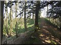
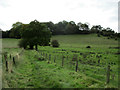
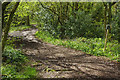
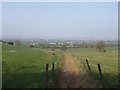
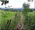
Nearby Images from Geograph Britain and Ireland:
©2009(licence)
©2017(licence)
©2018(licence)
©2009(licence)
©2020(licence)
The above images may not be of the site on this page, they are loaded from Geograph.
Please Submit an Image of this site or go out and take one for us!
Click here to see more info for this site
Nearby sites
Key: Red: member's photo, Blue: 3rd party photo, Yellow: other image, Green: no photo - please go there and take one, Grey: site destroyed
Download sites to:
KML (Google Earth)
GPX (GPS waypoints)
CSV (Garmin/Navman)
CSV (Excel)
To unlock full downloads you need to sign up as a Contributory Member. Otherwise downloads are limited to 50 sites.
Turn off the page maps and other distractions
Nearby sites listing. In the following links * = Image available
2.0km SE 137° The Four Stones* Modern Stone Circle etc (SO9337180328)
2.6km ESE 113° St Kenelm's Well* Holy Well or Sacred Spring (SO9444280755)
3.5km SW 227° Stakenbridge Lane* Round Barrow(s) (SO894794)
6.8km S 189° Barrow Hill (Worcestershire)* Barrow Cemetery (SO9088475138)
8.3km WNW 282° The Giant's Well (Kinver)* Holy Well or Sacred Spring (SO839836)
8.6km W 279° Kinver* Promontory Fort / Cliff Castle (SO835832)
9.7km WNW 282° Boltstone* Standing Stone (Menhir) (SO825839)
9.8km W 265° Drakelow Hillfort Hillfort (SO8219780879)
10.2km WSW 241° Kidderminster Cross* Ancient Cross (SO8303476939)
12.8km E 83° Lapworth Museum Museum (SP047834)
13.2km WSW 252° Wassell Wood earthwork* Misc. Earthwork (SO7944277665)
13.3km WSW 238° Devil's Spittleful* Natural Stone / Erratic / Other Natural Feature (SO80727468)
13.7km N 349° Lady Godiva's Cross* Ancient Cross (SO89439528)
14.1km NE 48° St Augustine's Well (Sandwell)* Holy Well or Sacred Spring (SP0248391296)
14.7km W 266° Upper Arley stone* Standing Stone (Menhir) (SO773809)
15.0km ENE 67° War Stone* Natural Stone / Erratic / Other Natural Feature (SP058877)
15.1km NNE 27° Ethelfleda's Hill Fort (Wednesdbury) Hillfort (SO9880095300)
15.3km WSW 237° Blackstone Iron Age Settlement Ancient Village or Settlement (SO791735)
15.4km ENE 71° Birmingham Museum & Art Gallery Museum (SP066869)
16.2km W 280° Alveley Cross* Ancient Cross (SO7595584525)
17.0km N 358° St Peter (Wolverhampton)* Ancient Cross (SO9141998765)
17.1km N 358° The Bargain Stone* Holed Stone (SO913989)
17.2km WNW 283° Hampton Loade Cross* Ancient Cross (SO75258574)
17.3km E 89° Moseley Bog Burnt Mound* Artificial Mound (SP0934382043)
17.4km N 355° West Park (Wolverhampton)* Natural Stone / Erratic / Other Natural Feature (SO90609912)
View more nearby sites and additional images


 We would like to know more about this location. Please feel free to add a brief description and any relevant information in your own language.
 Wir möchten mehr über diese Stätte erfahren. Bitte zögern Sie nicht, eine kurze Beschreibung und relevante Informationen in Deutsch hinzuzufügen.
 Nous aimerions en savoir encore un peu sur les lieux. S'il vous plaît n'hesitez pas à ajouter une courte description et tous les renseignements pertinents dans votre propre langue.
 Quisieramos informarnos un poco más de las lugares. No dude en añadir una breve descripción y otros datos relevantes en su propio idioma.