<< Our Photo Pages >> Bucks Head Round Barrow - Round Barrow(s) in England in Gloucestershire
Submitted by 4clydesdale7 on Saturday, 04 May 2013 Page Views: 2794
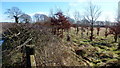
Neolithic and Bronze AgeSite Name: Bucks Head Round Barrow Alternative Name: Hungerfield Barrow, Cranham 3Country: England County: Gloucestershire Type: Round Barrow(s)
Nearest Town: Stroud Nearest Village: Cranham
Map Ref: SO91321260
Latitude: 51.811964N Longitude: 2.12731W
Condition:
| 5 | Perfect |
| 4 | Almost Perfect |
| 3 | Reasonable but with some damage |
| 2 | Ruined but still recognisable as an ancient site |
| 1 | Pretty much destroyed, possibly visible as crop marks |
| 0 | No data. |
| -1 | Completely destroyed |
| 5 | Superb |
| 4 | Good |
| 3 | Ordinary |
| 2 | Not Good |
| 1 | Awful |
| 0 | No data. |
| 5 | Can be driven to, probably with disabled access |
| 4 | Short walk on a footpath |
| 3 | Requiring a bit more of a walk |
| 2 | A long walk |
| 1 | In the middle of nowhere, a nightmare to find |
| 0 | No data. |
| 5 | co-ordinates taken by GPS or official recorded co-ordinates |
| 4 | co-ordinates scaled from a detailed map |
| 3 | co-ordinates scaled from a bad map |
| 2 | co-ordinates of the nearest village |
| 1 | co-ordinates of the nearest town |
| 0 | no data |
Internal Links:
External Links:
I have visited· I would like to visit
4clydesdale7 visited on 4th May 2013 - their rating: Cond: 3 Amb: 4 Access: 4 How many times have I sped past this one? Quite a history
SteveJJones saw from a distance
")
It was first excavated in 1880 (but poorly recorded) by J E Dorington and Prof. G Rolleston and it caused something of a stir in the halls of the Bristol and Gloucestershire Archaeological Society. They found both a primary and a secondary interment. The first of an adult female with child (who seemed to have been cremated on site) and the second an interment of two children (who also had been cremated) plus an uncremated person. No artefacts were reported thus dating has been difficult - certain schools believe it could be Neolithic (due to the presence of a burnt cist) but most tend to consider it to be early Bronze Age.
In 1880 it was 25m in diameter and almost 1.75m high - nowadays it is a little lower and thinner. It was mentioned by George Witts in his Archaeological Handbook of the County of Gloucester (1883/7) - No.27 in his chapter on Round Barrows - he believed it was called Hungerfield Barrow.
It is mentioned also:
(a) In the Transactions of BGAS 1960 Vol 79 p 111 by H O'Neil and L V Grinsell
(b) On the pastscape website Gloucestershire: Stroud: Cranham: 117536
With so much in the area why not take a look?
You may be viewing yesterday's version of this page. To see the most up to date information please register for a free account.
Do not use the above information on other web sites or publications without permission of the contributor.
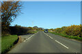
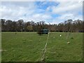
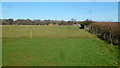
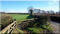
Nearby Images from Geograph Britain and Ireland:
©2022(licence)
©2024(licence)
©2016(licence)
©2016(licence)
©2016(licence)
The above images may not be of the site on this page, they are loaded from Geograph.
Please Submit an Image of this site or go out and take one for us!
Click here to see more info for this site
Nearby sites
Key: Red: member's photo, Blue: 3rd party photo, Yellow: other image, Green: no photo - please go there and take one, Grey: site destroyed
Download sites to:
KML (Google Earth)
GPX (GPS waypoints)
CSV (Garmin/Navman)
CSV (Excel)
To unlock full downloads you need to sign up as a Contributory Member. Otherwise downloads are limited to 50 sites.
Turn off the page maps and other distractions
Nearby sites listing. In the following links * = Image available
671m NNW 343° West Tump* Long Barrow (SO9112213241)
715m SSE 153° Climperwell Round Barrows* Round Barrow(s) (SO91641196)
886m SE 140° Climperwell* Holy Well or Sacred Spring (SO91891192)
2.1km NW 310° Tile Well* Holy Well or Sacred Spring (SO89721395)
2.4km NNE 26° Birdlip standing stones* Modern Stone Circle etc (SO9235214746)
2.5km WNW 299° High Brotheridge* Misc. Earthwork (SO89121381)
2.5km NE 48° Birdlip Roundhouse Ancient Village or Settlement (SO932143)
2.6km NNE 24° Birdlip Camp* Hillfort (SO924150)
2.9km W 281° Cranham Corner Earthworks* Misc. Earthwork (SO88501313)
3.1km NNE 33° Birdlip Barrow* Round Barrow(s) (SO9301015150)
3.3km SW 232° Holy well (Sheepscombe) Holy Well or Sacred Spring (SO887106)
3.5km S 179° Camp Barrow* Barrow Cemetery (SO914091)
3.8km NNE 23° Crickley Hill* Hillfort (SO928161)
3.8km NNE 32° Barrow Wake Barrow Round Barrow(s) (SO93381585)
4.0km NNE 33° Emma's Grove Round Barrows Round Barrow(s) (SO93481594)
4.1km SSE 156° Honeycombe Farm Chambered Tomb (SO930089)
4.4km W 263° Painswick Beacon* Hillfort (SO869121)
4.9km WSW 238° Washwell* Holy Well or Sacred Spring (SO872100)
5.0km NNE 26° Dry Heathfield Barrow Round Barrow(s) (SO93521711)
5.1km NNW 346° Badgeworth Round Barrow* Round Barrow(s) (SO90071750)
5.2km NE 54° Coberley* Chambered Tomb (SO95521564)
5.2km S 182° Througham* Chambered Tomb (SO911074)
5.2km NNE 24° Crippet's Barrow* Chambered Tomb (SO93421739)
5.2km E 83° High Cross Stone (Elkstone)* Standing Stone (Menhir) (SO9653213246)
5.3km SW 236° St Tibby's Well* Holy Well or Sacred Spring (SO86880961)
View more nearby sites and additional images


 We would like to know more about this location. Please feel free to add a brief description and any relevant information in your own language.
 Wir möchten mehr über diese Stätte erfahren. Bitte zögern Sie nicht, eine kurze Beschreibung und relevante Informationen in Deutsch hinzuzufügen.
 Nous aimerions en savoir encore un peu sur les lieux. S'il vous plaît n'hesitez pas à ajouter une courte description et tous les renseignements pertinents dans votre propre langue.
 Quisieramos informarnos un poco más de las lugares. No dude en añadir una breve descripción y otros datos relevantes en su propio idioma.