<< Our Photo Pages >> Througham - Chambered Tomb in England in Gloucestershire
Submitted by 4clydesdale7 on Tuesday, 24 September 2002 Page Views: 7299
Neolithic and Bronze AgeSite Name: Througham Alternative Name: Bisley-with-Lypiatt IICountry: England County: Gloucestershire Type: Chambered Tomb
Map Ref: SO911074 Landranger Map Number: 163
Latitude: 51.765207N Longitude: 2.130366W
Condition:
| 5 | Perfect |
| 4 | Almost Perfect |
| 3 | Reasonable but with some damage |
| 2 | Ruined but still recognisable as an ancient site |
| 1 | Pretty much destroyed, possibly visible as crop marks |
| 0 | No data. |
| -1 | Completely destroyed |
| 5 | Superb |
| 4 | Good |
| 3 | Ordinary |
| 2 | Not Good |
| 1 | Awful |
| 0 | No data. |
| 5 | Can be driven to, probably with disabled access |
| 4 | Short walk on a footpath |
| 3 | Requiring a bit more of a walk |
| 2 | A long walk |
| 1 | In the middle of nowhere, a nightmare to find |
| 0 | No data. |
| 5 | co-ordinates taken by GPS or official recorded co-ordinates |
| 4 | co-ordinates scaled from a detailed map |
| 3 | co-ordinates scaled from a bad map |
| 2 | co-ordinates of the nearest village |
| 1 | co-ordinates of the nearest town |
| 0 | no data |
Internal Links:
External Links:
I have visited· I would like to visit
4clydesdale7 visited on 20th Nov 2011 - their rating: Cond: -1 Amb: 1 Access: 3 What is it with the farming community in the Bisley (Glos) area? - this is just a dumping ground much like another site about 2 miles further south
")
This Long Barrow is now in a most pitiful state. The southern half of the Barrow was overwhelmed in 1833 when a Cottage and Pigsties were built, but now all respect for an Ancient Monument and Burial Chamber has been lost. It seems to have become a general dumping ground somewhat akin to another Barrow not too far south in the same parish. The Barrow was, even after its battle with the pigs, 30m Long 15m Wide just under 2m high and orientated E-W - it now it defies description. Mentioned in G Witts epic work on Gloucestershire as Long Barrow No. 32 and in the Daniel/Corcoran Gazetteer as GLO71 it also is begrudgingly alluded to by pastscape not by a name just a monument number 117149 - how are the mighty fallen! Position SO 91080743; it is rather hard to get to see it even though it seems to be less than 75m from a road - the cottage and pigsties get in the way.
You may be viewing yesterday's version of this page. To see the most up to date information please register for a free account.
Do not use the above information on other web sites or publications without permission of the contributor.
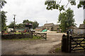
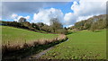
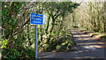
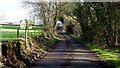
Nearby Images from Geograph Britain and Ireland:
©2021(licence)
©2016(licence)
©2016(licence)
©2016(licence)
©2006(licence)
The above images may not be of the site on this page, they are loaded from Geograph.
Please Submit an Image of this site or go out and take one for us!
Click here to see more info for this site
Nearby sites
Key: Red: member's photo, Blue: 3rd party photo, Yellow: other image, Green: no photo - please go there and take one, Grey: site destroyed
Download sites to:
KML (Google Earth)
GPX (GPS waypoints)
CSV (Garmin/Navman)
CSV (Excel)
To unlock full downloads you need to sign up as a Contributory Member. Otherwise downloads are limited to 50 sites.
Turn off the page maps and other distractions
Nearby sites listing. In the following links * = Image available
1.5km SSE 152° The Giant's Stone (Gloucestershire)* Chambered Cairn (SO918061)
1.7km SSW 204° Seven Wells* Holy Well or Sacred Spring (SO9039005827)
1.7km N 10° Camp Barrow* Barrow Cemetery (SO914091)
2.1km WSW 248° Lypiatt Cross* Ancient Cross (SO89150662)
2.3km ESE 117° Juniper Hill* Misc. Earthwork (SO93130638)
2.3km S 172° Bisley Barrow* Chambered Tomb (SO914051)
2.4km NE 52° Honeycombe Farm Chambered Tomb (SO930089)
2.7km SSW 197° Money Tump* Round Barrow(s) (SO90300479)
3.1km SE 145° The Trench* Misc. Earthwork (SO92900482)
3.3km SE 130° Westwood (Gloucestershire)* Chambered Tomb (SO936053)
3.7km S 186° Avenis Barrow* Long Barrow (SO907037)
3.8km SSE 157° The Golden Coffin (Far Oakridge)* Round Barrow(s) (SO92620388)
3.9km SSE 161° Litteridge Cross* Ancient Cross (SO92350373)
4.0km NW 323° Holy well (Sheepscombe) Holy Well or Sacred Spring (SO887106)
4.4km S 178° Ashmead Well* Holy Well or Sacred Spring (SO91270301)
4.6km N 10° Climperwell* Holy Well or Sacred Spring (SO91891192)
4.6km N 7° Climperwell Round Barrows* Round Barrow(s) (SO91641196)
4.6km E 92° Jack Barrow Chambered Cairn (SO957072)
4.7km WNW 304° Washwell* Holy Well or Sacred Spring (SO872100)
4.8km WNW 298° St Tibby's Well* Holy Well or Sacred Spring (SO86880961)
5.0km ESE 106° College Plantation 2* Chambered Tomb (SO959060)
5.1km ESE 106° College Plantation 1* Chambered Tomb (SO960060)
5.1km ESE 114° Pinbury Hillfort Hillfort (SO958053)
5.2km N 2° Bucks Head Round Barrow* Round Barrow(s) (SO91321260)
5.4km E 98° Hoar Stone at Duntisbourne* Chambered Tomb (SO965066)
View more nearby sites and additional images


 We would like to know more about this location. Please feel free to add a brief description and any relevant information in your own language.
 Wir möchten mehr über diese Stätte erfahren. Bitte zögern Sie nicht, eine kurze Beschreibung und relevante Informationen in Deutsch hinzuzufügen.
 Nous aimerions en savoir encore un peu sur les lieux. S'il vous plaît n'hesitez pas à ajouter une courte description et tous les renseignements pertinents dans votre propre langue.
 Quisieramos informarnos un poco más de las lugares. No dude en añadir una breve descripción y otros datos relevantes en su propio idioma.