


<< Text Pages >> Ring Stones Hill - Stone Circle in England in Lancashire
Submitted by Sunny100 on Tuesday, 17 September 2002 Page Views: 13165
Neolithic and Bronze AgeSite Name: Ring Stones HillCountry: England
NOTE: This site is 0.2 km away from the location you searched for.
County: Lancashire Type: Stone Circle
Nearest Town: Nelson Nearest Village: Catlow
Map Ref: SD89263693 Landranger Map Number: 103
Latitude: 53.828521N Longitude: 2.164653W
Condition:
| 5 | Perfect |
| 4 | Almost Perfect |
| 3 | Reasonable but with some damage |
| 2 | Ruined but still recognisable as an ancient site |
| 1 | Pretty much destroyed, possibly visible as crop marks |
| 0 | No data. |
| -1 | Completely destroyed |
| 5 | Superb |
| 4 | Good |
| 3 | Ordinary |
| 2 | Not Good |
| 1 | Awful |
| 0 | No data. |
| 5 | Can be driven to, probably with disabled access |
| 4 | Short walk on a footpath |
| 3 | Requiring a bit more of a walk |
| 2 | A long walk |
| 1 | In the middle of nowhere, a nightmare to find |
| 0 | No data. |
| 5 | co-ordinates taken by GPS or official recorded co-ordinates |
| 4 | co-ordinates scaled from a detailed map |
| 3 | co-ordinates scaled from a bad map |
| 2 | co-ordinates of the nearest village |
| 1 | co-ordinates of the nearest town |
| 0 | no data |
Internal Links:
External Links:
I have visited· I would like to visit
janeshiva Sunny100 would like to visit
Ring Stones Hill is situated 1 mile E of the village of Catlow near Nelson. This pre-historic site once had a stone circle, but in the 19th century the recumbent stones were taken up and used in the construction of local walls and farm buildings. Today no trace can be found of the circle, apart from one or two solitary stones close to Ring Stones Farm together with a burial mound or barrow, which could have links to nearby Knave Hill and also Walton Spire.
This site is also featured on The Northern Antiquarian (TNA) - see their entry for Ring Stones Hill, Catlow, Nelson, Lancashire. TNA reports:"Set in good landscape with fine views in most directions, it seems that the only thing that remains of this site is a place-name on a map—but I have to say that our search here was only a short one, and so more may be found hiding away in field walls or beneath the ground. However, if we listen to an early account of the place, it was said to have “completely gone by 1856.” A pity, as it was described as being “a large circle of stones.” The monument was used for repairing the nearby road and, in another account, we are told that the stones were added to the walls. Whether this was a cairn circle or a free standing stone circle isn’t known. The prevalence of tumuli close by at Catlow, Burwains, etc, would suggest a cairn circle, yet we have no accounts of human remains here… A puzzle."
The site is also mentioned in Pastscape Monument No. 887155, which has a simple entry saying: "(at) SD 89263693 Ringstone Hill II - small mound 3m diameter, on shoulder of hill at 975ft OD, SD 891367. [Ringstone Hill I is the possible stone circle]."
The Journal of Antiquities also includes an entry for Ring Stones Hill, Catlow, Nelson, Lancashire, which includes a photograph of the site of the stone circle, together with a photograph of large recumbent stones near Ring Stones Hill. The Journal refers to 'Historic Walks Around The Pendle Way' (1990) by John Dixon and Bob Mann which say the circle was dismantled when the present (farm) barn was built".
Note: Have you visited this site? Do you have any current or historical information, images, drawings or photographs to contribute?
You may be viewing yesterday's version of this page. To see the most up to date information please register for a free account.
Do not use the above information on other web sites or publications without permission of the contributor.
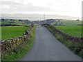
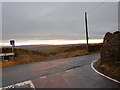
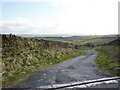
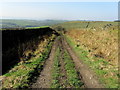
Nearby Images from Geograph Britain and Ireland:
©2017(licence)
©2010(licence)
©2010(licence)
©2012(licence)
©2012(licence)
The above images may not be of the site on this page, they are loaded from Geograph.
Please Submit an Image of this site or go out and take one for us!
Click here to see more info for this site
Nearby sites
Key: Red: member's photo, Blue: 3rd party photo, Yellow: other image, Green: no photo - please go there and take one, Grey: site destroyed
Download sites to:
KML (Google Earth)
GPX (GPS waypoints)
CSV (Garmin/Navman)
CSV (Excel)
To unlock full downloads you need to sign up as a Contributory Member. Otherwise downloads are limited to 50 sites.
![]()
Turn off the page maps and other distractions
Nearby sites listing. In the following links * = Image available
380m E 81° Knave Hill (Nelson)* Cairn (SD8963636991)
427m NNE 21° Walton Spire Cross* Standing Stone (Menhir) (SD8941637328)
583m NNE 13° Walton Spire Stone* Standing Stone (Menhir) (SD8939137498)
1.1km WNW 282° Catlow Well/Spring* Holy Well or Sacred Spring (SD8818137169)
1.2km SSW 202° Burwain's Farm Stone Circle (SD888358)
1.4km NNW 332° The Gib Clough Head Stone* Marker Stone (SD886382)
1.7km NNW 332° Castercliffe* Hillfort (SD8848738395)
1.7km SSE 154° Burwain's Camp* Misc. Earthwork (SD900354)
2.0km SSE 150° Broadbank* Ancient Village or Settlement (SD9023935227)
2.0km SW 215° Annot Cross (Brierfield) Ancient Cross (SD881353)
2.6km S 177° Bonfire Hill 1* Cairn (SD894343)
2.7km SSW 210° Calf Hey Well (Briercliffe) Holy Well or Sacred Spring (SD8794334622)
2.8km WSW 246° Finn's Well (Haggate) Holy Well or Sacred Spring (SD86713582)
2.8km N 355° St. Helen's Well (Waterside, Colne)* Holy Well or Sacred Spring (SD890397)
2.8km S 185° Beadle Hill (Extwistle) Misc. Earthwork (SD8901834112)
2.8km S 181° Bonfire Hill II* Round Barrow(s) (SD892341)
2.8km S 183° Bonfire Hill III* Round Barrow(s) (SD891341)
2.9km SSE 163° Hellclough Ring Cairn* Cairn (SD9012534145)
3.0km SSE 161° Hellclough Saucer Barrow* Ring Cairn (SD9020034124)
3.0km SSW 198° Nogworth Cross (Briercliffe) Ancient Cross (SD8833934086)
3.0km S 187° Beth Cross (Holden Clough) Ancient Cross (SD88863395)
3.2km N 352° Emmott Cross (Colne) Ancient Cross (SD888401)
3.2km S 185° Twist Hill Barrow* Round Barrow(s) (SD88983370)
3.3km SSE 166° Delf Hill* Stone Circle (SD9006433732)
3.4km NW 311° Swinden Cross (Swinden Clough) Ancient Cross (SD86733916)
View more nearby sites and additional images


 We would like to know more about this location. Please feel free to add a brief description and any relevant information in your own language.
 Wir möchten mehr über diese Stätte erfahren. Bitte zögern Sie nicht, eine kurze Beschreibung und relevante Informationen in Deutsch hinzuzufügen.
 Nous aimerions en savoir encore un peu sur les lieux. S'il vous plaît n'hesitez pas à ajouter une courte description et tous les renseignements pertinents dans votre propre langue.
 Quisieramos informarnos un poco más de las lugares. No dude en añadir una breve descripción y otros datos relevantes en su propio idioma.