<< Our Photo Pages >> Long Stone (Minchinhampton) - Standing Stones in England in Gloucestershire
Submitted by vicky on Monday, 15 November 2004 Page Views: 22452
Neolithic and Bronze AgeSite Name: Long Stone (Minchinhampton)Country: England County: Gloucestershire Type: Standing Stones
Nearest Town: Stroud Nearest Village: Minchinhampton
Map Ref: ST88359992 Landranger Map Number: 162
Latitude: 51.697903N Longitude: 2.169962W
Condition:
| 5 | Perfect |
| 4 | Almost Perfect |
| 3 | Reasonable but with some damage |
| 2 | Ruined but still recognisable as an ancient site |
| 1 | Pretty much destroyed, possibly visible as crop marks |
| 0 | No data. |
| -1 | Completely destroyed |
| 5 | Superb |
| 4 | Good |
| 3 | Ordinary |
| 2 | Not Good |
| 1 | Awful |
| 0 | No data. |
| 5 | Can be driven to, probably with disabled access |
| 4 | Short walk on a footpath |
| 3 | Requiring a bit more of a walk |
| 2 | A long walk |
| 1 | In the middle of nowhere, a nightmare to find |
| 0 | No data. |
| 5 | co-ordinates taken by GPS or official recorded co-ordinates |
| 4 | co-ordinates scaled from a detailed map |
| 3 | co-ordinates scaled from a bad map |
| 2 | co-ordinates of the nearest village |
| 1 | co-ordinates of the nearest town |
| 0 | no data |
Internal Links:
External Links:
I have visited· I would like to visit
SumDoood Geojazz would like to visit
bishop_pam visited on 8th May 2024 - their rating: Cond: 4 Amb: 4 Access: 5
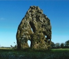
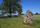
foz750 visited on 11th Dec 2023 - their rating: Cond: 3 Amb: 4 Access: 4 Passing through the area we made a detour and were rewarded with this lovely stone, shrouded in mystery. Easy to access and worth a visit.
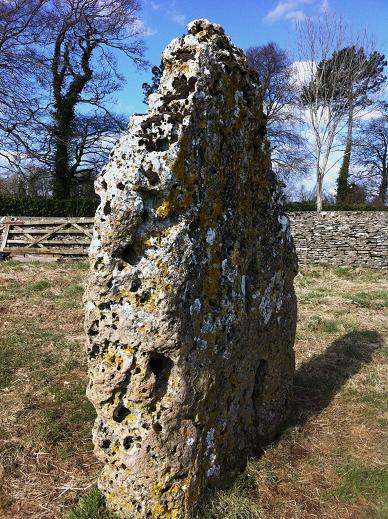
Lots of the nooks and crannies are filled with coins and other offerings.
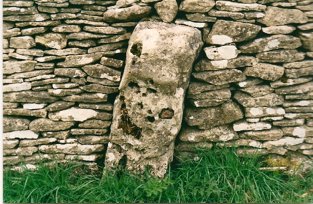
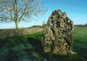
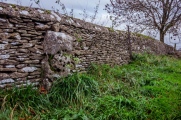
The smaller fallen stone is easily found embedded in the dry stone wall.
lichen visited on 14th Jan 2014 - their rating: Cond: 2 Amb: 3 Access: 4
NickyD visited on 1st Nov 2013 - their rating: Access: 5
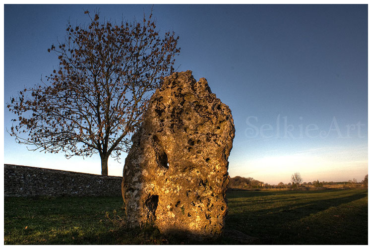
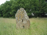
custer visited on 2nd Apr 2013 - their rating: Cond: 4 Amb: 4 Access: 5 Recent wall work means it is clearly visible from the road. A gorgeous stone lovely penetrating holes add to the vision.
whitemere visited on 24th Jun 2012 - their rating: Cond: 3 Amb: 3 Access: 5
madlookin visited on 31st Aug 2011 - their rating: Cond: 4 Amb: 5 unfortunately....the surrounding area is due to be developed into a sports facility...if planning is allowed
4clydesdale7 visited on 30th May 2011 - their rating: Cond: 4 Amb: 4 Access: 5 So this stone is from 'The Devil's Churchyard' - it caused HRH to think again when a planning application she made failed because of it
TheWhiteRider visited on 20th Jun 2010 - their rating: Cond: 3 Amb: 3 Access: 2
TheCaptain TimPrevett Andy B hamish coin have visited here
Average ratings for this site from all visit loggers: Condition: 3.38 Ambience: 3.75 Access: 4.38
The stone is located on the Minchinhampton to Avening road about half a mile from Hollybush farm. It is set just off the road with easy access.
You may be viewing yesterday's version of this page. To see the most up to date information please register for a free account.








These are just the first 25 photos of Long Stone (Minchinhampton). If you log in with a free user account you will be able to see our entire collection.
Do not use the above information on other web sites or publications without permission of the contributor.
Click here to see more info for this site
Nearby sites
Key: Red: member's photo, Blue: 3rd party photo, Yellow: other image, Green: no photo - please go there and take one, Grey: site destroyed
Download sites to:
KML (Google Earth)
GPX (GPS waypoints)
CSV (Garmin/Navman)
CSV (Excel)
To unlock full downloads you need to sign up as a Contributory Member. Otherwise downloads are limited to 50 sites.
Turn off the page maps and other distractions
Nearby sites listing. In the following links * = Image available
204m SSE 169° Gatcombe Lodge* Long Barrow (ST88399972)
484m NE 38° Crackstone Long Barrow* Long Barrow (SO88650030)
867m WNW 282° Bubblewell* Standing Stone (Menhir) (SO875001)
937m S 187° The Tingle Stone* Long Barrow (ST88239899)
1.1km NW 318° The Bulwarks - East 1 and 2 - Minchinhampton* Misc. Earthwork (SO87620072)
1.2km W 276° The Lang Stone* Standing Stone (Menhir) (SO87170004)
1.5km WNW 301° The Cobstone* Holed Stone (SO87050070)
1.6km NNE 27° Hyde Tumulus 2* Round Barrow(s) (SO89070130)
1.6km SSW 196° Avening burial chambers* Burial Chamber or Dolmen (ST87899837)
1.6km SSE 159° Norn's Tump* Chambered Tomb (ST88949839)
1.7km NNE 24° Hyde Tumulus 1* Round Barrow(s) (SO89060149)
2.3km SW 225° The Oven* Round Barrow(s) (ST86769832)
2.4km SSE 151° Barrow Tumps* Long Barrow (ST89519783)
2.6km WSW 241° Oldfield Wood* Chambered Tomb (ST861987)
2.7km W 280° The Bulwarks (Gloucestershire)* Ancient Village or Settlement (SO857004)
2.9km WSW 240° Hazlewood Copse Camp* Hillfort (ST85829850)
3.0km W 271° Beaudesert Park Standing Stone* Standing Stone (Menhir) (SO853000)
3.1km SW 228° Lechmore Tump* Long Barrow (ST86049783)
3.4km SW 224° Lechmore Round Barrow* Round Barrow(s) (ST860975)
3.4km WNW 301° Whitefield's Tump* Long Barrow (SO85400170)
3.5km WNW 292° Amberley Cross Bank* Misc. Earthwork (SO85130124)
3.5km WNW 295° Amberley Camp* Misc. Earthwork (SO852014)
3.6km NW 313° The Horestone (Rodborough)* Standing Stone (Menhir) (SO85740239)
3.8km NW 311° The Horestone (Sullivan)* Standing Stone (Menhir) (SO85490240)
4.1km SSW 198° Chavenage Sleight Round Barrows* Round Barrow(s) (ST87089601)
View more nearby sites and additional images


 We would like to know more about this location. Please feel free to add a brief description and any relevant information in your own language.
 Wir möchten mehr über diese Stätte erfahren. Bitte zögern Sie nicht, eine kurze Beschreibung und relevante Informationen in Deutsch hinzuzufügen.
 Nous aimerions en savoir encore un peu sur les lieux. S'il vous plaît n'hesitez pas à ajouter une courte description et tous les renseignements pertinents dans votre propre langue.
 Quisieramos informarnos un poco más de las lugares. No dude en añadir una breve descripción y otros datos relevantes en su propio idioma.