<< Our Photo Pages >> Cranham Corner Earthworks - Misc. Earthwork in England in Gloucestershire
Submitted by TheCaptain on Tuesday, 01 June 2021 Page Views: 634
EnglandSite Name: Cranham Corner EarthworksCountry: England County: Gloucestershire Type: Misc. Earthwork
Nearest Town: Gloucester Nearest Village: Cranham
Map Ref: SO88501313
Latitude: 51.816678N Longitude: 2.168233W
Condition:
| 5 | Perfect |
| 4 | Almost Perfect |
| 3 | Reasonable but with some damage |
| 2 | Ruined but still recognisable as an ancient site |
| 1 | Pretty much destroyed, possibly visible as crop marks |
| 0 | No data. |
| -1 | Completely destroyed |
| 5 | Superb |
| 4 | Good |
| 3 | Ordinary |
| 2 | Not Good |
| 1 | Awful |
| 0 | No data. |
| 5 | Can be driven to, probably with disabled access |
| 4 | Short walk on a footpath |
| 3 | Requiring a bit more of a walk |
| 2 | A long walk |
| 1 | In the middle of nowhere, a nightmare to find |
| 0 | No data. |
| 5 | co-ordinates taken by GPS or official recorded co-ordinates |
| 4 | co-ordinates scaled from a detailed map |
| 3 | co-ordinates scaled from a bad map |
| 2 | co-ordinates of the nearest village |
| 1 | co-ordinates of the nearest town |
| 0 | no data |
Internal Links:
External Links:
I have visited· I would like to visit
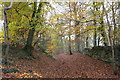
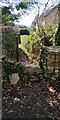
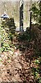
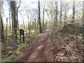
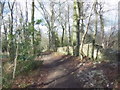
TheCaptain visited on 31st May 2021 - their rating: Cond: 3 Amb: 3 Access: 4 Walking a Cooper's Hill Circuit of the Cotswold Way from Cranham, and first off had a look at these small earthworks. I am not convinced they would have been of much use defensively, being on a slight slope not at the top of the hill, and not very large.
")
I cannot readily find out anything of their history, and am not convinced they would have been of much use defensively, being on a slight slope not at the top of the hill, and not very large.
You may be viewing yesterday's version of this page. To see the most up to date information please register for a free account.
")
")
")
Do not use the above information on other web sites or publications without permission of the contributor.
Nearby Images from Geograph Britain and Ireland:
©2017(licence)
©2022(licence)
©2022(licence)
©2014(licence)
©2013(licence)
The above images may not be of the site on this page, they are loaded from Geograph.
Please Submit an Image of this site or go out and take one for us!
Click here to see more info for this site
Nearby sites
Key: Red: member's photo, Blue: 3rd party photo, Yellow: other image, Green: no photo - please go there and take one, Grey: site destroyed
Download sites to:
KML (Google Earth)
GPX (GPS waypoints)
CSV (Garmin/Navman)
CSV (Excel)
To unlock full downloads you need to sign up as a Contributory Member. Otherwise downloads are limited to 50 sites.
Turn off the page maps and other distractions
Nearby sites listing. In the following links * = Image available
919m NE 42° High Brotheridge* Misc. Earthwork (SO89121381)
1.5km NE 56° Tile Well* Holy Well or Sacred Spring (SO89721395)
1.9km WSW 237° Painswick Beacon* Hillfort (SO869121)
2.5km S 175° Holy well (Sheepscombe) Holy Well or Sacred Spring (SO887106)
2.6km E 87° West Tump* Long Barrow (SO9112213241)
2.9km E 101° Bucks Head Round Barrow* Round Barrow(s) (SO91321260)
3.0km WSW 256° King Charles Stone* Marker Stone (SO856124)
3.3km ESE 110° Climperwell Round Barrows* Round Barrow(s) (SO91641196)
3.4km SSW 202° Washwell* Holy Well or Sacred Spring (SO872100)
3.6km ESE 110° Climperwell* Holy Well or Sacred Spring (SO91891192)
3.9km SSW 205° St Tibby's Well* Holy Well or Sacred Spring (SO86880961)
4.2km ENE 67° Birdlip standing stones* Modern Stone Circle etc (SO9235214746)
4.3km WNW 300° Red Well (Matson)* Holy Well or Sacred Spring (SO8479615289)
4.3km ENE 64° Birdlip Camp* Hillfort (SO924150)
4.6km NNE 20° Badgeworth Round Barrow* Round Barrow(s) (SO90071750)
4.8km WNW 293° Robins Wood Hill Standing Stones (SO841150)
4.8km ENE 76° Birdlip Roundhouse Ancient Village or Settlement (SO932143)
4.9km ENE 66° Birdlip Barrow* Round Barrow(s) (SO9301015150)
5.0km SE 144° Camp Barrow* Barrow Cemetery (SO914091)
5.1km WNW 299° Well House (Gloucester)* Holy Well or Sacred Spring (SO84001561)
5.2km NE 55° Crickley Hill* Hillfort (SO928161)
5.6km ENE 61° Barrow Wake Barrow Round Barrow(s) (SO93381585)
5.7km ENE 60° Emma's Grove Round Barrows Round Barrow(s) (SO93481594)
5.8km N 356° Churchdown Hill Camp* Hillfort (SO881189)
6.2km SE 133° Honeycombe Farm Chambered Tomb (SO930089)
View more nearby sites and additional images


 We would like to know more about this location. Please feel free to add a brief description and any relevant information in your own language.
 Wir möchten mehr über diese Stätte erfahren. Bitte zögern Sie nicht, eine kurze Beschreibung und relevante Informationen in Deutsch hinzuzufügen.
 Nous aimerions en savoir encore un peu sur les lieux. S'il vous plaît n'hesitez pas à ajouter une courte description et tous les renseignements pertinents dans votre propre langue.
 Quisieramos informarnos un poco más de las lugares. No dude en añadir una breve descripción y otros datos relevantes en su propio idioma.