 with our Megalithic Portal iPhone app")

<< Other Photo Pages >> Sutton Common Henge - Henge in England in Wiltshire
Submitted by Dooclay on Friday, 31 October 2025 Page Views: 7649
Neolithic and Bronze AgeSite Name: Sutton Common HengeCountry: England
NOTE: This site is 1.7 km away from the location you searched for.
County: Wiltshire Type: Henge
Map Ref: ST88544194
Latitude: 51.176579N Longitude: 2.165317W
Condition:
| 5 | Perfect |
| 4 | Almost Perfect |
| 3 | Reasonable but with some damage |
| 2 | Ruined but still recognisable as an ancient site |
| 1 | Pretty much destroyed, possibly visible as crop marks |
| 0 | No data. |
| -1 | Completely destroyed |
| 5 | Superb |
| 4 | Good |
| 3 | Ordinary |
| 2 | Not Good |
| 1 | Awful |
| 0 | No data. |
| 5 | Can be driven to, probably with disabled access |
| 4 | Short walk on a footpath |
| 3 | Requiring a bit more of a walk |
| 2 | A long walk |
| 1 | In the middle of nowhere, a nightmare to find |
| 0 | No data. |
| 5 | co-ordinates taken by GPS or official recorded co-ordinates |
| 4 | co-ordinates scaled from a detailed map |
| 3 | co-ordinates scaled from a bad map |
| 2 | co-ordinates of the nearest village |
| 1 | co-ordinates of the nearest town |
| 0 | no data |
Internal Links:
External Links:
")
Source: Historic England.
Page originally by Coldrum
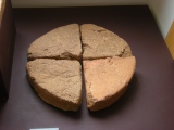
Note: A nicely visible henge monument!
You may be viewing yesterday's version of this page. To see the most up to date information please register for a free account.
")
")
Do not use the above information on other web sites or publications without permission of the contributor.
coldrum has found this location on Google Street View:
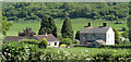
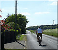
Nearby Images from Geograph Britain and Ireland:
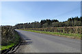
©2017(licence)
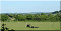
©2010(licence)
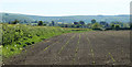
©2010(licence)
©2010(licence)
©2010(licence)
The above images may not be of the site on this page, they are loaded from Geograph.
Please Submit an Image of this site or go out and take one for us!
Click here to see more info for this site
Nearby sites
Key: Red: member's photo, Blue: 3rd party photo, Yellow: other image, Green: no photo - please go there and take one, Grey: site destroyed
Download sites to:
KML (Google Earth)
GPX (GPS waypoints)
CSV (Garmin/Navman)
CSV (Excel)
To unlock full downloads you need to sign up as a Contributory Member. Otherwise downloads are limited to 50 sites.
Turn off the page maps and other distractions
Nearby sites listing. In the following links * = Image available
946m WNW 295° Robin Hood's Bower Ancient Village or Settlement (ST87684234)
1.6km NNE 31° Bishopstrow Road Barrows* Round Barrow(s) (ST8936043273)
2.2km NNE 19° Boreham Mill Barrows Round Barrow(s) (ST89274400)
2.8km NNE 25° King Barrow (Warminster)* Long Barrow (ST8975044477)
3.4km NE 48° Scratchbury Camp* Hillfort (ST911442)
3.5km ENE 62° Chalk Quarries Barrow Group* Barrow Cemetery (ST9162143584)
3.7km NNE 20° Battlesbury bowl barrow 3 Round Barrow(s) (ST898454)
3.7km NNE 20° Battlesbury hillfort Barrows Round Barrow(s) (ST898454)
3.7km N 351° Cop Heap Round Barrow(s) (ST87984558)
3.7km NNE 19° Battlesbury Bowl barrow 2 Round Barrow(s) (ST89774544)
3.7km NE 37° Middle Hill* Round Barrow(s) (ST908449)
3.7km NNE 20° Battlesbury Bowl Barrow 1 Round Barrow(s) (ST89804545)
3.9km NNE 19° Battlesbury Camp* Hillfort (ST898456)
4.4km NNW 345° Arn Hill barrow Round Barrow(s) (ST874462)
4.4km ENE 61° West Hill long barrow Long Barrow (ST924441)
4.4km NNW 346° Arn Hill Barrow Round Barrow(s) (ST87444623)
4.6km N 349° Warminster Round Barrow(s) (ST87674647)
4.7km WNW 292° Nutball Stone Standing Stone (Menhir) (ST842437)
4.7km SSW 196° Pertwood Down Long Barrow Long Barrow (ST872374)
4.8km ESE 109° Corton Long Barrow* Long Barrow (ST9307740336)
5.1km NNW 348° Colloway Clump Barrow Round Barrow(s) (ST87464695)
5.2km NE 39° Norton Bavant 14 Long Barrow (ST91854596)
5.2km N 10° Mancombe Down Enclosure* Ancient Village or Settlement (ST8949047100)
5.3km NNW 347° Arn Hill Long Barrow Long Barrow (ST874471)
5.4km WNW 302° Cley Hill* Hillfort (ST840448)
View more nearby sites and additional images


 We would like to know more about this location. Please feel free to add a brief description and any relevant information in your own language.
 Wir möchten mehr über diese Stätte erfahren. Bitte zögern Sie nicht, eine kurze Beschreibung und relevante Informationen in Deutsch hinzuzufügen.
 Nous aimerions en savoir encore un peu sur les lieux. S'il vous plaît n'hesitez pas à ajouter une courte description et tous les renseignements pertinents dans votre propre langue.
 Quisieramos informarnos un poco más de las lugares. No dude en añadir una breve descripción y otros datos relevantes en su propio idioma.