


<< Our Photo Pages >> Bubblewell - Standing Stone (Menhir) in England in Gloucestershire
Submitted by Anonymous on Wednesday, 26 August 2015 Page Views: 2358
Neolithic and Bronze AgeSite Name: BubblewellCountry: England County: Gloucestershire Type: Standing Stone (Menhir)
Nearest Town: Stroud Nearest Village: Minchinhampton
Map Ref: SO875001
Latitude: 51.699503N Longitude: 2.182267W
Condition:
| 5 | Perfect |
| 4 | Almost Perfect |
| 3 | Reasonable but with some damage |
| 2 | Ruined but still recognisable as an ancient site |
| 1 | Pretty much destroyed, possibly visible as crop marks |
| 0 | No data. |
| -1 | Completely destroyed |
| 5 | Superb |
| 4 | Good |
| 3 | Ordinary |
| 2 | Not Good |
| 1 | Awful |
| 0 | No data. |
| 5 | Can be driven to, probably with disabled access |
| 4 | Short walk on a footpath |
| 3 | Requiring a bit more of a walk |
| 2 | A long walk |
| 1 | In the middle of nowhere, a nightmare to find |
| 0 | No data. |
| 5 | co-ordinates taken by GPS or official recorded co-ordinates |
| 4 | co-ordinates scaled from a detailed map |
| 3 | co-ordinates scaled from a bad map |
| 2 | co-ordinates of the nearest village |
| 1 | co-ordinates of the nearest town |
| 0 | no data |
Internal Links:
External Links:
")
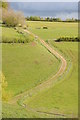
Has all the appearance of an ancient standing stone, by itself in a field overlooking Gatcombe Park. I can't find any record of one here though, and would appreciate confirmation. This links to a photo of the stone.
You may be viewing yesterday's version of this page. To see the most up to date information please register for a free account.
")
")
Do not use the above information on other web sites or publications without permission of the contributor.
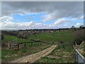
Nearby Images from Geograph Britain and Ireland:
©2024(licence)
©2021(licence)
©2021(licence)
©2012(licence)
©2012(licence)
The above images may not be of the site on this page, they are loaded from Geograph.
Please Submit an Image of this site or go out and take one for us!
Click here to see more info for this site
Nearby sites
Key: Red: member's photo, Blue: 3rd party photo, Yellow: other image, Green: no photo - please go there and take one, Grey: site destroyed
Download sites to:
KML (Google Earth)
GPX (GPS waypoints)
CSV (Garmin/Navman)
CSV (Excel)
To unlock full downloads you need to sign up as a Contributory Member. Otherwise downloads are limited to 50 sites.
Turn off the page maps and other distractions
Nearby sites listing. In the following links * = Image available
335m W 260° The Lang Stone* Standing Stone (Menhir) (SO87170004)
631m N 11° The Bulwarks - East 1 and 2 - Minchinhampton* Misc. Earthwork (SO87620072)
749m NW 323° The Cobstone* Holed Stone (SO87050070)
867m ESE 102° Long Stone (Minchinhampton)* Standing Stones (ST88359992)
965m ESE 113° Gatcombe Lodge* Long Barrow (ST88399972)
1.2km E 80° Crackstone Long Barrow* Long Barrow (SO88650030)
1.3km SSE 147° The Tingle Stone* Long Barrow (ST88239899)
1.8km SSE 167° Avening burial chambers* Burial Chamber or Dolmen (ST87899837)
1.8km W 279° The Bulwarks (Gloucestershire)* Ancient Village or Settlement (SO857004)
1.9km SSW 202° The Oven* Round Barrow(s) (ST86769832)
2.0km NE 52° Hyde Tumulus 2* Round Barrow(s) (SO89070130)
2.0km SW 225° Oldfield Wood* Chambered Tomb (ST861987)
2.1km NE 48° Hyde Tumulus 1* Round Barrow(s) (SO89060149)
2.2km W 267° Beaudesert Park Standing Stone* Standing Stone (Menhir) (SO853000)
2.2km SE 140° Norn's Tump* Chambered Tomb (ST88949839)
2.3km SW 226° Hazlewood Copse Camp* Hillfort (ST85829850)
2.6km WNW 296° Amberley Cross Bank* Misc. Earthwork (SO85130124)
2.6km NW 307° Whitefield's Tump* Long Barrow (SO85400170)
2.6km WNW 299° Amberley Camp* Misc. Earthwork (SO852014)
2.7km SSW 213° Lechmore Tump* Long Barrow (ST86049783)
2.9km NW 323° The Horestone (Rodborough)* Standing Stone (Menhir) (SO85770241)
3.0km SSW 210° Lechmore Round Barrow* Round Barrow(s) (ST860975)
3.0km SE 138° Barrow Tumps* Long Barrow (ST89519783)
3.1km NW 319° The Horestone (Sullivan)* Standing Stone (Menhir) (SO85490240)
4.0km NW 322° Rodborough Camp* Ancient Village or Settlement (SO85050324)
View more nearby sites and additional images


 We would like to know more about this location. Please feel free to add a brief description and any relevant information in your own language.
 Wir möchten mehr über diese Stätte erfahren. Bitte zögern Sie nicht, eine kurze Beschreibung und relevante Informationen in Deutsch hinzuzufügen.
 Nous aimerions en savoir encore un peu sur les lieux. S'il vous plaît n'hesitez pas à ajouter une courte description et tous les renseignements pertinents dans votre propre langue.
 Quisieramos informarnos un poco más de las lugares. No dude en añadir una breve descripción y otros datos relevantes en su propio idioma.