


<< Our Photo Pages >> Crookbarrow Hill - Artificial Mound in England in Worcestershire
Submitted by RaulRobbo on Wednesday, 04 December 2019 Page Views: 30850
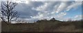
Multi-periodSite Name: Crookbarrow Hill Alternative Name: One Tree Hill, Whittington TumpCountry: England County: Worcestershire Type: Artificial Mound
Nearest Town: Worcester Nearest Village: Whittington
Map Ref: SO874523 Landranger Map Number: 150
Latitude: 52.168818N Longitude: 2.185643W
Condition:
| 5 | Perfect |
| 4 | Almost Perfect |
| 3 | Reasonable but with some damage |
| 2 | Ruined but still recognisable as an ancient site |
| 1 | Pretty much destroyed, possibly visible as crop marks |
| 0 | No data. |
| -1 | Completely destroyed |
| 5 | Superb |
| 4 | Good |
| 3 | Ordinary |
| 2 | Not Good |
| 1 | Awful |
| 0 | No data. |
| 5 | Can be driven to, probably with disabled access |
| 4 | Short walk on a footpath |
| 3 | Requiring a bit more of a walk |
| 2 | A long walk |
| 1 | In the middle of nowhere, a nightmare to find |
| 0 | No data. |
| 5 | co-ordinates taken by GPS or official recorded co-ordinates |
| 4 | co-ordinates scaled from a detailed map |
| 3 | co-ordinates scaled from a bad map |
| 2 | co-ordinates of the nearest village |
| 1 | co-ordinates of the nearest town |
| 0 | no data |
Internal Links:
External Links:
I have visited· I would like to visit
MercuryMars has visited here
")
See here for more information. (archive link)
Note: BBC Radio 4 Open Country visit Crookbarrow Hill - it's Scheduled but is it a barrow, or what?
You may be viewing yesterday's version of this page. To see the most up to date information please register for a free account.
")
Do not use the above information on other web sites or publications without permission of the contributor.
coldrum has found this location on Google Street View:
Nearby Images from Geograph Britain and Ireland:
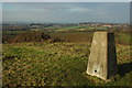
©2009(licence)
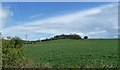
©2012(licence)
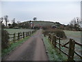
©2012(licence)
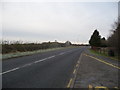
©2012(licence)
©2020(licence)
The above images may not be of the site on this page, they are loaded from Geograph.
Please Submit an Image of this site or go out and take one for us!
Click here to see more info for this site
Nearby sites
Key: Red: member's photo, Blue: 3rd party photo, Yellow: other image, Green: no photo - please go there and take one, Grey: site destroyed
Download sites to:
KML (Google Earth)
GPX (GPS waypoints)
CSV (Garmin/Navman)
CSV (Excel)
To unlock full downloads you need to sign up as a Contributory Member. Otherwise downloads are limited to 50 sites.
Turn off the page maps and other distractions
Nearby sites listing. In the following links * = Image available
4.1km SW 219° Kempsey Cross* Ancient Cross (SO8482149096)
4.8km NNE 17° Warndon Cross* Ancient Cross (SO8878256887)
6.7km NNE 26° Tibberton Cursus Cursus (SO90335831)
10.9km ESE 121° Wick A Cursus Cursus (SO96704665)
12.1km WSW 237° St Ann's Well (Great Malvern)* Holy Well or Sacred Spring (SO77234579)
12.3km SE 125° Wick B Cursus Cursus (SO975453)
14.4km WNW 295° The Berrow* Hillfort (SO744585)
14.4km SSE 146° St. Catherine's Well (Eckington)* Holy Well or Sacred Spring (SO95364030)
14.4km SW 226° Holy Well (Malvern)* Holy Well or Sacred Spring (SO770423)
14.5km ESE 120° St Michael (Cropthorne)* Ancient Cross (SP00014512)
14.7km SW 226° Jubilee Hill barrow* Round Barrow(s) (SO768421)
14.7km SE 146° Kemerton Camp* Hillfort (SO957401)
15.2km SSE 154° Norton Stones* Misc. Earthwork (SO940386)
15.4km S 178° Towbury Camp* Hillfort (SO88003695)
15.4km SSE 152° The King and Queen Stones* Standing Stones (SO9456738632)
16.0km SE 139° Elmley Castle* Hillfort (SO979402)
16.4km S 169° Chad Well (Twyning)* Holy Well or Sacred Spring (SO90363617)
16.7km SW 223° Herefordshire Beacon* Hillfort (SO75974003)
17.0km SE 145° Conderton Camp* Promontory Fort / Cliff Castle (SO972384)
17.3km SW 221° Walms Well* Holy Well or Sacred Spring (SO76053927)
17.4km NW 314° Woodbury Hill (Worcestershire)* Hillfort (SO749645)
18.2km ESE 105° New Farm Roman Settlement* Ancient Village or Settlement (SP0499847546)
18.5km ESE 104° Norton and Lenchwick Cursus* Cursus (SP054477)
18.6km SW 217° Midsummer Hill* Hillfort (SO761375)
19.2km W 267° Stanford Bishop Church Stone* Standing Stone (Menhir) (SO682515)
View more nearby sites and additional images


 We would like to know more about this location. Please feel free to add a brief description and any relevant information in your own language.
 Wir möchten mehr über diese Stätte erfahren. Bitte zögern Sie nicht, eine kurze Beschreibung und relevante Informationen in Deutsch hinzuzufügen.
 Nous aimerions en savoir encore un peu sur les lieux. S'il vous plaît n'hesitez pas à ajouter une courte description et tous les renseignements pertinents dans votre propre langue.
 Quisieramos informarnos un poco más de las lugares. No dude en añadir una breve descripción y otros datos relevantes en su propio idioma.