<< Text Pages >> Giant's Graves (Halton Gill) - Cairn in England in Yorkshire (North)
Submitted by Anne T on Thursday, 26 October 2017 Page Views: 2525
Neolithic and Bronze AgeSite Name: Giant's Graves (Halton Gill)Country: England County: Yorkshire (North) Type: Cairn
Nearest Town: Grassington Nearest Village: Horton-in-Ribblesdale
Map Ref: SD8564873346
Latitude: 54.155725N Longitude: 2.22126W
Condition:
| 5 | Perfect |
| 4 | Almost Perfect |
| 3 | Reasonable but with some damage |
| 2 | Ruined but still recognisable as an ancient site |
| 1 | Pretty much destroyed, possibly visible as crop marks |
| 0 | No data. |
| -1 | Completely destroyed |
| 5 | Superb |
| 4 | Good |
| 3 | Ordinary |
| 2 | Not Good |
| 1 | Awful |
| 0 | No data. |
| 5 | Can be driven to, probably with disabled access |
| 4 | Short walk on a footpath |
| 3 | Requiring a bit more of a walk |
| 2 | A long walk |
| 1 | In the middle of nowhere, a nightmare to find |
| 0 | No data. |
| 5 | co-ordinates taken by GPS or official recorded co-ordinates |
| 4 | co-ordinates scaled from a detailed map |
| 3 | co-ordinates scaled from a bad map |
| 2 | co-ordinates of the nearest village |
| 1 | co-ordinates of the nearest town |
| 0 | no data |
Be the first person to rate this site - see the 'Contribute!' box in the right hand menu.
Internal Links:
External Links:
Cairn in Yorkshire (North)
This late Neolithic/Bronze Age round barrow survives as an earthwork on Pen-y-Ghent Fell, and is recorded asPastscape Monument No. 45813. Their first entry in the record dates from 1956 and says: "a scheduled round barrow (2), consists of a much disturbed large mound. Excavation by W. Bennett in 1936 uncovered Flag-built burial chambers, the general arrangement of which, and the shape of the mound, suggesting a late Neolithic date. Also found were secondary burials of possibly Iron Age date."
This barrow is also a scheduled ancient monument - see Historic England List ID 1010536, which adds: "is situated in a low lying position beside Pen-y-ghent Gill. It includes a nearly circular, turf covered stone bank 2.4m wide and in places up to 0.6m high, surrounding a much disturbed area of mounds and hollows. At the west end of the monument there is a smaller bank roughly in the form of a circular arc extending a further 9m. The northern, southern and western sides of a stone lined burial cist are still visible at the north east end of the site. The present form of the site owes much to the various excavations which have taken place on it, leaving behind hollows and irregular mounds of soil. The north east area of the site was excavated in 1936 by W Bennett who discovered a number of human burials around the cist area. At the west end of the monument are two large stones, 0.8m long and slightly overlapping, probably part of a chamber wall. The ground around them had been excavated at some time during the early 19th century and the hole partially refilled with boulders."
The Northern Antiquarian (TNA) also feature a page for this site - see their entry for Giants’ Graves, Halton Gill, North Yorkshire, which describes this as "easy enough to get to". TNA include directions for finding the barrow together with a brief archaeology & history , a 1937 plan of the site and local folklore.
Note: Have you visited this site? Do you have any photographs or information to add?
You may be viewing yesterday's version of this page. To see the most up to date information please register for a free account.
Do not use the above information on other web sites or publications without permission of the contributor.
Nearby Images from Geograph Britain and Ireland:
©2012(licence)
©2010(licence)
©2010(licence)
©2019(licence)
©2019(licence)
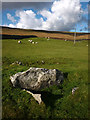
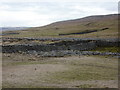
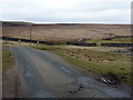
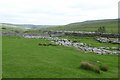
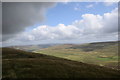
The above images may not be of the site on this page, they are loaded from Geograph.
Please Submit an Image of this site or go out and take one for us!
Click here to see more info for this site
Nearby sites
Key: Red: member's photo, Blue: 3rd party photo, Yellow: other image, Green: no photo - please go there and take one, Grey: site destroyed
Download sites to:
KML (Google Earth)
GPX (GPS waypoints)
CSV (Garmin/Navman)
CSV (Excel)
To unlock full downloads you need to sign up as a Contributory Member. Otherwise downloads are limited to 50 sites.
Turn off the page maps and other distractions
Nearby sites listing. In the following links * = Image available
6.7km SE 125° Dewbottoms (Arncliffe) Ancient Village or Settlement (SD912695)
7.3km W 281° Skirtful of Stones (Ingleborough) Cairn (SD785747)
7.4km NE 35° Yockenthwaite* Ring Cairn (SD8995779376)
7.5km SSW 199° Samson's Toe (Langcliffe) Natural Stone / Erratic / Other Natural Feature (SD8317666229)
7.9km ESE 107° Blue Scar (Arncliffe)* Ancient Village or Settlement (SD93237100)
8.1km SW 223° Feizor Celtic Wall* Misc. Earthwork (SD8008067386)
8.3km SW 225° Feizor Thwaite (Lawkland) Ring Cairn (SD79796747)
8.3km SW 217° Feizor Thwaite Propped Stone* Rock Outcrop (SD8057466703)
8.5km SSW 192° Albert Cave Cave or Rock Shelter (SD83796508)
8.5km SW 215° Sheep Scar Cairn (Giggleswick) Cairn (SD8067866436)
8.5km SSW 192° Victoria Cave* Cave or Rock Shelter (SD838650)
8.6km SW 217° Sheep Scar Circle (Giggleswick) Ring Cairn (SD8051366473)
8.7km SW 215° Apronful of Stones (Giggleswick) Cairn (SD8065266193)
8.9km SSW 192° Attermire Scar (Settle)* Rock Art (SD83836464)
9.0km SSE 153° Torlery Edge (Malham Moor) Ancient Village or Settlement (SD8978465292)
9.3km SSE 156° Comb Scar* Ancient Village or Settlement (SD89366485)
9.3km SSE 163° Ewe Moor* Ring Cairn (SD88326445)
9.4km SW 229° Feizor (Lawkland) Standing Stone (Menhir) (SD78586718)
9.4km SSE 148° Seaty Hill (Malham Moor) Cairn (SD9069265390)
9.5km SSE 157° Ing Scar* Ancient Village or Settlement (SD8931964626)
9.5km SSW 213° The Ebbing and Flowing Well* Holy Well or Sacred Spring (SD80396538)
9.6km WSW 250° Norber Erratics Natural Stone / Erratic / Other Natural Feature (SD76597003)
9.7km SSE 161° Jorden Scar* Ancient Village or Settlement (SD88776419)
10.1km S 175° Rye Loaf Hill (Settle) Cairn (SD8641963309)
10.1km N 360° Mêni Mabbin Stone Row / Alignment (SD856835)
View more nearby sites and additional images


 We would like to know more about this location. Please feel free to add a brief description and any relevant information in your own language.
 Wir möchten mehr über diese Stätte erfahren. Bitte zögern Sie nicht, eine kurze Beschreibung und relevante Informationen in Deutsch hinzuzufügen.
 Nous aimerions en savoir encore un peu sur les lieux. S'il vous plaît n'hesitez pas à ajouter une courte description et tous les renseignements pertinents dans votre propre langue.
 Quisieramos informarnos un poco más de las lugares. No dude en añadir una breve descripción y otros datos relevantes en su propio idioma.