<< Our Photo Pages >> Three Kings - Stone Circle in England in Northumberland
Submitted by cosmic on Sunday, 29 August 2004 Page Views: 14542
Neolithic and Bronze AgeSite Name: Three Kings Alternative Name: Three Kings of DenmarkCountry: England County: Northumberland Type: Stone Circle
Nearest Town: Otterburn Nearest Village: Byrness
Map Ref: NT7742500922 Landranger Map Number: 80
Latitude: 55.301876N Longitude: 2.357119W
Condition:
| 5 | Perfect |
| 4 | Almost Perfect |
| 3 | Reasonable but with some damage |
| 2 | Ruined but still recognisable as an ancient site |
| 1 | Pretty much destroyed, possibly visible as crop marks |
| 0 | No data. |
| -1 | Completely destroyed |
| 5 | Superb |
| 4 | Good |
| 3 | Ordinary |
| 2 | Not Good |
| 1 | Awful |
| 0 | No data. |
| 5 | Can be driven to, probably with disabled access |
| 4 | Short walk on a footpath |
| 3 | Requiring a bit more of a walk |
| 2 | A long walk |
| 1 | In the middle of nowhere, a nightmare to find |
| 0 | No data. |
| 5 | co-ordinates taken by GPS or official recorded co-ordinates |
| 4 | co-ordinates scaled from a detailed map |
| 3 | co-ordinates scaled from a bad map |
| 2 | co-ordinates of the nearest village |
| 1 | co-ordinates of the nearest town |
| 0 | no data |
Internal Links:
External Links:
I have visited· I would like to visit
Modern-neolithic would like to visit
Anne T visited on 28th Mar 2019 - their rating: Cond: 3 Amb: 4 Access: 3 Three Kings Stone Circle, Byrness: Driving up the A68 from Corbridge, passing through Rochester, we turned left off the A68 at NT 78013 01533 into the Border Forest Caravan Park. We thought we’d get to a car park where we could leave the park, but instead ended up at a Reception hut with a barrier closing off the road. There was no one in the hut, so I rang the buzzer. Rather than explain what I wanted, a man’s voice came through the speaker “I’ll be with you in a moment”, and rang off. Seconds later a man on a bike appeared. I asked him if there was anywhere we could park to go and see the Three Kings, and he said “as we’d asked, we could park here” (by the hut), and he gave very precise directions for reaching the stone circle. He also told us that the Forestry Commission hadn’t been maintaining the track to the stone circle very well, and some of it was very overgrown.
Stopping to almost scratch the pet pig’s nose (he was called Bubbles (sadly not more 'Squeak')), we set off south west through the static caravan area, crossing over the metal bridge, then turned north west along part of the Pennine Way, walking over a wider bridge where two rivers meet, then turned almost due west along a forest track, which turned a corner southwards and climbed steadily uphill.
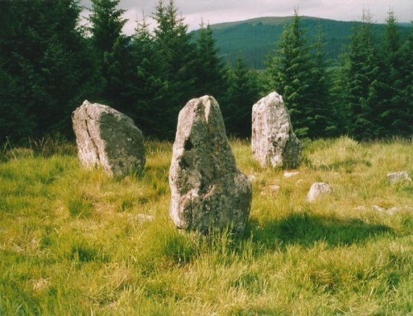
We missed the first track up to the stone circle, as it really was very overgrown, but continued up the hill and came to reasonably well defined track, over a boggy area, then uphill along a moss covered track which eventually came to some wooden steps, which even had a handrail in parts. From the comparative dark of the forest, we came out into a sunlit clearing with the four poster to our right hand side.
bishop_pam visited on 25th Aug 2017 - their rating: Cond: 4 Amb: 5 Access: 3
SolarMegalith visited on 17th Mar 2016 - their rating: Cond: 3 Amb: 5 Access: 4
Average ratings for this site from all visit loggers: Condition: 3.33 Ambience: 4.67 Access: 3.33
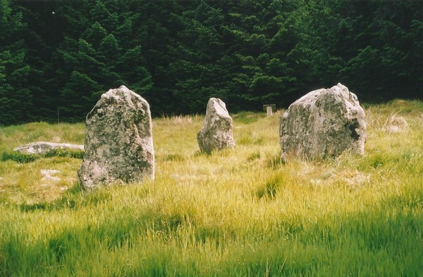
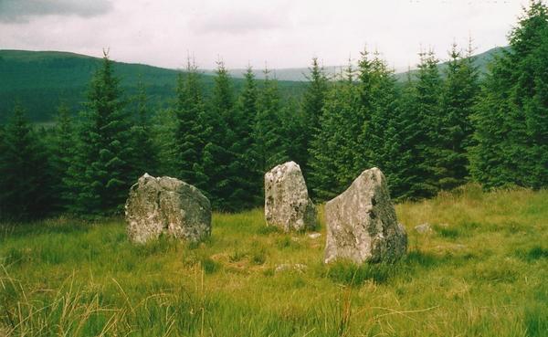
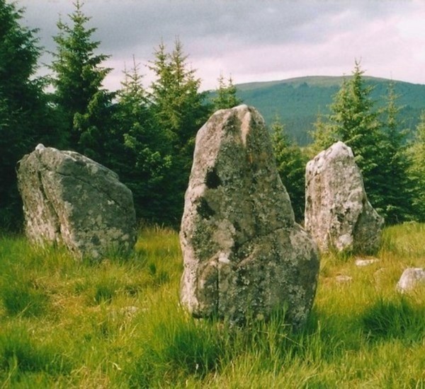
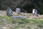
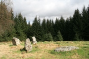
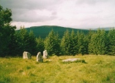
This Bronze Age 4-poster stone circle has 3 erect stones and one prostrate. They form a near rectangle and stand on the circumference of a circle with diameter 14'4" indicating that the circle was important in its construction rather than the rectangle. They have heights of 4'6" (NW), 4'7" (NW) and 4'8" (SW). When erect, the 7'6" long fallen SE stone would have stood to a height of 4'6". Inside the ring is a circular ring cairn which has been thoroughly pillaged.
The name is from a local legend that this was the grave of three kings of Denmark who had been killed in battle.
For more information see Pastscape Monument No. 64 which adds: "an outer periphery of small stones extends for two thirds of the circumference. Probably a burial site ... Eleven miles to the E is the Five Kings stone row."
This four poster is scheduled as Historic England List ID 1015525.
You may be viewing yesterday's version of this page. To see the most up to date information please register for a free account.






These are just the first 25 photos of Three Kings. If you log in with a free user account you will be able to see our entire collection.
Do not use the above information on other web sites or publications without permission of the contributor.
Click here to see more info for this site
Nearby sites
Key: Red: member's photo, Blue: 3rd party photo, Yellow: other image, Green: no photo - please go there and take one, Grey: site destroyed
Download sites to:
KML (Google Earth)
GPX (GPS waypoints)
CSV (Garmin/Navman)
CSV (Excel)
To unlock full downloads you need to sign up as a Contributory Member. Otherwise downloads are limited to 50 sites.
Turn off the page maps and other distractions
Nearby sites listing. In the following links * = Image available
751m NE 43° Byrness Forest Office Site Rock Art (NT7794101470)
2.1km NE 54° Dour Hill Long Cairn c* Rock Art (NT7917002158)
2.1km NE 55° Dour Hill Long Cairn a Rock Art (NT7920302130)
2.1km NE 55° Dour Hill Long Cairn d & e Rock Art (NT7920002140)
2.2km NE 55° Dour Hill Long Cairn b* Rock Art (NT7920302142)
2.2km NE 56° Dour Hill (Rochester)* Chambered Cairn (NT79230212)
3.3km ESE 103° Bellshiel Law 2f Rock Art (NT8064400188)
3.5km E 88° Bellshiel Law 1a Rock Art (NT8094901039)
3.7km E 83° Bellshiel Law 1g Rock Art (NT8111801331)
3.7km E 85° Bellshiel Law 1c Rock Art (NT8116001200)
3.7km E 85° Bellshiel Law 1b Rock Art (NT8116001204)
3.9km E 86° Bellshiel Law* Chambered Cairn (NT8131601173)
3.9km E 87° Bellshiel Law 1d Rock Art (NT8135801135)
3.9km E 87° Bellshiel Law 1f Rock Art (NT8138001120)
4.0km E 87° Bellshiel Law 1e Rock Art (NT8138401127)
4.1km E 94° Bellshiel Law 2d Rock Art (NT8150600619)
4.1km E 94° Bellshiel Law 2c Rock Art (NT8153400619)
4.1km E 94° Bellshiel Law 2a Rock Art (NT8154200601)
4.1km E 94° Bellshiel Law 2b Rock Art (NT8154600609)
4.2km E 95° Bellshiel Law 2e Rock Art (NT8158800501)
4.5km ESE 121° Burdhope (Rochester)* Ancient Village or Settlement (NY8128098584)
6.2km ESE 116° Rochester (Otterburn)* Modern Stone Circle etc (NY8293998149)
6.4km NE 42° Inner Golden Pot (Otterburn)* Marker Stone (NT81730571)
6.6km NE 35° Middle Golden Pot (Otterburn)* Marker Stone (NT8122006330)
7.0km ESE 113° Bremenium Roman tumulus* Artificial Mound (NY8384098165)
View more nearby sites and additional images


 We would like to know more about this location. Please feel free to add a brief description and any relevant information in your own language.
 Wir möchten mehr über diese Stätte erfahren. Bitte zögern Sie nicht, eine kurze Beschreibung und relevante Informationen in Deutsch hinzuzufügen.
 Nous aimerions en savoir encore un peu sur les lieux. S'il vous plaît n'hesitez pas à ajouter une courte description et tous les renseignements pertinents dans votre propre langue.
 Quisieramos informarnos un poco más de las lugares. No dude en añadir una breve descripción y otros datos relevantes en su propio idioma.