<< Our Photo Pages >> Conkwell well - Holy Well or Sacred Spring in England in Wiltshire
Submitted by vicky on Monday, 29 March 2004 Page Views: 10366
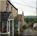
Springs and Holy WellsSite Name: Conkwell wellCountry: England
NOTE: This site is 1.8 km away from the location you searched for.
County: Wiltshire Type: Holy Well or Sacred Spring
Nearest Village: Winsley
Map Ref: ST791626 Landranger Map Number: 172
Latitude: 51.362078N Longitude: 2.301571W
Condition:
| 5 | Perfect |
| 4 | Almost Perfect |
| 3 | Reasonable but with some damage |
| 2 | Ruined but still recognisable as an ancient site |
| 1 | Pretty much destroyed, possibly visible as crop marks |
| 0 | No data. |
| -1 | Completely destroyed |
| 5 | Superb |
| 4 | Good |
| 3 | Ordinary |
| 2 | Not Good |
| 1 | Awful |
| 0 | No data. |
| 5 | Can be driven to, probably with disabled access |
| 4 | Short walk on a footpath |
| 3 | Requiring a bit more of a walk |
| 2 | A long walk |
| 1 | In the middle of nowhere, a nightmare to find |
| 0 | No data. |
| 5 | co-ordinates taken by GPS or official recorded co-ordinates |
| 4 | co-ordinates scaled from a detailed map |
| 3 | co-ordinates scaled from a bad map |
| 2 | co-ordinates of the nearest village |
| 1 | co-ordinates of the nearest town |
| 0 | no data |
Be the first person to rate this site - see the 'Contribute!' box in the right hand menu.
Internal Links:
External Links:
")
Have you visited this site? Please add a comment below.
You may be viewing yesterday's version of this page. To see the most up to date information please register for a free account.
Do not use the above information on other web sites or publications without permission of the contributor.
Nearby Images from Geograph Britain and Ireland:
![ST7962 : A short walk around Conkwell [27] by Michael Dibb](https://s3.geograph.org.uk/geophotos/07/36/69/7366979_aaa1fc88_120x120.jpg)
©2022(licence)
![ST7962 : A short walk around Conkwell [28] by Michael Dibb](https://s3.geograph.org.uk/geophotos/07/36/69/7366983_95a8f6ff_120x120.jpg)
©2022(licence)
![ST7962 : A short walk around Conkwell [1] by Michael Dibb](https://s2.geograph.org.uk/geophotos/07/36/63/7366342_1d797509_120x120.jpg)
©2022(licence)
©2007(licence)
![ST7962 : A short walk around Conkwell [26] by Michael Dibb](https://s1.geograph.org.uk/geophotos/07/36/69/7366977_9efb006f_120x120.jpg)
©2022(licence)
The above images may not be of the site on this page, they are loaded from Geograph.
Please Submit an Image of this site or go out and take one for us!
Click here to see more info for this site
Nearby sites
Key: Red: member's photo, Blue: 3rd party photo, Yellow: other image, Green: no photo - please go there and take one, Grey: site destroyed
Download sites to:
KML (Google Earth)
GPX (GPS waypoints)
CSV (Garmin/Navman)
CSV (Excel)
To unlock full downloads you need to sign up as a Contributory Member. Otherwise downloads are limited to 50 sites.
Turn off the page maps and other distractions
Nearby sites listing. In the following links * = Image available
402m ENE 60° Conkwell stone circle* Stone Circle (ST79456280)
741m NE 52° Jug's Grave* Round Barrow(s) (ST79696305)
1.7km SW 220° Shingle Bell* Holy Well or Sacred Spring (ST780613)
2.2km SSE 156° Winsley Chambered Tomb (ST800606)
2.3km SE 144° Turleigh Trows* Holy Well or Sacred Spring (ST8044960725)
2.9km NW 326° Bathampton Camp* Hillfort (ST77456502)
3.2km NW 324° Bathampton* Standing Stones (ST772652)
3.3km NNE 22° Monk's Conduit (Monkton Farleigh)* Holy Well or Sacred Spring (ST8036265692)
3.4km NW 312° Bathampton Round Barrow 2* Round Barrow(s) (ST76616489)
3.7km ESE 119° Ladywell (Bradford on Avon)* Holy Well or Sacred Spring (ST823608)
3.7km SW 217° Hill Farm Barrow (Somerset) Round Barrow(s) (ST76855969)
3.7km ESE 117° St Laurence's Church (Bradford on Avon)* Early Christian Sculptured Stone (ST8241960914)
3.9km SSW 210° Beacon Barrow (Somerset) Round Barrow(s) (ST77095920)
4.4km SW 223° The Giants Graves Cist (ST761594)
4.5km NW 318° Kensington Meadows Holed Megalith Holed Stone
4.6km WNW 298° Sacred Spring, Bath* Holy Well or Sacred Spring (ST7505364726)
4.7km WNW 300° Bath Postal Museum* Museum (ST7504564998)
5.8km NNW 337° Solsbury Hill* Hillfort (ST76876797)
6.4km NW 317° St Mary's Well (Charlcombe)* Holy Well or Sacred Spring (ST748673)
6.7km NNE 30° Becket's Well (Box) Holy Well or Sacred Spring (ST825684)
6.9km NNE 27° Box Rock Circus* Modern Stone Circle etc (ST823687)
7.1km WSW 239° Twinhoe Stone Circle (ST730590)
7.2km NE 37° Hazelbury Manor Menhirs* Modern Stone Circle etc (ST83476830)
7.4km N 4° Three Shires Stones* Modern Stone Circle etc (ST7961070021)
7.8km SW 226° Stoney Littleton* Chambered Cairn (ST7349257208)
View more nearby sites and additional images


 We would like to know more about this location. Please feel free to add a brief description and any relevant information in your own language.
 Wir möchten mehr über diese Stätte erfahren. Bitte zögern Sie nicht, eine kurze Beschreibung und relevante Informationen in Deutsch hinzuzufügen.
 Nous aimerions en savoir encore un peu sur les lieux. S'il vous plaît n'hesitez pas à ajouter une courte description et tous les renseignements pertinents dans votre propre langue.
 Quisieramos informarnos un poco más de las lugares. No dude en añadir una breve descripción y otros datos relevantes en su propio idioma.