<< Our Photo Pages >> Jubilee Hill barrow - Round Barrow(s) in England in Herefordshire
Submitted by Jimwithnoname on Tuesday, 24 September 2019 Page Views: 7544
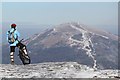
Neolithic and Bronze AgeSite Name: Jubilee Hill barrowCountry: England
NOTE: This site is 0.2 km away from the location you searched for.
County: Herefordshire Type: Round Barrow(s)
Nearest Town: Malvern
Map Ref: SO768421
Latitude: 52.076770N Longitude: 2.339927W
Condition:
| 5 | Perfect |
| 4 | Almost Perfect |
| 3 | Reasonable but with some damage |
| 2 | Ruined but still recognisable as an ancient site |
| 1 | Pretty much destroyed, possibly visible as crop marks |
| 0 | No data. |
| -1 | Completely destroyed |
| 5 | Superb |
| 4 | Good |
| 3 | Ordinary |
| 2 | Not Good |
| 1 | Awful |
| 0 | No data. |
| 5 | Can be driven to, probably with disabled access |
| 4 | Short walk on a footpath |
| 3 | Requiring a bit more of a walk |
| 2 | A long walk |
| 1 | In the middle of nowhere, a nightmare to find |
| 0 | No data. |
| 5 | co-ordinates taken by GPS or official recorded co-ordinates |
| 4 | co-ordinates scaled from a detailed map |
| 3 | co-ordinates scaled from a bad map |
| 2 | co-ordinates of the nearest village |
| 1 | co-ordinates of the nearest town |
| 0 | no data |
Internal Links:
External Links:
I have visited· I would like to visit
Jimwithnoname visited - their rating: Cond: 2 Amb: 3 Access: 4
Humbucker have visited here
")
There is also an alleged hermits cave just south of the Camp - Clutters Cave, which is on the OS map.
You may be viewing yesterday's version of this page. To see the most up to date information please register for a free account.
")
")
Do not use the above information on other web sites or publications without permission of the contributor.
Nearby Images from Geograph Britain and Ireland:
©2006(licence)
©2013(licence)
©2023(licence)
©2023(licence)
©2012(licence)
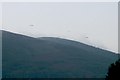
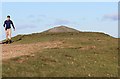
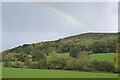
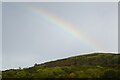
The above images may not be of the site on this page, they are loaded from Geograph.
Please Submit an Image of this site or go out and take one for us!
Click here to see more info for this site
Nearby sites
Key: Red: member's photo, Blue: 3rd party photo, Yellow: other image, Green: no photo - please go there and take one, Grey: site destroyed
Download sites to:
KML (Google Earth)
GPX (GPS waypoints)
CSV (Garmin/Navman)
CSV (Excel)
To unlock full downloads you need to sign up as a Contributory Member. Otherwise downloads are limited to 50 sites.
Turn off the page maps and other distractions
Nearby sites listing. In the following links * = Image available
282m NE 45° Holy Well (Malvern)* Holy Well or Sacred Spring (SO770423)
2.2km SSW 202° Herefordshire Beacon* Hillfort (SO75974003)
2.9km SSW 195° Walms Well* Holy Well or Sacred Spring (SO76053927)
3.7km N 6° St Ann's Well (Great Malvern)* Holy Well or Sacred Spring (SO77234579)
4.7km S 188° Midsummer Hill* Hillfort (SO761375)
7.4km W 280° Bosbury Church Stone* Standing Stone (Menhir) (SO695434)
8.5km WSW 243° Wall Hills Camp* Hillfort (SO692382)
8.8km WSW 242° Redhill Wood Hillfort* Hillfort (SO690380)
9.3km SSW 208° Haffield Camp* Hillfort (SO72303390)
10.6km NE 49° Kempsey Cross* Ancient Cross (SO8482149096)
10.8km SSE 166° Gadbury Bank* Hillfort (SO793316)
12.3km ESE 114° Towbury Camp* Hillfort (SO88003695)
12.7km NW 317° Stanford Bishop Church Stone* Standing Stone (Menhir) (SO682515)
14.7km NE 46° Crookbarrow Hill* Artificial Mound (SO874523)
14.8km ESE 113° Chad Well (Twyning)* Holy Well or Sacred Spring (SO90363617)
15.7km SE 128° Tewkesbury Abbey holy well* Holy Well or Sacred Spring (SO892325)
16.4km W 264° St Edith's Well (Herefordshire)* Holy Well or Sacred Spring (SO604406)
16.6km SW 235° Oldbury Camp (Herefordshire)* Hillfort (SO632326)
16.6km N 351° The Berrow* Hillfort (SO744585)
16.7km SSW 195° St Mary's Church (Newent) Ancient Cross (SO724260)
17.5km ESE 101° Norton Stones* Misc. Earthwork (SO940386)
18.1km E 101° The King and Queen Stones* Standing Stones (SO9456738632)
18.3km W 260° Backbury* Hillfort (SO587389)
18.6km E 95° St. Catherine's Well (Eckington)* Holy Well or Sacred Spring (SO95364030)
19.0km E 96° Kemerton Camp* Hillfort (SO957401)
View more nearby sites and additional images


 We would like to know more about this location. Please feel free to add a brief description and any relevant information in your own language.
 Wir möchten mehr über diese Stätte erfahren. Bitte zögern Sie nicht, eine kurze Beschreibung und relevante Informationen in Deutsch hinzuzufügen.
 Nous aimerions en savoir encore un peu sur les lieux. S'il vous plaît n'hesitez pas à ajouter une courte description et tous les renseignements pertinents dans votre propre langue.
 Quisieramos informarnos un poco más de las lugares. No dude en añadir una breve descripción y otros datos relevantes en su propio idioma.