 with our Megalithic Portal iPhone app")

<< Our Photo Pages >> Park Hill Camp - Hillfort in England in Wiltshire
Submitted by JimChampion on Sunday, 19 September 2010 Page Views: 8753
Iron Age and Later PrehistorySite Name: Park Hill CampCountry: England County: Wiltshire Type: Hillfort
Nearest Village: Stourton
Map Ref: ST76383471
Latitude: 51.111192N Longitude: 2.338789W
Condition:
| 5 | Perfect |
| 4 | Almost Perfect |
| 3 | Reasonable but with some damage |
| 2 | Ruined but still recognisable as an ancient site |
| 1 | Pretty much destroyed, possibly visible as crop marks |
| 0 | No data. |
| -1 | Completely destroyed |
| 5 | Superb |
| 4 | Good |
| 3 | Ordinary |
| 2 | Not Good |
| 1 | Awful |
| 0 | No data. |
| 5 | Can be driven to, probably with disabled access |
| 4 | Short walk on a footpath |
| 3 | Requiring a bit more of a walk |
| 2 | A long walk |
| 1 | In the middle of nowhere, a nightmare to find |
| 0 | No data. |
| 5 | co-ordinates taken by GPS or official recorded co-ordinates |
| 4 | co-ordinates scaled from a detailed map |
| 3 | co-ordinates scaled from a bad map |
| 2 | co-ordinates of the nearest village |
| 1 | co-ordinates of the nearest town |
| 0 | no data |
Internal Links:
External Links:
I have visited· I would like to visit
Jansold visited on 31st Oct 2016 - their rating: Cond: 2 Amb: 4 Access: 3
JimChampion have visited here
")
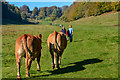
Iron age camp on the Park Hill ridge, west of Six Wells Bottom (source of the River Stour). The earthworks lie within Stourhead Park, managed by the National Trust, and can be reached along footpaths. There is a National Trust 'interpretation board' at the modern south-east entrance to the fort, basically saying that the site has not been excavated so the best guess is that it was a hillfort.
You may be viewing yesterday's version of this page. To see the most up to date information please register for a free account.
")
Do not use the above information on other web sites or publications without permission of the contributor.
Nearby Images from Geograph Britain and Ireland:
©2017(licence)
©2017(licence)

©2009(licence)
©2019(licence)
©2018(licence)
The above images may not be of the site on this page, they are loaded from Geograph.
Please Submit an Image of this site or go out and take one for us!
Click here to see more info for this site
Nearby sites
Key: Red: member's photo, Blue: 3rd party photo, Yellow: other image, Green: no photo - please go there and take one, Grey: site destroyed
Download sites to:
KML (Google Earth)
GPX (GPS waypoints)
CSV (Garmin/Navman)
CSV (Excel)
To unlock full downloads you need to sign up as a Contributory Member. Otherwise downloads are limited to 50 sites.
Turn off the page maps and other distractions
Nearby sites listing. In the following links * = Image available
744m NNW 338° St. Peter's Pump* Holy Well or Sacred Spring (ST761354)
3.7km SSE 164° Egbert's Stone Standing Stone (Menhir) (ST774312)
3.7km SSE 161° Bourton Monolith* Standing Stone (Menhir) (ST7757731221)
3.8km E 83° Whitesheet Hill* Ancient Village or Settlement (ST80163518)
4.0km E 91° Whitesheet Castle* Hillfort (ST804346)
5.7km NE 40° Town Well (Maiden Bradley) Holy Well or Sacred Spring (ST8010039028)
5.9km ENE 78° Rodmead Hill Enclosure Ancient Village or Settlement (ST82123593)
6.0km E 81° Rodmead Barrow Cemetery Barrow Cemetery (ST823356)
7.2km NNW 341° Witham Friary I Round Barrow(s) (ST74014156)
7.3km N 351° Witham Friary 2 Round Barrow(s) (ST75264194)
7.3km S 186° St Barbara's Well* Holy Well or Sacred Spring
7.7km SSW 207° Physic Well (Wincanton) Holy Well or Sacred Spring (ST728279)
7.8km SW 219° Wincanton and District Museum* Museum (ST7149528680)
7.8km SW 222° Shad Well* Holy Well or Sacred Spring (ST711289)
7.9km W 271° Patwell* Holy Well or Sacred Spring (ST6843434863)
8.8km N 4° Conquest Field Round Barrow(s) (ST77004347)
9.2km SSE 152° Gillingham Vicarage (Dorset) Ancient Cross (ST80682656)
9.6km ESE 107° Puckwell* Holy Well or Sacred Spring (ST856319)
11.0km WNW 302° Evercreech 14-15 Bowl Barrows* Round Barrow(s) (ST67094063)
11.1km ENE 76° Pertwood Down Long Barrow Long Barrow (ST872374)
11.4km WNW 301° Small Down Barrows* Barrow Cemetery (ST666406)
11.4km WNW 301° Small Down Camp* Hillfort (ST666407)
11.5km NNW 341° Nunney Artificial Mound (ST72734564)
11.9km NE 41° Nutball Stone Standing Stone (Menhir) (ST842437)
12.3km ESE 110° St Mary the Virgin (East Knoyle)* Ancient Cross (ST880305)
View more nearby sites and additional images


 We would like to know more about this location. Please feel free to add a brief description and any relevant information in your own language.
 Wir möchten mehr über diese Stätte erfahren. Bitte zögern Sie nicht, eine kurze Beschreibung und relevante Informationen in Deutsch hinzuzufügen.
 Nous aimerions en savoir encore un peu sur les lieux. S'il vous plaît n'hesitez pas à ajouter une courte description et tous les renseignements pertinents dans votre propre langue.
 Quisieramos informarnos un poco más de las lugares. No dude en añadir una breve descripción y otros datos relevantes en su propio idioma.