<< Text Pages >> Chatley Crags - Ring Cairn in England in Northumberland
Submitted by SolarMegalith on Friday, 22 February 2013 Page Views: 2164
Neolithic and Bronze AgeSite Name: Chatley CragsCountry: England County: Northumberland Type: Ring Cairn
Nearest Village: Gallowshieldrigg
Map Ref: NY75077012
Latitude: 55.024984N Longitude: 2.391489W
Condition:
| 5 | Perfect |
| 4 | Almost Perfect |
| 3 | Reasonable but with some damage |
| 2 | Ruined but still recognisable as an ancient site |
| 1 | Pretty much destroyed, possibly visible as crop marks |
| 0 | No data. |
| -1 | Completely destroyed |
| 5 | Superb |
| 4 | Good |
| 3 | Ordinary |
| 2 | Not Good |
| 1 | Awful |
| 0 | No data. |
| 5 | Can be driven to, probably with disabled access |
| 4 | Short walk on a footpath |
| 3 | Requiring a bit more of a walk |
| 2 | A long walk |
| 1 | In the middle of nowhere, a nightmare to find |
| 0 | No data. |
| 5 | co-ordinates taken by GPS or official recorded co-ordinates |
| 4 | co-ordinates scaled from a detailed map |
| 3 | co-ordinates scaled from a bad map |
| 2 | co-ordinates of the nearest village |
| 1 | co-ordinates of the nearest town |
| 0 | no data |
Be the first person to rate this site - see the 'Contribute!' box in the right hand menu.
Internal Links:
External Links:
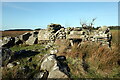
Ring Cairn in Northumberland
Remains of a multi-phased Bronze Age ring cairn, partially excavated in 1994.
Read More at Pastscape.
You may be viewing yesterday's version of this page. To see the most up to date information please register for a free account.
Do not use the above information on other web sites or publications without permission of the contributor.
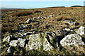
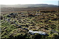
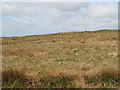
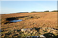
Nearby Images from Geograph Britain and Ireland:
©2022(licence)
©2022(licence)
©2009(licence)
©2022(licence)
©2022(licence)
The above images may not be of the site on this page, they are loaded from Geograph.
Please Submit an Image of this site or go out and take one for us!
Click here to see more info for this site
Nearby sites
Key: Red: member's photo, Blue: 3rd party photo, Yellow: other image, Green: no photo - please go there and take one, Grey: site destroyed
Download sites to:
KML (Google Earth)
GPX (GPS waypoints)
CSV (Garmin/Navman)
CSV (Excel)
To unlock full downloads you need to sign up as a Contributory Member. Otherwise downloads are limited to 50 sites.
Turn off the page maps and other distractions
Nearby sites listing. In the following links * = Image available
2.5km ESE 105° Greenlee Lough A* Rock Art (NY7751669468)
2.6km SSE 157° Hadrian's Wall - Milecastle 39* Stone Fort or Dun (NY76066773)
2.6km E 97° Ridley Common Enclosure* Ancient Village or Settlement (NY77676979)
2.7km E 97° Ridley Common* Stone Circle (NY77756977)
2.9km SE 139° Hadrian's Wall* Misc. Earthwork (NY770679)
3.0km E 92° Greenlee Lough B* Rock Art (NY7806069988)
3.2km S 176° The Sill* Museum (NY7527566896)
3.5km WSW 241° Ventner's Hall Cairn (2)* Cairn (NY7198068434)
3.7km ESE 112° Hadrian's Wall - Milecastle 37* Stone Fort or Dun (NY78506869)
3.8km WSW 243° Ventner's Hall Cairn (1)* Cairn (NY71696841)
3.9km S 172° Smith's Shield Milestone* Marker Stone (NY7561766242)
4.1km ESE 108° Housesteads Roman Fort* Stone Fort or Dun (NY78986880)
4.3km SSE 152° Vindolanda Roman Fort* Stone Fort or Dun (NY7705266352)
4.6km SSW 213° Mare and Foal* Standing Stones (NY72536633)
4.6km E 81° King's Crags Cairns* Round Cairn (NY79617080)
4.6km ENE 69° Crow Crags Cairnfield* Cairn (NY79397174)
4.6km SE 135° Barcombe Hill Settlement* Ancient Village or Settlement (NY78306682)
4.6km SE 142° Long Stone (Barcombe Hill)* Ancient Cross (NY77896646)
4.6km E 86° Queen's Crags Cup Marked Boulders* Rock Art (NY79717042)
4.7km ESE 112° Housesteads Tumulus* Artificial Mound (NY7938268330)
4.7km ESE 114° Housesteads Mound* Misc. Earthwork (NY79386815)
4.8km ENE 77° King's Crag 1 Rock Art (NY7976071130)
4.8km SW 224° Cawfield Roman Fort Stone Fort or Dun (NY71666667)
4.9km ENE 79° Kings Crags Cairn* Cairn (NY79857105)
5.0km ENE 67° Crow Crags Round Cairn* Round Cairn (NY79687200)
View more nearby sites and additional images


 We would like to know more about this location. Please feel free to add a brief description and any relevant information in your own language.
 Wir möchten mehr über diese Stätte erfahren. Bitte zögern Sie nicht, eine kurze Beschreibung und relevante Informationen in Deutsch hinzuzufügen.
 Nous aimerions en savoir encore un peu sur les lieux. S'il vous plaît n'hesitez pas à ajouter une courte description et tous les renseignements pertinents dans votre propre langue.
 Quisieramos informarnos un poco más de las lugares. No dude en añadir una breve descripción y otros datos relevantes en su propio idioma.