


<< Our Photo Pages >> Inchbrayock 3 - Class III Pictish Cross Slab in Scotland in Angus
Submitted by Anonymous on Monday, 18 October 2004 Page Views: 9325
Early Medieval (Dark Age)Site Name: Inchbrayock 3 Alternative Name: InchbraochCountry: Scotland
NOTE: This site is 2.3 km away from the location you searched for.
County: Angus Type: Class III Pictish Cross Slab
Map Ref: NO704558 Landranger Map Number: 54
Latitude: 56.692983N Longitude: 2.484888W
Condition:
| 5 | Perfect |
| 4 | Almost Perfect |
| 3 | Reasonable but with some damage |
| 2 | Ruined but still recognisable as an ancient site |
| 1 | Pretty much destroyed, possibly visible as crop marks |
| 0 | No data. |
| -1 | Completely destroyed |
| 5 | Superb |
| 4 | Good |
| 3 | Ordinary |
| 2 | Not Good |
| 1 | Awful |
| 0 | No data. |
| 5 | Can be driven to, probably with disabled access |
| 4 | Short walk on a footpath |
| 3 | Requiring a bit more of a walk |
| 2 | A long walk |
| 1 | In the middle of nowhere, a nightmare to find |
| 0 | No data. |
| 5 | co-ordinates taken by GPS or official recorded co-ordinates |
| 4 | co-ordinates scaled from a detailed map |
| 3 | co-ordinates scaled from a bad map |
| 2 | co-ordinates of the nearest village |
| 1 | co-ordinates of the nearest town |
| 0 | no data |
Be the first person to rate this site - see the 'Contribute!' box in the right hand menu.
Internal Links:
External Links:
I have visited· I would like to visit
MAIGO has visited here
")
The front of this stone depicts a decorated ring cross. However, the back is of greater interest and at first sight seems to show a pagan hunting scene In actual fact, the carving illustrates a scene from the Old Testament. At bottom left, Samson with his long hair strikes the Philistine with the jaw-bone of an ass. At the top is a mounted warrior with his hound and their prey. The tree with its exotic fruits may be the Tree of Life, but who is the ghostly person in the bottom right corner?
For details, visit: http://www.archaeoptics.co.uk/products/ecms/225.html
You may be viewing yesterday's version of this page. To see the most up to date information please register for a free account.
Do not use the above information on other web sites or publications without permission of the contributor.
Nearby Images from Geograph Britain and Ireland:
©2011(licence)
©2020(licence)
©2020(licence)
©2020(licence)
©2013(licence)
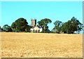
The above images may not be of the site on this page, they are loaded from Geograph.
Please Submit an Image of this site or go out and take one for us!
Click here to see more info for this site
Nearby sites
Key: Red: member's photo, Blue: 3rd party photo, Yellow: other image, Green: no photo - please go there and take one, Grey: site destroyed
Download sites to:
KML (Google Earth)
GPX (GPS waypoints)
CSV (Garmin/Navman)
CSV (Excel)
To unlock full downloads you need to sign up as a Contributory Member. Otherwise downloads are limited to 50 sites.
Turn off the page maps and other distractions
Nearby sites listing. In the following links * = Image available
2.3km NNE 32° Inchbrayock 1* Class II Pictish Symbol Stone (NO71625771)
2.3km NNE 32° Montrose Museum* Museum (NO7163457711)
3.9km WNW 288° Maryton Cursus Cursus (NO66715699)
4.5km WNW 287° Maryton Cursus Cursus (NO66105713)
5.0km NW 317° Gallows Knowe Round Barrow(s) (NO670595)
6.1km NW 320° Dun cup marked stone* Rock Art (NO6654060523)
7.1km N 10° Stone of Morphie* Standing Stone (Menhir) (NO71706275)
8.4km S 181° Red Head* Promontory Fort / Cliff Castle (NO70134740)
9.4km S 184° Prail Castle* Promontory Fort / Cliff Castle (NO69624643)
9.5km N 1° Canterland Cairn (NO706653)
9.9km S 186° West Mains of Ethie* Promontory Fort / Cliff Castle (NO69284600)
10.2km WNW 303° Easter Pitforthie Stone Circle (NO619614)
10.6km SW 216° Kinblethmont* Class I Pictish Symbol Stone (NO641472)
10.9km SW 223° Westfield 2 Timber Circle (NO629479)
10.9km SW 223° Westfield 1 Timber Circle (NO629479)
11.0km WSW 239° Kinnell Pictish Cross Slab Class III Pictish Cross Slab (NO60885028)
11.4km WSW 237° Kinnell Cursus Cursus (NO607497)
11.6km WNW 291° Brechin Cathedral* Sculptured Stone (NO596601)
11.7km SW 229° Inverkeilor Cursus Cursus (NO61534812)
11.8km WSW 237° Kinnell Cursus Cursus (NO605494)
11.8km WNW 291° Aldbar* Class III Pictish Cross Slab (NO594601)
11.9km S 191° Castle Rock (Auchmithie)* Promontory Fort / Cliff Castle (NO68074416)
12.0km W 274° St Murdoch's Well (Brechin) Holy Well or Sacred Spring (NO58405682)
12.1km WNW 285° St Ouret's Well (Brechin) Holy Well or Sacred Spring (NO58695904)
12.6km S 190° Lud Castle* Promontory Fort / Cliff Castle (NO68054342)
View more nearby sites and additional images


 We would like to know more about this location. Please feel free to add a brief description and any relevant information in your own language.
 Wir möchten mehr über diese Stätte erfahren. Bitte zögern Sie nicht, eine kurze Beschreibung und relevante Informationen in Deutsch hinzuzufügen.
 Nous aimerions en savoir encore un peu sur les lieux. S'il vous plaît n'hesitez pas à ajouter une courte description et tous les renseignements pertinents dans votre propre langue.
 Quisieramos informarnos un poco más de las lugares. No dude en añadir una breve descripción y otros datos relevantes en su propio idioma.