<< Our Photo Pages >> Kirkhaugh Barrow - Round Barrow(s) in England in Northumberland
Submitted by David on Friday, 04 February 2022 Page Views: 1133
Neolithic and Bronze AgeSite Name: Kirkhaugh BarrowCountry: England
NOTE: This site is 0.2 km away from the location you searched for.
County: Northumberland Type: Round Barrow(s)
Nearest Town: Alston Nearest Village: Ayle
Map Ref: NY7054749298
Latitude: 54.837630N Longitude: 2.460093W
Condition:
| 5 | Perfect |
| 4 | Almost Perfect |
| 3 | Reasonable but with some damage |
| 2 | Ruined but still recognisable as an ancient site |
| 1 | Pretty much destroyed, possibly visible as crop marks |
| 0 | No data. |
| -1 | Completely destroyed |
| 5 | Superb |
| 4 | Good |
| 3 | Ordinary |
| 2 | Not Good |
| 1 | Awful |
| 0 | No data. |
| 5 | Can be driven to, probably with disabled access |
| 4 | Short walk on a footpath |
| 3 | Requiring a bit more of a walk |
| 2 | A long walk |
| 1 | In the middle of nowhere, a nightmare to find |
| 0 | No data. |
| 5 | co-ordinates taken by GPS or official recorded co-ordinates |
| 4 | co-ordinates scaled from a detailed map |
| 3 | co-ordinates scaled from a bad map |
| 2 | co-ordinates of the nearest village |
| 1 | co-ordinates of the nearest town |
| 0 | no data |
Internal Links:
External Links:
")
A cushion block was also found and these small rectangular blocks of stone are reckoned as early metalworkers' tools. It's believed that the burial was of an early prospector for copper. The Amesbury Archer also was buried with a pair of gold hair tresses and a cushion block and the two burials are the only ones known with both metalworker tools and gold ornaments. The cushion block was perhaps used, together with a small amount of burning charcoal and a quill blowpipe, in assaying ore deposits.
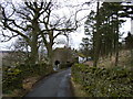
The excavation reports are freely available and a couple of other mounds in the same field were also dug in '35, with inconclusive results. What both sets of excavating groups missed was a pair of small barrows sheltering behind the fieldwall beside the road to the site. These are well preserved and obviously have never been dug and have been named Ayle Highside 1 and 2. The Kirkhaugh Barrow overlooks the stone circle site in the valley at Kirkhaugh and should be considered, perhaps, as being peripheral to it. The actual barrow has an equidistant lineal relationship with a very round natural hill - called a drumlin - a little way to the northwest and a ditched circular enclosure a similar distance to the southeast. The Kirkhaugh Barrow links both places, which are not intervisible. The circular ditched enclosure has been defined as an Iron Age roundhouse settlement and the outlines of half a dozen roundhouses show distinctly in the LiDAR image.
Although the barrow is within the Knaresdale and Kirkhaugh (merged) parish the field is very near to the hamlet of Ayle (formerly Ale) and this would have been a more appropriate name for the burial mound. The earliest metalworkers were often interred with boar tusks but these will have been lost to the acidic soil in Northumberland. Perhaps these tusks were an emblem for the new craft of metallurgy and that they hinted of the prospectors truffling about for surface deposits of copper ore, which on Alston Moor are malachite and chalcopyrite. There are no records of gold being found on Alston Moor but the word does persist in both the local placenames of Geltsdale and Gilderdale, perhaps suggesting alluvial traces. As well as introducing metalworking the Beaker People also brought the custom of drinking beer and this is perhaps carried on by the name of the burn and the colour of its pearty water. The nearby Ayle Burn Mine started as a network of flooded limestone caves but were later mined for zinc, until the 1920s, and maps of the workings may be found under 'Ayleburn Mine Cavern'.
You may be viewing yesterday's version of this page. To see the most up to date information please register for a free account.
")
")
")
")
Do not use the above information on other web sites or publications without permission of the contributor.
Nearby Images from Geograph Britain and Ireland:
©2006(licence)
©2007(licence)
©2010(licence)
©2007(licence)
©2006(licence)
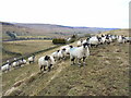
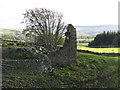
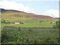
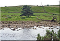
The above images may not be of the site on this page, they are loaded from Geograph.
Please Submit an Image of this site or go out and take one for us!
Click here to see more info for this site
Nearby sites
Key: Red: member's photo, Blue: 3rd party photo, Yellow: other image, Green: no photo - please go there and take one, Grey: site destroyed
Download sites to:
KML (Google Earth)
GPX (GPS waypoints)
CSV (Garmin/Navman)
CSV (Excel)
To unlock full downloads you need to sign up as a Contributory Member. Otherwise downloads are limited to 50 sites.
Turn off the page maps and other distractions
Nearby sites listing. In the following links * = Image available
528m WNW 285° Kirkhaugh Wells* Holy Well or Sacred Spring (NY7003749441)
619m W 281° Kirkhaugh Cross* Ancient Cross (NY6993849420)
690m SSW 210° Kirkhaugh Stone Circle* Stone Circle (NY702487)
1.2km WSW 240° Whitley Castle (Alston)* Hillfort (NY6948948692)
1.2km ENE 70° Bouker Stones* Standing Stones (NY717497)
1.6km NW 314° Railway Barrow* Artificial Mound (NY694504)
2.5km NNW 330° Saffron Well (Barhaugh)* Holy Well or Sacred Spring (NY69285148)
2.9km NW 310° Lintley Observatory* Misc. Earthwork (NY683512)
3.0km NW 311° Slaggyford Stone Rows* Stone Row / Alignment (NY683513)
3.0km NW 311° Low Thornhope Farm Rock Art (NY6825951318)
3.2km SSE 164° Raise Henge?* Misc. Earthwork (NY714462)
3.6km SSE 166° Bridge End Henge Misc. Earthwork (NY714458)
4.0km WNW 300° Slaggyford Robbed Cairn* Cairn (NY671513)
4.1km NW 311° Amos Hill* Artificial Mound (NY675520)
4.1km NNE 33° Wolf Hills Spearhead Find Site* Ancient Mine, Quarry or other Industry (NY728527)
4.2km WNW 285° David's Cobs* Cairn (NY665504)
4.2km WNW 290° Longpot Head Stone Circle* Stone Circle (NY666508)
4.2km WNW 298° Coal Tips Barrow Artificial Mound (NY668513)
4.2km WSW 248° Grey Nag Cairn* Cairn (NY666477)
4.7km WNW 283° Tot's Cupmarked Stone* Standing Stone (Menhir) (NY660504)
4.7km WNW 295° Slaggyford Stones* Standing Stones (NY663513)
4.7km W 268° Tot's Four-Poster* Stone Circle (NY658492)
4.8km WNW 300° Knar Standing Stone* Standing Stone (Menhir) (NY664517)
4.8km WNW 294° Knarsdale N01 Rock Art (NY6615451284)
4.8km WNW 296° Knaresdale 1 Rock Art (NY6619751454)
View more nearby sites and additional images


 We would like to know more about this location. Please feel free to add a brief description and any relevant information in your own language.
 Wir möchten mehr über diese Stätte erfahren. Bitte zögern Sie nicht, eine kurze Beschreibung und relevante Informationen in Deutsch hinzuzufügen.
 Nous aimerions en savoir encore un peu sur les lieux. S'il vous plaît n'hesitez pas à ajouter une courte description et tous les renseignements pertinents dans votre propre langue.
 Quisieramos informarnos un poco más de las lugares. No dude en añadir una breve descripción y otros datos relevantes en su propio idioma.