<< Text Pages >> Low Thornhope Farm - Rock Art in England in Northumberland
Submitted by Anne T on Friday, 27 April 2018 Page Views: 645
Rock ArtSite Name: Low Thornhope Farm Alternative Name: ERA-1367; Beckensall 1049Country: England County: Northumberland Type: Rock Art
Nearest Town: Alston Nearest Village: Kirkhaugh
Map Ref: NY6825951318
Latitude: 54.855641N Longitude: 2.495937W
Condition:
| 5 | Perfect |
| 4 | Almost Perfect |
| 3 | Reasonable but with some damage |
| 2 | Ruined but still recognisable as an ancient site |
| 1 | Pretty much destroyed, possibly visible as crop marks |
| 0 | No data. |
| -1 | Completely destroyed |
| 5 | Superb |
| 4 | Good |
| 3 | Ordinary |
| 2 | Not Good |
| 1 | Awful |
| 0 | No data. |
| 5 | Can be driven to, probably with disabled access |
| 4 | Short walk on a footpath |
| 3 | Requiring a bit more of a walk |
| 2 | A long walk |
| 1 | In the middle of nowhere, a nightmare to find |
| 0 | No data. |
| 5 | co-ordinates taken by GPS or official recorded co-ordinates |
| 4 | co-ordinates scaled from a detailed map |
| 3 | co-ordinates scaled from a bad map |
| 2 | co-ordinates of the nearest village |
| 1 | co-ordinates of the nearest town |
| 0 | no data |
Be the first person to rate this site - see the 'Contribute!' box in the right hand menu.
Internal Links:
External Links:
Rock Art in Northumberland
This rock art panel is recorded by NADRAP as being a small earthfast boulder, used in a field wall. Motifs include four concentric arcs with no central cups. NADRAP notes the arc cover approximately 60 degrees of a circle and are not continuous, concluding that they consider these to be formed naturally through weathering of the rock strata. The wall appears to be part of an Iron Age or later settlement.
For more information see England's Rock Art entry for ERA-1367 Low Thornhope Farm, which includes NADRAP's notes, photographs, a sketch of the rock and its motifs, plus photogrammetry, a VRML model and media from the Beckensall Archive.
The original Beckensall record can be found at Internet Archive: Beckensall 1049 Low Thornhope Farm.
Please note this rock art panel is located on private land.
Note: Have you seen this rock art panel? Do you have any photographs or information to add?
You may be viewing yesterday's version of this page. To see the most up to date information please register for a free account.
Do not use the above information on other web sites or publications without permission of the contributor.
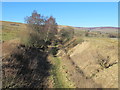
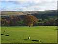
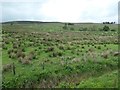
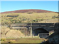
Nearby Images from Geograph Britain and Ireland:
©2013(licence)
©2008(licence)
©2019(licence)
©2013(licence)
©2022(licence)
The above images may not be of the site on this page, they are loaded from Geograph.
Please Submit an Image of this site or go out and take one for us!
Click here to see more info for this site
Nearby sites
Key: Red: member's photo, Blue: 3rd party photo, Yellow: other image, Green: no photo - please go there and take one, Grey: site destroyed
Download sites to:
KML (Google Earth)
GPX (GPS waypoints)
CSV (Garmin/Navman)
CSV (Excel)
To unlock full downloads you need to sign up as a Contributory Member. Otherwise downloads are limited to 50 sites.
Turn off the page maps and other distractions
Nearby sites listing. In the following links * = Image available
45m ESE 113° Slaggyford Stone Rows* Stone Row / Alignment (NY683513)
125m SSE 160° Lintley Observatory* Misc. Earthwork (NY683512)
1.0km NW 312° Amos Hill* Artificial Mound (NY675520)
1.0km E 81° Saffron Well (Barhaugh)* Holy Well or Sacred Spring (NY69285148)
1.2km W 269° Robbed Cairn* Cairn (NY671513)
1.5km W 269° Coal Tips Barrow Artificial Mound (NY668513)
1.5km SE 128° Railway Barrow* Artificial Mound (NY694504)
1.7km WSW 252° Longpot Head Stone Circle* Stone Circle (NY666508)
1.9km W 281° Knar Standing Stone* Standing Stone (Menhir) (NY664517)
2.0km W 269° Slaggyford Stones* Standing Stones (NY663513)
2.0km WSW 242° David's Cobs* Cairn (NY665504)
2.1km W 273° Knaresdale 1 Rock Art (NY6619751454)
2.1km W 269° Knarsdale N01 Rock Art (NY6615451284)
2.4km WSW 247° Tot's Cupmarked Stone* Standing Stone (Menhir) (NY660504)
2.5km WSW 255° Butter Well Cairns* Cairn (NY658507)
2.5km SE 138° Kirkhaugh Cross* Ancient Cross (NY6993849420)
2.6km W 269° Bold Venture* Ancient Mine, Quarry or other Industry (NY657513)
2.6km SE 136° Kirkhaugh Wells* Holy Well or Sacred Spring (NY7003749441)
2.8km WNW 288° Hanging Shaw Long Cairn* Cairn (NY656522)
2.9km W 277° Hut Burn Roundhouse* Ancient Village or Settlement (NY654517)
2.9km SSE 155° Whitley Castle (Alston)* Hillfort (NY6948948692)
3.0km SE 131° Kirkhaugh Barrow* Round Barrow(s) (NY7054749298)
3.2km SW 229° Tot's Four-Poster* Stone Circle (NY658492)
3.3km SE 143° Kirkhaugh Stone Circle* Stone Circle (NY702487)
3.8km ESE 115° Bouker Stones* Standing Stones (NY717497)
View more nearby sites and additional images


 We would like to know more about this location. Please feel free to add a brief description and any relevant information in your own language.
 Wir möchten mehr über diese Stätte erfahren. Bitte zögern Sie nicht, eine kurze Beschreibung und relevante Informationen in Deutsch hinzuzufügen.
 Nous aimerions en savoir encore un peu sur les lieux. S'il vous plaît n'hesitez pas à ajouter une courte description et tous les renseignements pertinents dans votre propre langue.
 Quisieramos informarnos un poco más de las lugares. No dude en añadir una breve descripción y otros datos relevantes en su propio idioma.