<< Text Pages >> Asby Common - Ancient Village or Settlement in England in Cumbria
Submitted by vicky on Tuesday, 17 September 2002 Page Views: 7682
Multi-periodSite Name: Asby CommonCountry: England County: Cumbria Type: Ancient Village or Settlement
Nearest Town: Brough Nearest Village: Great Asby
Map Ref: NY673109 Landranger Map Number: 91
Latitude: 54.492372N Longitude: 2.506333W
Condition:
| 5 | Perfect |
| 4 | Almost Perfect |
| 3 | Reasonable but with some damage |
| 2 | Ruined but still recognisable as an ancient site |
| 1 | Pretty much destroyed, possibly visible as crop marks |
| 0 | No data. |
| -1 | Completely destroyed |
| 5 | Superb |
| 4 | Good |
| 3 | Ordinary |
| 2 | Not Good |
| 1 | Awful |
| 0 | No data. |
| 5 | Can be driven to, probably with disabled access |
| 4 | Short walk on a footpath |
| 3 | Requiring a bit more of a walk |
| 2 | A long walk |
| 1 | In the middle of nowhere, a nightmare to find |
| 0 | No data. |
| 5 | co-ordinates taken by GPS or official recorded co-ordinates |
| 4 | co-ordinates scaled from a detailed map |
| 3 | co-ordinates scaled from a bad map |
| 2 | co-ordinates of the nearest village |
| 1 | co-ordinates of the nearest town |
| 0 | no data |
Internal Links:
External Links:
Ancient Settlement in Cumbria
Have you visited this site? Please add a comment below.
You may be viewing yesterday's version of this page. To see the most up to date information please register for a free account.
Do not use the above information on other web sites or publications without permission of the contributor.
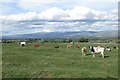
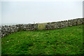
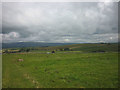
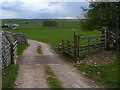
Nearby Images from Geograph Britain and Ireland:
©2018(licence)

©2018(licence)
©2020(licence)
©2017(licence)
©2012(licence)
The above images may not be of the site on this page, they are loaded from Geograph.
Please Submit an Image of this site or go out and take one for us!
Click here to see more info for this site
Nearby sites
Key: Red: member's photo, Blue: 3rd party photo, Yellow: other image, Green: no photo - please go there and take one, Grey: site destroyed
Download sites to:
KML (Google Earth)
GPX (GPS waypoints)
CSV (Garmin/Navman)
CSV (Excel)
To unlock full downloads you need to sign up as a Contributory Member. Otherwise downloads are limited to 50 sites.
Turn off the page maps and other distractions
Nearby sites listing. In the following links * = Image available
905m W 263° Ling Bank South Prehistoric Settlement/Enclosures* Ancient Village or Settlement (NY6639910793)
1.1km W 270° Ling Bank North Settlement/Enclosures* Ancient Village or Settlement (NY6616310906)
1.2km SSW 192° Muddygill Plain, Great Asby Scar* Cairn (NY6704309747)
1.7km NNE 32° Holborn Hill Ancient Village or Settlement (NY682123)
2.1km SSW 201° Little Kinmond Cairn* Cairn (NY66540899)
2.2km WNW 290° Hollin Stump Cairn* Cairn (NY652117)
2.5km NNE 20° St Helen's Well (Great Asby)* Holy Well or Sacred Spring (NY6817813278)
2.6km W 276° Gaythorn Plain* Ring Cairn (NY647112)
2.6km SSE 163° Howes Well ring cairn* Ring Cairn (NY6804908373)
2.7km WNW 292° Gaythorne Plain Round Cairns* Cairn (NY64811193)
2.8km SW 236° Castle Folds* Ancient Village or Settlement (NY64990936)
2.8km SW 226° Raisbeck Wood* Round Cairn (NY65260896)
3.1km SE 141° Little Asby Scar Round Cairn* Round Cairn (NY6920808493)
3.8km SSE 163° Raiset Pike* Long Barrow (NY68400725)
4.2km WNW 300° Raise Howe Cairn* Cairn (NY63711303)
4.3km SW 230° Gamelands* Stone Circle (NY64010816)
4.4km W 264° Penhurrock* Multiple Stone Rows / Avenue (NY62881043)
4.8km W 265° Howe Robin Ancient Village or Settlement (NY625105)
5.1km WNW 296° Howarcles Ancient Village or Settlement (NY627132)
5.3km SE 141° Bent's Hill Round Cairn* Round Cairn (NY7060206780)
5.3km WNW 285° Burwens Ancient Village or Settlement (NY622123)
5.8km W 280° Cow Green Long Barrow* Long Barrow (NY61541199)
6.0km WNW 301° Crosby Ravensworth Stone Row* Multiple Stone Rows / Avenue (NY6212514022)
6.1km W 269° Kings Well spring* Holy Well or Sacred Spring (NY612108)
6.2km W 270° Hazel Moor Enclosure* Ancient Village or Settlement (NY611109)
View more nearby sites and additional images


 We would like to know more about this location. Please feel free to add a brief description and any relevant information in your own language.
 Wir möchten mehr über diese Stätte erfahren. Bitte zögern Sie nicht, eine kurze Beschreibung und relevante Informationen in Deutsch hinzuzufügen.
 Nous aimerions en savoir encore un peu sur les lieux. S'il vous plaît n'hesitez pas à ajouter une courte description et tous les renseignements pertinents dans votre propre langue.
 Quisieramos informarnos un poco más de las lugares. No dude en añadir una breve descripción y otros datos relevantes en su propio idioma.