<< Our Photo Pages >> Soudley Camp - Promontory Fort / Cliff Castle in England in Gloucestershire
Submitted by 4clydesdale7 on Saturday, 01 October 2011 Page Views: 6524
Iron Age and Later PrehistorySite Name: Soudley CampCountry: England County: Gloucestershire Type: Promontory Fort / Cliff Castle
Map Ref: SO66161058
Latitude: 51.792841N Longitude: 2.492059W
Condition:
| 5 | Perfect |
| 4 | Almost Perfect |
| 3 | Reasonable but with some damage |
| 2 | Ruined but still recognisable as an ancient site |
| 1 | Pretty much destroyed, possibly visible as crop marks |
| 0 | No data. |
| -1 | Completely destroyed |
| 5 | Superb |
| 4 | Good |
| 3 | Ordinary |
| 2 | Not Good |
| 1 | Awful |
| 0 | No data. |
| 5 | Can be driven to, probably with disabled access |
| 4 | Short walk on a footpath |
| 3 | Requiring a bit more of a walk |
| 2 | A long walk |
| 1 | In the middle of nowhere, a nightmare to find |
| 0 | No data. |
| 5 | co-ordinates taken by GPS or official recorded co-ordinates |
| 4 | co-ordinates scaled from a detailed map |
| 3 | co-ordinates scaled from a bad map |
| 2 | co-ordinates of the nearest village |
| 1 | co-ordinates of the nearest town |
| 0 | no data |
Internal Links:
External Links:
I have visited· I would like to visit
4clydesdale7 visited on 30th Jul 2011 - their rating: Cond: 2 Amb: 2 Access: 4 If only the conservationists would allow the bracken to be cleared
")
From Pastscape: "Soudley Camp is a probable Iron Age promontory fort and consists of an enclosed area roughly triangular in shape situated on the end of a spur that overlooks the junction of three valleys. The western and wider end is protected by a very large bank and ditch with a central entrance. The north and south sides are protected by precipitous natural slopes. These earthworks are visible on aerial photographs. "
http://www.pastscape.org.uk/hob.aspx?hob_id=111775
Note: This site is worth highlighting as one that would benefit from some serious bracken clearance, as is happening around Lanyon Quoit
You may be viewing yesterday's version of this page. To see the most up to date information please register for a free account.
")
Do not use the above information on other web sites or publications without permission of the contributor.
Andy B has found this location on Google Street View:
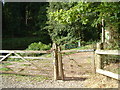
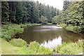
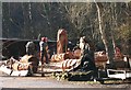
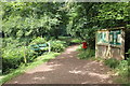
Nearby Images from Geograph Britain and Ireland:
©2005(licence)
©2017(licence)
©2015(licence)
©2017(licence)
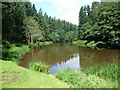
©2012(licence)
The above images may not be of the site on this page, they are loaded from Geograph.
Please Submit an Image of this site or go out and take one for us!
Click here to see more info for this site
Nearby sites
Key: Red: member's photo, Blue: 3rd party photo, Yellow: other image, Green: no photo - please go there and take one, Grey: site destroyed
Download sites to:
KML (Google Earth)
GPX (GPS waypoints)
CSV (Garmin/Navman)
CSV (Excel)
To unlock full downloads you need to sign up as a Contributory Member. Otherwise downloads are limited to 50 sites.
Turn off the page maps and other distractions
Nearby sites listing. In the following links * = Image available
240m E 85° Dean Heritage Centre* Museum (SO664106)
1.1km SSW 207° Patten Stone Marker Stone (SO65640959)
1.7km SSW 203° Drummer Boys Grave Stone* Ancient Mine, Quarry or other Industry (SO65470898)
3.6km NNE 18° Littledean Standing Stone* Marker Stone (SO6731713967)
4.4km WNW 290° The Speech Stone* Marker Stone (SO62011212)
5.1km NNE 18° Welshbury Hill Ancient Village or Settlement (SO678154)
5.2km NNE 17° Welshbury Camp* Hillfort (SO67751555)
5.2km N 9° St Anthony's Well (Cinderford)* Holy Well or Sacred Spring (SO67051574)
5.2km NNE 18° Welshbury Cairn* Cairn (SO67831555)
5.4km E 97° The Awen Stone* Modern Stone Circle etc (SO7149809889)
8.3km WSW 255° Gattle's Cross* Marker Stone (SO5812608512)
8.8km WSW 254° Clearwell Caves* Ancient Mine, Quarry or other Industry (SO57700822)
9.1km SSW 210° Lydney Hillfort* Hillfort (SO616027)
9.4km S 188° Lydney Harbour* Modern Stone Circle etc (SO64730126)
9.6km SSE 163° Wanswell Holy Well or Sacred Spring (SO68980139)
9.8km SSW 206° Aylburton Cross* Ancient Cross (SO6172101791)
10.3km W 278° Long Stone, Staunton* Standing Stone (Menhir) (SO55931206)
10.4km WNW 298° Coldwell Rocks Cave or Rock Shelter (SO570156)
10.6km WSW 246° Stowe Enclosure* Misc. Earthwork (SO56430643)
10.9km W 264° Newland Crosses* Ancient Cross (SO5530809511)
11.1km WNW 297° Symonds Yat Fort* Hillfort (SO563157)
11.2km WNW 296° Bowler's Hole Cave or Rock Shelter (SO56101545)
11.2km WNW 296° Symonds Yat Cave Cave or Rock Shelter (SO56101555)
11.2km WNW 296° Symonds Yat Cave 2 Cave or Rock Shelter (SO56101555)
11.2km WNW 296° Symonds Yat Cave 3 Cave or Rock Shelter (SO56101555)
View more nearby sites and additional images


 We would like to know more about this location. Please feel free to add a brief description and any relevant information in your own language.
 Wir möchten mehr über diese Stätte erfahren. Bitte zögern Sie nicht, eine kurze Beschreibung und relevante Informationen in Deutsch hinzuzufügen.
 Nous aimerions en savoir encore un peu sur les lieux. S'il vous plaît n'hesitez pas à ajouter une courte description et tous les renseignements pertinents dans votre propre langue.
 Quisieramos informarnos un poco más de las lugares. No dude en añadir una breve descripción y otros datos relevantes en su propio idioma.