<< Text Pages >> Furzey Down Road - Ancient Trackway in England in Dorset
Submitted by coldrum on Monday, 04 January 2010 Page Views: 3794
Multi-periodSite Name: Furzey Down RoadCountry: England County: Dorset Type: Ancient Trackway
Nearest Village: Godmanstone
Map Ref: SY654974
Latitude: 50.775141N Longitude: 2.492076W
Condition:
| 5 | Perfect |
| 4 | Almost Perfect |
| 3 | Reasonable but with some damage |
| 2 | Ruined but still recognisable as an ancient site |
| 1 | Pretty much destroyed, possibly visible as crop marks |
| 0 | No data. |
| -1 | Completely destroyed |
| 5 | Superb |
| 4 | Good |
| 3 | Ordinary |
| 2 | Not Good |
| 1 | Awful |
| 0 | No data. |
| 5 | Can be driven to, probably with disabled access |
| 4 | Short walk on a footpath |
| 3 | Requiring a bit more of a walk |
| 2 | A long walk |
| 1 | In the middle of nowhere, a nightmare to find |
| 0 | No data. |
| 5 | co-ordinates taken by GPS or official recorded co-ordinates |
| 4 | co-ordinates scaled from a detailed map |
| 3 | co-ordinates scaled from a bad map |
| 2 | co-ordinates of the nearest village |
| 1 | co-ordinates of the nearest town |
| 0 | no data |
Be the first person to rate this site - see the 'Contribute!' box in the right hand menu.
Internal Links:
External Links:
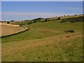
Ancient Trackway in Dorset
From Pastscape: "A pre-Roman trackway leaves the Great Ridgeway on Batcombe Hill and extends south-south-east over Gore Hill and Ridge Hill to Crete Hill. From this point, Timperley and Brill suggested that the trackway proceeded through the settlement on Grimstone Down (SY 69 NW 38) before descending to the River Frome at Muckleford. They also supposed that the trackway originally extended further south-west from Muckleford towards Black Down, where it joined the Coastal Ridgeway. Good, however, believed that the trackway continued south-eastwards from Crete Hill towards the river at Wrackleford (SY 668928) and headed towards Maiden Castle. The route favoured by Timperley and Brill (via Muckleford to Black Down) was described by Good as part of a Medieval road from Abbotsbury to Cerne Abbas (see SY 69 SW 63) with no mention of having had pre-Roman origin. Taylor's map of 1756 marks the trackway (as a complete road) for four miles over Gore Hill and annotates it as 'Furzey Down Road'."
You may be viewing yesterday's version of this page. To see the most up to date information please register for a free account.
Do not use the above information on other web sites or publications without permission of the contributor.
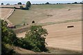
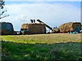
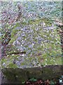
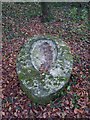
Nearby Images from Geograph Britain and Ireland:
©2018(licence)
©2014(licence)
©2014(licence)
©2014(licence)
©2007(licence)
The above images may not be of the site on this page, they are loaded from Geograph.
Please Submit an Image of this site or go out and take one for us!
Click here to see more info for this site
Nearby sites
Key: Red: member's photo, Blue: 3rd party photo, Yellow: other image, Green: no photo - please go there and take one, Grey: site destroyed
Download sites to:
KML (Google Earth)
GPX (GPS waypoints)
CSV (Garmin/Navman)
CSV (Excel)
To unlock full downloads you need to sign up as a Contributory Member. Otherwise downloads are limited to 50 sites.
Turn off the page maps and other distractions
Nearby sites listing. In the following links * = Image available
223m ENE 63° Crete Hill Bowl Barrow Round Barrow(s) (SY656975)
670m SSW 206° Crete Hill Field System Misc. Earthwork (SY651968)
720m NNE 33° Nether Cerne Field System Misc. Earthwork (SY658980)
1.2km SSW 191° Coronation Plantation Bowl Barrow Round Barrow(s) (SY65159620)
1.4km SSW 199° Lawyer's Plantation Cross Dyke Misc. Earthwork (SY64949606)
1.4km SSW 199° Jackman's Plantation Bowl Barrow Round Barrow(s) (SY64929604)
1.4km SW 216° Jackman's Cross Bowl Barrow Round Barrow(s) (SY64559623)
1.7km S 176° Howde's Barrow Plantation Bowl Barrow Round Barrow(s) (SY65509574)
1.9km SSW 205° Grimstone Down Settlements Ancient Village or Settlement (SY646957)
2.0km N 9° Smacam Down Long Barrow Long Barrow (SY6572599389)
2.0km N 8° Smacam Down Settlement Ancient Village or Settlement (SY657994)
2.1km NNE 12° Smacam Down Bowl Barrow Round Barrow(s) (SY65859946)
2.1km S 169° Forston Settlement Ancient Village or Settlement (SY658953)
2.1km SSW 207° Grimstone Down Barrow Cemetery Barrow Cemetery (SY644955)
2.6km NE 43° Green Hill Field System Misc. Earthwork (SY672993)
2.6km NE 39° Green Hill Barrows Barrow Cemetery (SY67069943)
2.9km N 4° Dickley Hill Bowl Barrows Round Barrow(s) (ST65600026)
2.9km N 5° Dickley Hill Settlement Ancient Village or Settlement (ST65650027)
3.1km WSW 253° Hog Cliff Hill Settlement Ancient Village or Settlement (SY624965)
3.3km WSW 258° Hog Cliff Hill Barrow Round Barrow(s) (SY62179676)
3.4km NE 35° Oxencombe Bottom Bowl Barrow Round Barrow(s) (ST67380018)
3.5km NNW 346° Up Cerne/Sydling St Nicholas Boundary Stone Marker Stone (ST64610078)
3.6km NNE 30° Black Hill Farm Enclosure Ancient Village or Settlement (ST672005)
3.6km S 184° Stratton Churchyard Cross* Ancient Cross (SY6510893793)
3.8km NW 307° The Combe (Dorset) Misc. Earthwork (SY624997)
View more nearby sites and additional images


 We would like to know more about this location. Please feel free to add a brief description and any relevant information in your own language.
 Wir möchten mehr über diese Stätte erfahren. Bitte zögern Sie nicht, eine kurze Beschreibung und relevante Informationen in Deutsch hinzuzufügen.
 Nous aimerions en savoir encore un peu sur les lieux. S'il vous plaît n'hesitez pas à ajouter une courte description et tous les renseignements pertinents dans votre propre langue.
 Quisieramos informarnos un poco más de las lugares. No dude en añadir una breve descripción y otros datos relevantes en su propio idioma.