<< Our Photo Pages >> Gamelands - Stone Circle in England in Cumbria
Submitted by Anne T on Saturday, 23 October 2021 Page Views: 18677
Neolithic and Bronze AgeSite Name: Gamelands Alternative Name: OrtonCountry: England County: Cumbria Type: Stone Circle
Nearest Town: Kendal Nearest Village: Orton
Map Ref: NY64010816 Landranger Map Number: 91
Latitude: 54.467525N Longitude: 2.556787W
Condition:
| 5 | Perfect |
| 4 | Almost Perfect |
| 3 | Reasonable but with some damage |
| 2 | Ruined but still recognisable as an ancient site |
| 1 | Pretty much destroyed, possibly visible as crop marks |
| 0 | No data. |
| -1 | Completely destroyed |
| 5 | Superb |
| 4 | Good |
| 3 | Ordinary |
| 2 | Not Good |
| 1 | Awful |
| 0 | No data. |
| 5 | Can be driven to, probably with disabled access |
| 4 | Short walk on a footpath |
| 3 | Requiring a bit more of a walk |
| 2 | A long walk |
| 1 | In the middle of nowhere, a nightmare to find |
| 0 | No data. |
| 5 | co-ordinates taken by GPS or official recorded co-ordinates |
| 4 | co-ordinates scaled from a detailed map |
| 3 | co-ordinates scaled from a bad map |
| 2 | co-ordinates of the nearest village |
| 1 | co-ordinates of the nearest town |
| 0 | no data |
Internal Links:
External Links:
I have visited· I would like to visit
SumDoood KeeleyJane would like to visit
rvbaker2003 visited on 30th Dec 2024 - their rating: Cond: 3 Amb: 4 Access: 4
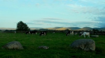
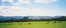
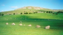
wildtalents visited on 22nd Apr 2023 - their rating: Cond: 4 Amb: 5 Access: 4 Deceptively large circle of medium-sized boulders, mostly undisturbed, and larger stones, mostly prone. On the day I visited a small mob of very young lambs were having great fun leaping about on the smaller/lower stones.
bishop_pam visited on 29th Sep 2020 - their rating: Cond: 3 Amb: 4 Access: 4
drolaf visited on 5th Aug 2020 - their rating: Cond: 4 Amb: 5 Access: 4
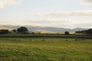
NorthernerInLondon visited on 9th Dec 2014 - their rating: Cond: 3 Amb: 4 Access: 4 Great circle to visit. Almost better than Long Meg and her daughters. Circle itself is not in the greatest of conditions but on a quiet evening nothing is better. Great views of the surrounding mountains and a real peacefulness.
Anne T visited on 7th Sep 2014 - their rating: Cond: 3 Amb: 4 Access: 4 Gamelands Stone Circle, near Orton, Cumbria: By now, it was late afternoon, with the evening rapidly approaching, and almost time to head off home. From the Oddendale Cairns and Stone Circle we headed off in search of something to eat and drink before finding Gamelands. In Orton, we found the Chocolate Factory still open and busy, so stopped off for very welcome refreshments.
I found navigating to this stone circle tricky, as it’s on the edge of two map sheets, so we took the wrong road out of Orton before identifying the right minor road, signposted to Raisbeck. Following the B6261 past a minor crossroads just out of Orton village (the left hand side being Street Lane), the B road shortly afterwards turns to the right; the minor road needed to get to Gamelands Stone Circle carrying straight on to Knott Lane, signposted as ‘Public Byway leading over Knott Green to Public Bridleway’. Knott Lane is about 1 mile east of Orton. When we visited, there was a large pile of stones, being used to repair the bridleway blocking part of the entrance, but the minor road was wide enough (just) to bump up onto the grass verge and leave the car to walk up Knott Lane.
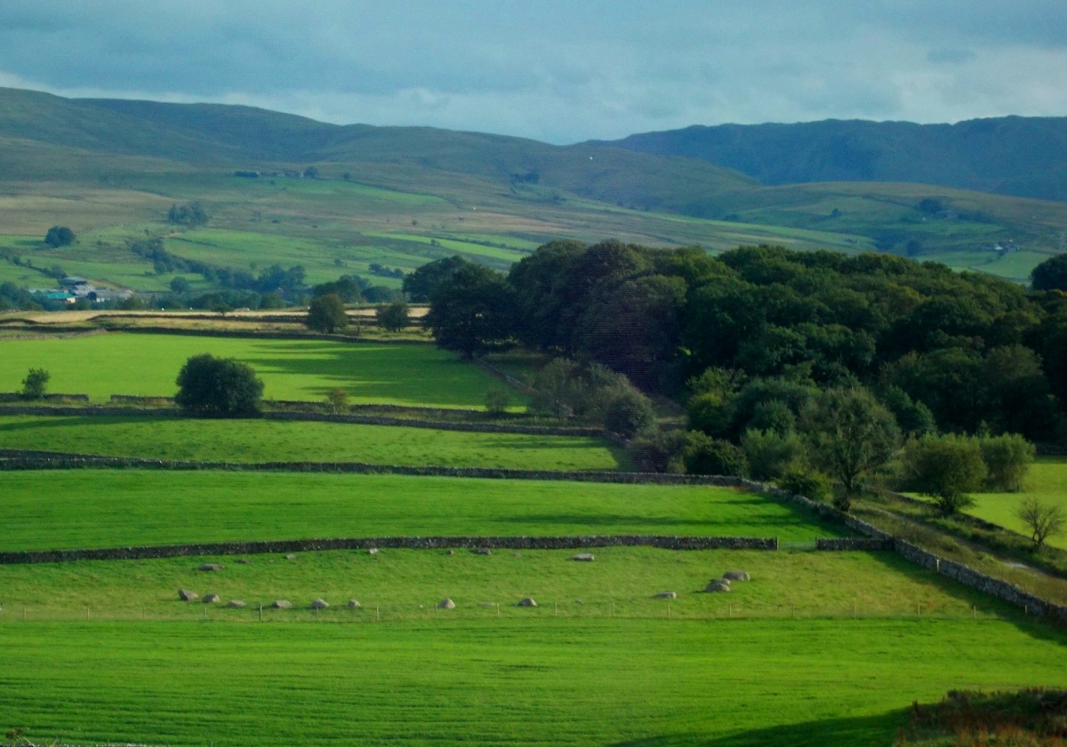
As we walked up the bridleway, we didn’t see the stone circle until we were almost upon it. The farmer has put in what looks like a relatively new wooden kissing gate to let people access the field, which was refreshingly nice. Thank you, Mr. Farmer! This is one of the largest stone circles we’ve seen in this area; the Visit Cumbria website tells me that this circle is some 100 yards in circumference.
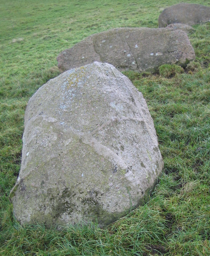
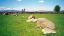
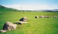
All the stones have fallen, and it must have been impressive when they stood upright. This stone circle (oval) is certainly in a lovely location and very tranquil. It is situated on a plateau immediately below the impressive Knott Scar which rises up to the North, with spectacular views over the Eden Valley and the North Pennines.
I got to see at close hand how the Shap Red Granite is made up – with large ‘tabular’ feldspar crystals glinting out from the whole. My husband has seen this type of granite polished and used in construction projects/buildings, and if our ancestors did polish these stones, then this circle must have been fantastic when it was created.
After spending some time here, just soaking in the atmosphere, we left to go home, with one final stop, at Raise Howe Tumulus, which was on our way home. A glorious afternoon, very well spent.
markj99 visited on 1st Mar 2014 - their rating: Cond: 3 Amb: 4 Access: 4 This ruined stone circle has a presence greater than its physical footprint. It has no typical standing stones but the N half is well delineated as is the S Arc. The location reminded me of Drummore Stone Circle near Kirkudbright however the remains of Gamelands Stone Circle are more impressive.
WindC visited on 9th Oct 2011 - their rating: Cond: 3 Amb: 4 Access: 3 This circle is, and feels, so very incomplete. The stone wall that passes close by, is too near, invading their already robbed space
There where 6 boulders of Shap granite, who may well have come from that site, around an area I wandered. brilliant if they could be moved back/ or too the site, and if someone/s could figure out how they, and where they should be.
There's sure to be more around..
Many stone walls with older stone posts.
BolshieBoris visited on 1st Jan 1995 - their rating: Cond: 4 Amb: 3 Access: 4
Runemage visited - their rating: Amb: 5 Access: 4 Not very well known locally, none of the staff in our hotel had heard of it.
MAIGO nicoladidsbury Linanjohn kelpie have visited here
Average ratings for this site from all visit loggers: Condition: 3.33 Ambience: 4.2 Access: 3.9
More at the Heritage Gateway.
Page originally by Stu.
You may be viewing yesterday's version of this page. To see the most up to date information please register for a free account.









These are just the first 25 photos of Gamelands. If you log in with a free user account you will be able to see our entire collection.
Do not use the above information on other web sites or publications without permission of the contributor.
Click here to see more info for this site
Nearby sites
Key: Red: member's photo, Blue: 3rd party photo, Yellow: other image, Green: no photo - please go there and take one, Grey: site destroyed
Download sites to:
KML (Google Earth)
GPX (GPS waypoints)
CSV (Garmin/Navman)
CSV (Excel)
To unlock full downloads you need to sign up as a Contributory Member. Otherwise downloads are limited to 50 sites.
Turn off the page maps and other distractions
Nearby sites listing. In the following links * = Image available
1.5km ENE 57° Raisbeck Wood* Round Cairn (NY65260896)
1.5km NE 39° Castle Folds* Ancient Village or Settlement (NY64990936)
2.5km NNW 333° Penhurrock* Multiple Stone Rows / Avenue (NY62881043)
2.7km ENE 71° Little Kinmond Cairn* Cairn (NY66540899)
2.8km NNW 327° Howe Robin Ancient Village or Settlement (NY625105)
3.1km NNE 12° Gaythorn Plain* Ring Cairn (NY647112)
3.4km ENE 62° Muddygill Plain, Great Asby Scar* Cairn (NY6704309747)
3.5km NE 38° Ling Bank North Settlement/Enclosures* Ancient Village or Settlement (NY6616310906)
3.5km NE 42° Ling Bank South Prehistoric Settlement/Enclosures* Ancient Village or Settlement (NY6639910793)
3.7km NNE 18° Hollin Stump Cairn* Cairn (NY652117)
3.8km NW 313° Kings Well spring* Holy Well or Sacred Spring (NY612108)
3.9km NNE 12° Gaythorne Plain Round Cairns* Cairn (NY64811193)
4.0km NW 313° Hazel Moor Enclosure* Ancient Village or Settlement (NY611109)
4.0km E 87° Howes Well ring cairn* Ring Cairn (NY6804908373)
4.3km NE 50° Asby Common Ancient Village or Settlement (NY673109)
4.5km ESE 101° Raiset Pike* Long Barrow (NY68400725)
4.5km NNW 336° Burwens Ancient Village or Settlement (NY622123)
4.5km NW 318° White Hag Round cairn* Round Cairn (NY61011158)
4.6km NNW 327° Cow Green Long Barrow* Long Barrow (NY61541199)
4.8km NW 316° White Hag* Stone Circle (NY60721160)
4.9km N 356° Raise Howe Cairn* Cairn (NY63711303)
5.1km NW 314° Wicker Street* Cairn (NY60411173)
5.2km E 86° Little Asby Scar Round Cairn* Round Cairn (NY6920808493)
5.2km NNW 345° Howarcles Ancient Village or Settlement (NY627132)
5.4km WNW 300° Long Scar Pike* Cairn (NY5933810862)
View more nearby sites and additional images


 We would like to know more about this location. Please feel free to add a brief description and any relevant information in your own language.
 Wir möchten mehr über diese Stätte erfahren. Bitte zögern Sie nicht, eine kurze Beschreibung und relevante Informationen in Deutsch hinzuzufügen.
 Nous aimerions en savoir encore un peu sur les lieux. S'il vous plaît n'hesitez pas à ajouter une courte description et tous les renseignements pertinents dans votre propre langue.
 Quisieramos informarnos un poco más de las lugares. No dude en añadir una breve descripción y otros datos relevantes en su propio idioma.