


<< Our Photo Pages >> Colouring Crags Long Cairn - Long Barrow in England in Northumberland
Submitted by David on Thursday, 20 January 2022 Page Views: 764
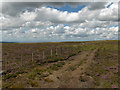
Date UncertainSite Name: Colouring Crags Long Cairn Alternative Name: Big DaddyCountry: England County: Northumberland Type: Long Barrow
Nearest Town: Alston Nearest Village: Slaggyford
Map Ref: NY628527
Latitude: 54.867683N Longitude: 2.581143W
Condition:
| 5 | Perfect |
| 4 | Almost Perfect |
| 3 | Reasonable but with some damage |
| 2 | Ruined but still recognisable as an ancient site |
| 1 | Pretty much destroyed, possibly visible as crop marks |
| 0 | No data. |
| -1 | Completely destroyed |
| 5 | Superb |
| 4 | Good |
| 3 | Ordinary |
| 2 | Not Good |
| 1 | Awful |
| 0 | No data. |
| 5 | Can be driven to, probably with disabled access |
| 4 | Short walk on a footpath |
| 3 | Requiring a bit more of a walk |
| 2 | A long walk |
| 1 | In the middle of nowhere, a nightmare to find |
| 0 | No data. |
| 5 | co-ordinates taken by GPS or official recorded co-ordinates |
| 4 | co-ordinates scaled from a detailed map |
| 3 | co-ordinates scaled from a bad map |
| 2 | co-ordinates of the nearest village |
| 1 | co-ordinates of the nearest town |
| 0 | no data |
Internal Links:
External Links:
")
Right To Roam access.
You may be viewing yesterday's version of this page. To see the most up to date information please register for a free account.
")
")
Do not use the above information on other web sites or publications without permission of the contributor.
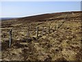
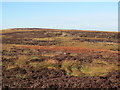
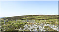
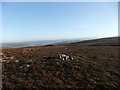
Nearby Images from Geograph Britain and Ireland:
©2019(licence)
©2012(licence)
©2021(licence)
©2012(licence)
©2006(licence)
The above images may not be of the site on this page, they are loaded from Geograph.
Please Submit an Image of this site or go out and take one for us!
Click here to see more info for this site
Nearby sites
Key: Red: member's photo, Blue: 3rd party photo, Yellow: other image, Green: no photo - please go there and take one, Grey: site destroyed
Download sites to:
KML (Google Earth)
GPX (GPS waypoints)
CSV (Garmin/Navman)
CSV (Excel)
To unlock full downloads you need to sign up as a Contributory Member. Otherwise downloads are limited to 50 sites.
Turn off the page maps and other distractions
Nearby sites listing. In the following links * = Image available
2.8km ESE 111° Hut Burn Roundhouse* Ancient Village or Settlement (NY654517)
2.8km E 100° Hanging Shaw Long Cairn* Cairn (NY656522)
3.2km ESE 115° Bold Venture* Ancient Mine, Quarry or other Industry (NY657513)
3.6km ESE 123° Butter Well Cairns* Cairn (NY658507)
3.6km ESE 110° Knaresdale 1 Rock Art (NY6619751454)
3.6km ESE 112° Knarsdale N01 Rock Art (NY6615451284)
3.7km SSE 149° Green Hill Standing Stone* Standing Stone (Menhir) (NY647495)
3.7km ESE 105° Knar Standing Stone* Standing Stone (Menhir) (NY664517)
3.8km ESE 111° Slaggyford Stones* Standing Stones (NY663513)
3.9km SSE 150° Green Hill Cairns* Cairn (NY647493)
3.9km SE 125° Tot's Cupmarked Stone* Standing Stone (Menhir) (NY660504)
4.2km ESE 109° Coal Tips Barrow Artificial Mound (NY668513)
4.2km ESE 116° Longpot Head Stone Circle* Stone Circle (NY666508)
4.3km SSE 152° Raillton Sike Cist* Cist (NY648489)
4.3km ESE 121° David's Cobs* Cairn (NY665504)
4.5km ESE 108° Robbed Cairn* Cairn (NY671513)
4.6km SE 139° Tot's Four-Poster* Stone Circle (NY658492)
4.6km SSE 166° Broad Mea Long Cairn* Cairn (NY639482)
4.7km E 98° Amos Hill* Artificial Mound (NY675520)
5.6km ESE 104° Low Thornhope Farm Rock Art (NY6825951318)
5.7km ESE 104° Slaggyford Stone Rows* Stone Row / Alignment (NY683513)
5.7km ESE 105° Lintley Observatory* Misc. Earthwork (NY683512)
6.3km SE 142° Grey Nag Cairn* Cairn (NY666477)
6.6km E 100° Saffron Well (Barhaugh)* Holy Well or Sacred Spring (NY69285148)
6.7km WNW 302° Glendue Burn Standing Stone* Standing Stone (Menhir) (NY571563)
View more nearby sites and additional images


 We would like to know more about this location. Please feel free to add a brief description and any relevant information in your own language.
 Wir möchten mehr über diese Stätte erfahren. Bitte zögern Sie nicht, eine kurze Beschreibung und relevante Informationen in Deutsch hinzuzufügen.
 Nous aimerions en savoir encore un peu sur les lieux. S'il vous plaît n'hesitez pas à ajouter une courte description et tous les renseignements pertinents dans votre propre langue.
 Quisieramos informarnos un poco más de las lugares. No dude en añadir una breve descripción y otros datos relevantes en su propio idioma.