<< Our Photo Pages >> Oldbury Camp (Herefordshire) - Hillfort in England in Herefordshire
Submitted by coldrum on Monday, 04 January 2010 Page Views: 5488
Iron Age and Later PrehistorySite Name: Oldbury Camp (Herefordshire)Country: England County: Herefordshire Type: Hillfort
Map Ref: SO632326
Latitude: 51.990623N Longitude: 2.537332W
Condition:
| 5 | Perfect |
| 4 | Almost Perfect |
| 3 | Reasonable but with some damage |
| 2 | Ruined but still recognisable as an ancient site |
| 1 | Pretty much destroyed, possibly visible as crop marks |
| 0 | No data. |
| -1 | Completely destroyed |
| 5 | Superb |
| 4 | Good |
| 3 | Ordinary |
| 2 | Not Good |
| 1 | Awful |
| 0 | No data. |
| 5 | Can be driven to, probably with disabled access |
| 4 | Short walk on a footpath |
| 3 | Requiring a bit more of a walk |
| 2 | A long walk |
| 1 | In the middle of nowhere, a nightmare to find |
| 0 | No data. |
| 5 | co-ordinates taken by GPS or official recorded co-ordinates |
| 4 | co-ordinates scaled from a detailed map |
| 3 | co-ordinates scaled from a bad map |
| 2 | co-ordinates of the nearest village |
| 1 | co-ordinates of the nearest town |
| 0 | no data |
Be the first person to rate this site - see the 'Contribute!' box in the right hand menu.
Internal Links:
External Links:
 (PID:63805)")
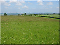
Iron age Hillfort From Pastscape: "Oldbury Camp is a roughly oval enclosure. The ridge has a steep slope on the W and slight slope on the E and S; the ground rises slightly to the N. The W face of the camp has a scarp and berm. On the N there are traces of a scarp, an inner rampart and faint traces of a ditch in the western half. On the other side the defences have been ploughed down, but a scarp remains to show the outline of the earthwork."
You may be viewing yesterday's version of this page. To see the most up to date information please register for a free account.
Do not use the above information on other web sites or publications without permission of the contributor.
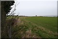
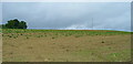
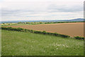
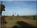
Nearby Images from Geograph Britain and Ireland:
©2007(licence)
©2008(licence)
©2015(licence)
©2007(licence)
©2010(licence)
The above images may not be of the site on this page, they are loaded from Geograph.
Please Submit an Image of this site or go out and take one for us!
Click here to see more info for this site
Nearby sites
Key: Red: member's photo, Blue: 3rd party photo, Yellow: other image, Green: no photo - please go there and take one, Grey: site destroyed
Download sites to:
KML (Google Earth)
GPX (GPS waypoints)
CSV (Garmin/Navman)
CSV (Excel)
To unlock full downloads you need to sign up as a Contributory Member. Otherwise downloads are limited to 50 sites.
Turn off the page maps and other distractions
Nearby sites listing. In the following links * = Image available
3.9km W 274° Capler Camp* Hillfort (SO593329)
4.4km SSW 208° Holy Well (Hole in the wall)* Holy Well or Sacred Spring (SO6109028682)
6.1km WNW 295° Cherry Hill* Hillfort (SO577352)
7.7km NW 324° Backbury* Hillfort (SO587389)
7.9km NE 47° Redhill Wood Hillfort* Hillfort (SO690380)
8.2km NE 46° Wall Hills Camp* Hillfort (SO692382)
8.5km NNW 340° St Edith's Well (Herefordshire)* Holy Well or Sacred Spring (SO604406)
9.2km E 81° Haffield Camp* Hillfort (SO72303390)
9.4km SW 230° Picts Cross Stone (Sellack) Standing Stone (Menhir) (SO560266)
10.7km SSW 196° Chase Wood Camp* Promontory Fort / Cliff Castle (SO602223)
11.3km SE 125° St Mary's Church (Newent) Ancient Cross (SO724260)
11.4km WNW 282° Holy Well (Dinedor)* Holy Well or Sacred Spring (SO52013501)
11.4km WNW 289° Dinedor Camp* Hillfort (SO524364)
11.9km WNW 291° Rotherwas Ribbon* Ancient Trackway (SO52053690)
12.0km W 273° St Ann's Well (Aconbury)* Holy Well or Sacred Spring (SO51173338)
12.1km W 264° Higgin's Well* Holy Well or Sacred Spring (SO51163141)
12.5km NNE 30° Bosbury Church Stone* Standing Stone (Menhir) (SO695434)
12.8km W 272° Aconbury Hill* Hillfort (SO504331)
13.0km SSE 150° May Hill* Misc. Earthwork (SO69542128)
13.8km ENE 69° Midsummer Hill* Hillfort (SO761375)
14.0km WNW 300° St Ethelbert's Well (Hereford)* Holy Well or Sacred Spring (SO5112239684)
14.2km WNW 300° The King's Ditch Natural Stone / Erratic / Other Natural Feature (SO50873974)
14.2km WNW 300° Hereford Museum and Art Gallery* Museum (SO5090039851)
14.4km ENE 62° Walms Well* Holy Well or Sacred Spring (SO76053927)
14.7km ENE 59° Herefordshire Beacon* Hillfort (SO75974003)
View more nearby sites and additional images


 We would like to know more about this location. Please feel free to add a brief description and any relevant information in your own language.
 Wir möchten mehr über diese Stätte erfahren. Bitte zögern Sie nicht, eine kurze Beschreibung und relevante Informationen in Deutsch hinzuzufügen.
 Nous aimerions en savoir encore un peu sur les lieux. S'il vous plaît n'hesitez pas à ajouter une courte description et tous les renseignements pertinents dans votre propre langue.
 Quisieramos informarnos un poco más de las lugares. No dude en añadir una breve descripción y otros datos relevantes en su propio idioma.