


<< Text Pages >> Stone Standing Stone - Standing Stone (Menhir) in Scotland in East Lothian
Submitted by vicky on Thursday, 29 April 2004 Page Views: 6139
Neolithic and Bronze AgeSite Name: Stone Standing Stone Alternative Name: Kingside BurnCountry: Scotland County: East Lothian Type: Standing Stone (Menhir)
Nearest Town: Cranshaws Nearest Village: Crow Moss
Map Ref: NT62586518 Landranger Map Number: 67
Latitude: 55.878313N Longitude: 2.59967W
Condition:
| 5 | Perfect |
| 4 | Almost Perfect |
| 3 | Reasonable but with some damage |
| 2 | Ruined but still recognisable as an ancient site |
| 1 | Pretty much destroyed, possibly visible as crop marks |
| 0 | No data. |
| -1 | Completely destroyed |
| 5 | Superb |
| 4 | Good |
| 3 | Ordinary |
| 2 | Not Good |
| 1 | Awful |
| 0 | No data. |
| 5 | Can be driven to, probably with disabled access |
| 4 | Short walk on a footpath |
| 3 | Requiring a bit more of a walk |
| 2 | A long walk |
| 1 | In the middle of nowhere, a nightmare to find |
| 0 | No data. |
| 5 | co-ordinates taken by GPS or official recorded co-ordinates |
| 4 | co-ordinates scaled from a detailed map |
| 3 | co-ordinates scaled from a bad map |
| 2 | co-ordinates of the nearest village |
| 1 | co-ordinates of the nearest town |
| 0 | no data |
Be the first person to rate this site - see the 'Contribute!' box in the right hand menu.
Internal Links:
External Links:
Standing Stone/Stone Setting in East Lothian
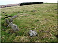
This site is recorded as Canmore ID 57490. Located just south of Nine Stone Rig, Canmore tells us in 1913 the site was described as: "a setting of five small stones, forming an irregular pentagon, is situated almost at 1000ft OD, on the sloping hillside some 300 yards S of the Nine Stones. The stones are small, the largest being 1ft 7ins long, and they are from 2ins to 5ins high. The greatest distance between two stones diagonally is 8ft 10ins. Four of the stones are earthfast; three are pointed and two flat. The enclosed area is slightly hollowed in the centre and there is a slight mound to the E."
An updated entry from 1979 revises this to saying seven stones were detected, one by probing, around the edge of an apparently artificial peat mound … The earthfast stones, four of which are red stone (and one of these is uprooted), lie at apparently irregular intervals around the edge and are of random shape and size. It is probably best described as a stone setting. About 18.0m west of this feature is another less coherent example with three stones protruding from its downhill S side. It cannot, however, be assessed with any certainty."
At the same grid reference, the Ancient Stones website includes an entry for 008 Stone, Crow Moss, Cranshaws, which describes a small earth-fast stone not far from two other groups of stones. Ancient Stones gives a short description, directions for finding this site with details of nearby parking and fieldnotes.
Note: Have you visited this site? Do you have any photographs or information to add?
You may be viewing yesterday's version of this page. To see the most up to date information please register for a free account.
Do not use the above information on other web sites or publications without permission of the contributor.
Nearby Images from Geograph Britain and Ireland:
©2020(licence)
©2007(licence)

©2007(licence)

©2007(licence)

©2006(licence)
The above images may not be of the site on this page, they are loaded from Geograph.
Please Submit an Image of this site or go out and take one for us!
Click here to see more info for this site
Nearby sites
Key: Red: member's photo, Blue: 3rd party photo, Yellow: other image, Green: no photo - please go there and take one, Grey: site destroyed
Download sites to:
KML (Google Earth)
GPX (GPS waypoints)
CSV (Garmin/Navman)
CSV (Excel)
To unlock full downloads you need to sign up as a Contributory Member. Otherwise downloads are limited to 50 sites.
Turn off the page maps and other distractions
Nearby sites listing. In the following links * = Image available
158m SSE 161° Kingside Hill Stone Circle (NT62636503)
312m N 352° Nine Stones Rig* Stone Circle (NT62546549)
663m SE 143° Mayshiel Stone Circle* Stone Circle (NT62986465)
748m W 270° Crow Stones (Cranshaws)* Stone Circle (NT61836519)
1.1km SW 236° Mayshiel Stone Circle (NT617646)
1.2km SSE 147° Penshiel Hill Stone Circle (NT632642)
1.5km N 352° Tavers Cleugh* Cairn (NT62386671)
1.8km ESE 116° Packman's Grave (Whiteadder Reservoir) Stone Row / Alignment (NT64176439)
2.0km NNW 341° Ragstone Rig (Cranshaws) Stone Row / Alignment (NT61956705)
2.0km ESE 119° Whiteadder Reservoir* Cairn (NT64336421)
2.2km ESE 119° Kell Burn Stone Circle (NT645641)
2.3km NE 37° Spartleton Edge Stone Circle (NT640670)
2.5km SE 144° Penshiel Grange Stone Circle* Stone Circle (NT64016317)
2.5km SE 144° Chapel Stone (Penshiel Grange)* Stone Circle (NT64016317)
3.5km NE 52° Yadlee* Stone Circle (NT65406732)
3.6km NNW 340° White Castle Fort* Hillfort (NT61356860)
4.4km ESE 117° Kilmade Hillfort* Hillfort (NT66456315)
5.1km E 81° Bothwell Water (Cranshaws) Natural Stone / Erratic / Other Natural Feature (NT67656598)
6.2km S 183° Mutiny Stones* Cairn (NT62255902)
9.2km N 358° Rood Well* Holy Well or Sacred Spring (NT6237674417)
9.7km NNW 330° Standingstone (East Lothian)* Standing Stone (Menhir) (NT57737363)
10.1km NNW 332° Loth Stone* Standing Stone (Menhir) (NT5782374146)
10.5km NNW 335° Maiden Stone (East Lothian)* Standing Stone (Menhir) (NT5830774748)
10.5km S 180° Twin Law Cairns* Cairn (NT624547)
10.5km NNW 334° Traprain Law* Hillfort (NT5805674696)
View more nearby sites and additional images


 We would like to know more about this location. Please feel free to add a brief description and any relevant information in your own language.
 Wir möchten mehr über diese Stätte erfahren. Bitte zögern Sie nicht, eine kurze Beschreibung und relevante Informationen in Deutsch hinzuzufügen.
 Nous aimerions en savoir encore un peu sur les lieux. S'il vous plaît n'hesitez pas à ajouter une courte description et tous les renseignements pertinents dans votre propre langue.
 Quisieramos informarnos un poco más de las lugares. No dude en añadir una breve descripción y otros datos relevantes en su propio idioma.