<< Our Photo Pages >> Sellet Bank Enclosure - Ancient Village or Settlement in England in Lancashire
Submitted by LivingRocks on Saturday, 07 May 2005 Page Views: 7422
Multi-periodSite Name: Sellet Bank EnclosureCountry: England County: Lancashire Type: Ancient Village or Settlement
Nearest Town: Kirby Lonsdale Nearest Village: Whittington
Map Ref: SD60517733
Latitude: 54.190206N Longitude: 2.606691W
Condition:
| 5 | Perfect |
| 4 | Almost Perfect |
| 3 | Reasonable but with some damage |
| 2 | Ruined but still recognisable as an ancient site |
| 1 | Pretty much destroyed, possibly visible as crop marks |
| 0 | No data. |
| -1 | Completely destroyed |
| 5 | Superb |
| 4 | Good |
| 3 | Ordinary |
| 2 | Not Good |
| 1 | Awful |
| 0 | No data. |
| 5 | Can be driven to, probably with disabled access |
| 4 | Short walk on a footpath |
| 3 | Requiring a bit more of a walk |
| 2 | A long walk |
| 1 | In the middle of nowhere, a nightmare to find |
| 0 | No data. |
| 5 | co-ordinates taken by GPS or official recorded co-ordinates |
| 4 | co-ordinates scaled from a detailed map |
| 3 | co-ordinates scaled from a bad map |
| 2 | co-ordinates of the nearest village |
| 1 | co-ordinates of the nearest town |
| 0 | no data |
Internal Links:
External Links:
")
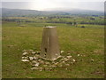
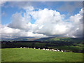
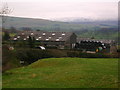
Situated on a gently sloping bank on the eastern slope of Sellet Bank overlooking the Lune Valley. The enclosure is sub-circular in plan with maximum internal dimensions of approximately 52m by 50m. It is defended on the north and east sides by an inner and outer bank; the former measuring 6m-9m wide and up to 0.4m high, the latter measuring 4m-8m wide and up to 0.8m high, with a gap of about 6m between the two banks. On the south side the enclosure is defended by a single bank 6m wide and 0.3m high with traces of a shallow ditch close to the south western corner. The west side has no delimiter in the form of a bank, but has a steep slope formed by the enclosure having apparently been cut into the hillside. There is an entrance close to the south east corner of the enclosure between the single bank and the linking of the double bank. Internally a cross bank running east-west sub-divides the eastern half of the enclosure. To the south of this bank there is a sub-rectangular hollowed area measuring c.14m by 12m which is interpreted as a small enclosure or stock pen. A large pit 8m in diameter by 1m deep and an adjacent mound at the enclosure's south west corner are of uncertain function, however, they may relate to open cast coal mining which is evident elsewhere in the vicinity.
Enclosures of this type were constructed from the seventh to fifth centuries BC and may possibly have continued to be built up to the first century AD. (Description taken from DEFRA Magic Map)
You may be viewing yesterday's version of this page. To see the most up to date information please register for a free account.
")
")
")
Do not use the above information on other web sites or publications without permission of the contributor.
Nearby Images from Geograph Britain and Ireland:
©2006(licence)
©2006(licence)
©2010(licence)
©2018(licence)
©2012(licence)
The above images may not be of the site on this page, they are loaded from Geograph.
Please Submit an Image of this site or go out and take one for us!
Click here to see more info for this site
Nearby sites
Key: Red: member's photo, Blue: 3rd party photo, Yellow: other image, Green: no photo - please go there and take one, Grey: site destroyed
Download sites to:
KML (Google Earth)
GPX (GPS waypoints)
CSV (Garmin/Navman)
CSV (Excel)
To unlock full downloads you need to sign up as a Contributory Member. Otherwise downloads are limited to 50 sites.
Turn off the page maps and other distractions
Nearby sites listing. In the following links * = Image available
2.8km NW 304° Gallowber Lane Romano-British Settlement/Enclosure* Ancient Village or Settlement (SD5823678908)
3.5km SSE 165° St John the Baptist (Tunstall)* Early Christian Sculptured Stone (SD6141473925)
3.8km WNW 284° Hutton Roof Crag perched Limestone Boulder* Natural Stone / Erratic / Other Natural Feature (SD5686878268)
4.3km NE 52° Casterton* Stone Circle (SD63937999)
4.4km E 97° Leck Hall* Ancient Village or Settlement (SD64927677)
5.0km NNE 23° Howerigg* Ancient Village or Settlement (SD62488192)
5.3km NE 53° Brownthwaite Pike Round Cairn* Round Cairn (SD6477280479)
6.3km S 186° St Wilfrid (Melling)* Ancient Cross (SD5978571115)
6.6km WNW 293° Holme Park Fell 2* Rock Outcrop (SD5439879957)
6.9km WNW 294° Holme Park Fell 1* Rock Outcrop (SD5419280141)
7.4km W 266° St James's Church (Burton-in-Kendal) Ancient Cross (SD5305076921)
8.0km SSW 196° Castle Stede Hillfort (SD582697)
8.1km SSW 203° St John the Evangelist (Gressingham)* Ancient Cross (SD5725069915)
8.9km S 176° Tatham Enclosure* Ancient Village or Settlement (SD61086846)
9.0km SSW 193° St Margaret (Hornby)* Ancient Cross (SD5847068580)
9.3km WSW 241° Manor Farm* Round Barrow(s) (SD52387285)
9.4km WSW 257° Yealand ancient stone walls or rows 2 Misc. Earthwork (SD513753)
9.5km WSW 253° Yealand ancient stone walls or rows 1 Misc. Earthwork (SD514746)
10.0km E 80° Yordas cave* Cave or Rock Shelter (SD704790)
10.2km E 99° Twisleton Scar* Rock Outcrop (SD70597563)
10.4km E 82° Apron Full of Stones* Ring Cairn (SD709787)
10.8km WSW 253° Summerhouse Hill Cairn* Cairn (SD50147428)
10.8km W 279° The Rent Stone* Natural Stone / Erratic / Other Natural Feature (SD498792)
10.9km WSW 254° Summerhouse Hill* Modern Stone Circle etc (SD50037437)
11.3km WNW 284° Bela Stone Row* Stone Row / Alignment (SD495801)
View more nearby sites and additional images


 We would like to know more about this location. Please feel free to add a brief description and any relevant information in your own language.
 Wir möchten mehr über diese Stätte erfahren. Bitte zögern Sie nicht, eine kurze Beschreibung und relevante Informationen in Deutsch hinzuzufügen.
 Nous aimerions en savoir encore un peu sur les lieux. S'il vous plaît n'hesitez pas à ajouter une courte description et tous les renseignements pertinents dans votre propre langue.
 Quisieramos informarnos un poco más de las lugares. No dude en añadir una breve descripción y otros datos relevantes en su propio idioma.