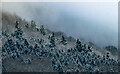
<< Our Photo Pages >> Chase Wood Camp - Promontory Fort / Cliff Castle in England in Herefordshire
Submitted by coldrum on Tuesday, 05 January 2010 Page Views: 8948
Iron Age and Later PrehistorySite Name: Chase Wood CampCountry: England
NOTE: This site is 0.2 km away from the location you searched for.
County: Herefordshire Type: Promontory Fort / Cliff Castle
Nearest Town: Ross-on-Wye
Map Ref: SO602223
Latitude: 51.897816N Longitude: 2.579824W
Condition:
| 5 | Perfect |
| 4 | Almost Perfect |
| 3 | Reasonable but with some damage |
| 2 | Ruined but still recognisable as an ancient site |
| 1 | Pretty much destroyed, possibly visible as crop marks |
| 0 | No data. |
| -1 | Completely destroyed |
| 5 | Superb |
| 4 | Good |
| 3 | Ordinary |
| 2 | Not Good |
| 1 | Awful |
| 0 | No data. |
| 5 | Can be driven to, probably with disabled access |
| 4 | Short walk on a footpath |
| 3 | Requiring a bit more of a walk |
| 2 | A long walk |
| 1 | In the middle of nowhere, a nightmare to find |
| 0 | No data. |
| 5 | co-ordinates taken by GPS or official recorded co-ordinates |
| 4 | co-ordinates scaled from a detailed map |
| 3 | co-ordinates scaled from a bad map |
| 2 | co-ordinates of the nearest village |
| 1 | co-ordinates of the nearest town |
| 0 | no data |
Be the first person to rate this site - see the 'Contribute!' box in the right hand menu.
Internal Links:
External Links:
I have visited· I would like to visit
SumDoood Ellpezz would like to visit
")
From Pastscape:
"Of the promontory type with a steep fall on all sides except the S. The camp with its defences occupies an area of about 27 acres and is of irregular oval form. At the S end it is defended by a rampart now rising about 5 1/2 feet above the ground outside; the defences on the other sides are formed by scarping the natural slope; the scarp has a berm along the greater part of its length with traces of an outer bank to the berm on the W side. There is a raking entrance cut through the rock on the NE side A second entrance at the extreme N end and a third in the middle of the W side; the two latter may be of later date. "
http://www.pastscape.org.uk/hob.aspx?hob_id=111919
You may be viewing yesterday's version of this page. To see the most up to date information please register for a free account.
")
Do not use the above information on other web sites or publications without permission of the contributor.
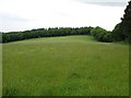
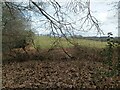
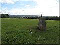
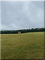
Nearby Images from Geograph Britain and Ireland:
©2009(licence)
©2023(licence)
©2013(licence)
©2021(licence)
©2021(licence)
The above images may not be of the site on this page, they are loaded from Geograph.
Please Submit an Image of this site or go out and take one for us!
Click here to see more info for this site
Nearby sites
Key: Red: member's photo, Blue: 3rd party photo, Yellow: other image, Green: no photo - please go there and take one, Grey: site destroyed
Download sites to:
KML (Google Earth)
GPX (GPS waypoints)
CSV (Garmin/Navman)
CSV (Excel)
To unlock full downloads you need to sign up as a Contributory Member. Otherwise downloads are limited to 50 sites.
Turn off the page maps and other distractions
Nearby sites listing. In the following links * = Image available
5.8km SW 224° The Queen Stone* Standing Stone (Menhir) (SO561182)
6.0km NW 315° Picts Cross Stone (Sellack) Standing Stone (Menhir) (SO560266)
6.4km N 7° Holy Well (Hole in the wall)* Holy Well or Sacred Spring (SO6109028682)
6.9km SW 216° Huntsham Hill Rockshelters Cave or Rock Shelter (SO561168)
7.2km W 260° St Deinst (Llangarron)* Early Christian Sculptured Stone (SO531211)
7.4km SSW 205° Coldwell Rocks Cave or Rock Shelter (SO570156)
7.6km SSW 213° Symonds Yat East Rockshelter Cave or Rock Shelter (SO56001600)
7.7km SSW 210° Symonds Yat Fort* Hillfort (SO563157)
7.9km SSW 211° Symonds Yat Cave 2 Cave or Rock Shelter (SO56101555)
7.9km SSW 211° Wye Rapids Cave Cave or Rock Shelter (SO56101555)
7.9km SSW 211° Symonds Yat Cave 3 Cave or Rock Shelter (SO56101555)
7.9km SSW 211° Symonds Yat Cave Cave or Rock Shelter (SO56101555)
8.0km SSW 210° Bowler's Hole Cave or Rock Shelter (SO56101545)
8.1km SSW 213° Symonds Yat West Cave or Rock Shelter (SO55701555)
8.4km SSW 213° Merlin's Cave (Herefordshire) Cave or Rock Shelter (SO556153)
8.6km SSW 212° Lord's Wood Cave Cave or Rock Shelter (SO55551503)
8.7km SSW 213° Biblins Cave or Rock Shelter (SO554150)
8.7km SW 219° King Arthur's North* Cave or Rock Shelter (SO54601559)
8.8km SW 220° King Arthur's Cave* Cave or Rock Shelter (SO54561559)
8.8km SW 224° Little Doward* Hillfort (SO5416)
8.9km SW 224° King Arthur's Hall Cave Cave or Rock Shelter (SO53901600)
8.9km SW 224° Little Doward Barrows Round Barrow(s) (SO539160)
9.0km SW 218° Cavall's Cave Cave or Rock Shelter (SO546153)
9.0km SW 218° Madawg Rockshelter Cave or Rock Shelter (SO54651526)
9.3km SSW 212° The Biblins Cave Cave or Rock Shelter (SO55161446)
View more nearby sites and additional images


 We would like to know more about this location. Please feel free to add a brief description and any relevant information in your own language.
 Wir möchten mehr über diese Stätte erfahren. Bitte zögern Sie nicht, eine kurze Beschreibung und relevante Informationen in Deutsch hinzuzufügen.
 Nous aimerions en savoir encore un peu sur les lieux. S'il vous plaît n'hesitez pas à ajouter une courte description et tous les renseignements pertinents dans votre propre langue.
 Quisieramos informarnos un poco más de las lugares. No dude en añadir una breve descripción y otros datos relevantes en su propio idioma.