Featured: Hare and Tabor T Shirts for discerning antiquarians

Hare and Tabor T Shirts for discerning antiquarians

Random Image


Stellhead S

Help Protect this Brigantes Hillfort - Click to Sign the Petition

Help Protect this Brigantes Hillfort - Click to Sign the Petition

Who's Online

There are currently, 305 guests and 2 members online.

You are a guest. To join in, please register for free by clicking here

Sponsors

<< Our Photo Pages >> Hautville's Quoit - Chambered Tomb in England in Somerset

Submitted by bec-zog on Monday, 30 April 2012  Page Views: 15995

Neolithic and Bronze AgeSite Name: Hautville's Quoit Alternative Name: Stanton Drew
Country: England County: Somerset Type: Chambered Tomb
Nearest Town: Bristol  Nearest Village: Stanton Drew
Map Ref: ST60176380  Landranger Map Number: 172
Latitude: 51.371852N  Longitude: 2.573583W
Condition:
5Perfect
4Almost Perfect
3Reasonable but with some damage
2Ruined but still recognisable as an ancient site
1Pretty much destroyed, possibly visible as crop marks
0No data.
-1Completely destroyed
2 Ambience:
5Superb
4Good
3Ordinary
2Not Good
1Awful
0No data.
3 Access:
5Can be driven to, probably with disabled access
4Short walk on a footpath
3Requiring a bit more of a walk
2A long walk
1In the middle of nowhere, a nightmare to find
0No data.
4 Accuracy:
5co-ordinates taken by GPS or official recorded co-ordinates
4co-ordinates scaled from a detailed map
3co-ordinates scaled from a bad map
2co-ordinates of the nearest village
1co-ordinates of the nearest town
0no data
5

Internal Links:
External Links:

I have visited· I would like to visit

myf would like to visit

NickyD visited on 5th Apr 2016 - their rating: Cond: 2 Amb: 3 Access: 4

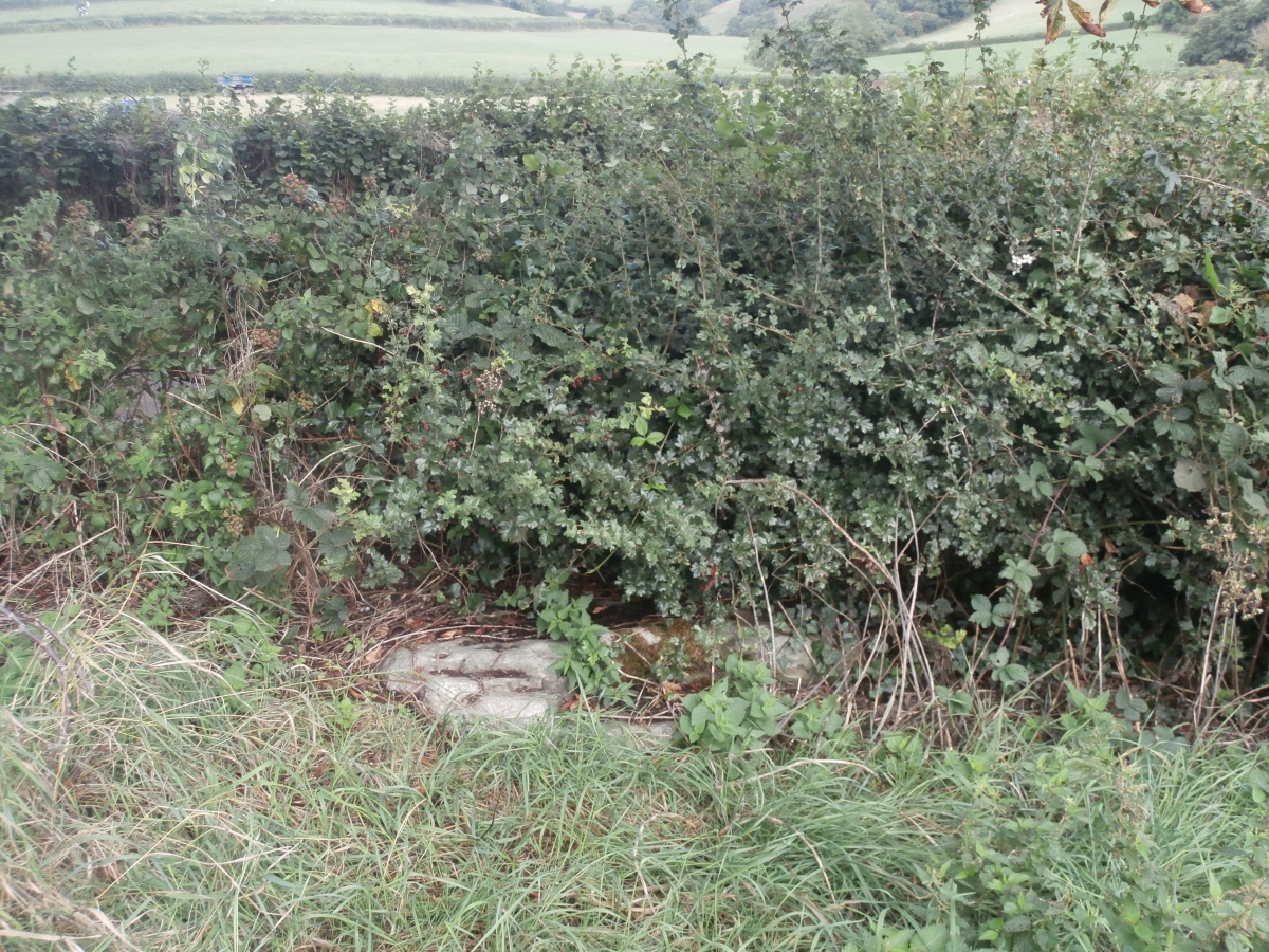
markj99 visited on 29th Aug 2014 - their rating: Cond: 1 Amb: 3 Access: 3 The remaining stone of Hauteville's Quoit half-buried next to a hedge requires more imagination than I have to reconstruct the monument. One for the completists.

Ogham visited on 9th Jul 2010 - their rating: Cond: 2 Amb: 4 Access: 4


Average ratings for this site from all visit loggers: Condition: 1.67 Ambience: 3.33 Access: 3.67

Hautville's Quoit
Hautville's Quoit submitted by bec-zog : Hautville Quoit. Late neolithic remnant. Located @ ST 602,638 (NNE 0f Stanton Drew Great Circle) Aligns with centre of the Great Circle & the SW Circle. Possibly part of a larger, now destroyed, structure. (Vote or comment on this photo)
Late neolithic remnant of possible chambered tomb. Located NNE of Stanton Drew Great Circle, it aligns with the centre of the Great Circle and the SW Circle. It is possibly part of a larger, now destroyed, structure.

Folklore has it that it was thrown by a giant from the top of Maes Knoll.

Note: Interim report from the BACAS Survey of an area around Hautville's Quoit and NE of Stanton Drew is published
You may be viewing yesterday's version of this page. To see the most up to date information please register for a free account.
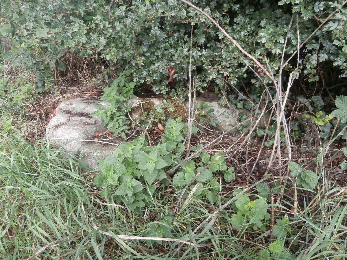
Hautville's Quoit
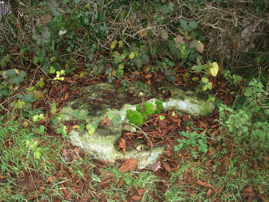
Hautville's Quoit submitted by hamish : I found this before the archeologists had cleared the area, it was covered with leaf debris. It looks small here but is in fact much larger. (Vote or comment on this photo)

Hautville's Quoit
Hautville's Quoit submitted by markj99 : Hautville's Quoit viewed from S. (29.08.14) (Vote or comment on this photo)

Hautville's Quoit
Hautville's Quoit submitted by markj99 (Vote or comment on this photo)

Hautville's Quoit
Hautville's Quoit submitted by markj99 : Hautville's Quoit viewed from ESE. (29.08.14) (Vote or comment on this photo)

Hautville's Quoit
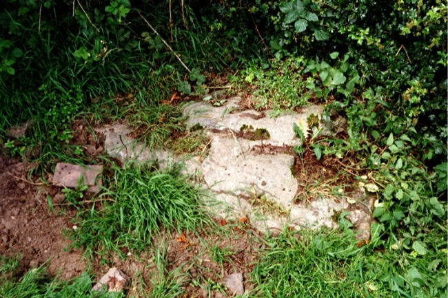
Hautville's Quoit submitted by Bladup : Hautville's Quoit.

Do not use the above information on other web sites or publications without permission of the contributor.
Click here to see more info for this site

Nearby sites

Click here to view sites on an interactive OS map

Key: Red: member's photo, Blue: 3rd party photo, Yellow: other image, Green: no photo - please go there and take one, Grey: site destroyed

Download sites to:
KML (Google Earth)
GPX (GPS waypoints)
CSV (Garmin/Navman)
CSV (Excel)

To unlock full downloads you need to sign up as a Contributory Member. Otherwise downloads are limited to 50 sites.


Turn off the page maps and other distractions

Nearby sites listing. In the following links * = Image available
 463m S 186° Stanton Drew NE Avenue* Multiple Stone Rows / Avenue (ST60126334)
 467m S 189° Stanton Drew NE Circle* Stone Circle (ST60096334)
 500m S 191° Stanton Drew - Avenue* Multiple Stone Rows / Avenue (ST60076331)
 528m SSW 198° Stanton Drew* Stone Circle (ST60006330)
 550m SSW 199° Stanton Drew Great Circle* Stone Circle (ST59996328)
 762m SSW 199° Stanton Drew SSW* Stone Circle (ST59926308)
 816m SSW 210° Stanton Drew - The Cove* Standing Stones (ST59756310)
 1.3km WSW 250° Lower Tyning Standing Stones (ST58986337)
 2.2km N 355° Maes Knoll* Hillfort (ST600660)
 2.6km WSW 256° Chew Magna Church Cross Ancient Cross (ST5767363199)
 3.7km NW 316° Dundry Long Barrow* Long Barrow (ST57606645)
 4.6km WSW 254° Pagans Hill* Ancient Temple (ST55766261)
 4.7km WSW 242° Chew Stoke* Stone Circle (ST560616)
 5.7km SSW 200° Burledge Hillfort* Hillfort (ST582584)
 6.0km W 271° Leigh Down* Stone Circle (ST542639)
 7.1km E 91° Stantonbury Camp* Hillfort (ST67256366)
 8.0km WNW 282° Felton Village Bowl Barrow* Round Barrow(s) (ST52386550)
 8.1km W 277° Felton Hill Bowl Barrow T30A* Round Barrow(s) (ST52126490)
 8.2km W 277° Felton Bowl Barrows T28 & T29* Round Barrow(s) (ST51966480)
 8.3km W 276° Felton Common Suck Stone* Natural Stone / Erratic / Other Natural Feature (ST5187164800)
 8.3km WSW 256° Fairy Toot* Long Barrow (ST52056178)
 8.4km NW 304° Fairy Well (Barrow Gurney) Holy Well or Sacred Spring (ST532686)
 8.6km NW 326° Long Ashton Cross* Ancient Cross (ST5539070910)
 8.6km W 262° Butcombe Barrow* Round Barrow(s) (ST51646273)
 8.6km W 277° Felton Hill Long Barrow T26* Chambered Tomb (ST51626491)
View more nearby sites and additional images

<< Rowanfield Cottage

Dorje Dolmen Thamshing >>

Please add your thoughts on this site

Understanding the Neolithic

Understanding the Neolithic

Sponsors

Auto-Translation (Google)

Translate from English into:

"Hautville's Quoit" | Login/Create an Account | 1 comment
  
Go back to top of page    Comments are owned by the poster. We aren't responsible for their content.
Interim Report from BACAS Survey of Hautville's Quoit is published by Andy B on Monday, 30 April 2012
(User Info | Send a Message)
On Saturday 28th of March, John Oswin and John Richards from Bath and Camerton Archaeological Society kindly gave us a tour of the Stanton Drew circles, telling us about the recent survey work they have been carrying out in the area around Hautville’s Quoit. Here is a short extract from their interim report:

The Quoit is described by Aubrey as being 10 feet 16 inches (sic) long, 6 feet 6 inches broad, and 1 foot 10 inches thick (Aubrey et al 1980). Stukeley (1776) said there were two quoits, half a mile either side of the bridge. John Richards has identified this second quoit on Stukeley's plan but has not yet gone looking for its possible location.

Stukeley gives the size of the Quoit as thirteen feet by eight feet by four feet. As it could not possibly have grown in size, the most likely explanation is that he got the two stones confused (Burl 1999: 55). Part of the stone was broken off in 1836, and Grinsell (1994) described it as about 2.2 metres long. Roger Mercer (1969) carried out a resistivity survey and excavation to try and find the original location of the Quoit, but failed to find any stone socket.

A pattern of what could be large and small post holes has been detected just south-east of the Quoit. The 'post holes' are as much as 2 or 3 metres in diameter and could be for timber posts, or sockets for stones. However, no definite geometric pattern can be identified and no corroboration for these anomalies can be detected in any of the other surveys: twin-probe resistance, resistance profiling, magsus, or radar.

The hill in Big Ground occupies an interesting place in the landscape. It is situated just over 200 metres away from the NE Circle. The regular shape and flat top lead to the question whether the mound is just a natural outcrop, or if any or all of it is man-made and whether any structures were once placed on it, or if there is any evidence for an encircling ditch. The small magnetometry survey was inconclusive and a fuller survey is desirable.

The position of the mound in relation to the river is also noteworthy. The symbolism of water in proximity to Neolithic monuments has been commented on by various authors.

Prior to the construction of Chew Valley Lake extensive flooding was common, in particular at Stanton Drew. The Environment Agency’s flood map shows that, today, the area that would have flooded quite frequently in ancient times extends from the edge of the NE Circle across the valley to the foot of the mound. At times of flood, the mound would form a promontory surrounded on three sides by water with the NE Circle on the opposite ‘bank’.

The BACAS researchers plan a geophysical survey of the field to the north of the road to determine if the monument extends in that direction. They also hope to do a further survey of the mound and surroundings in Big Ground to attempt to determine whether the mound is a natural outcrop and whether it had significance in the Neolithic landscape, and to investigate the flood plain by auguring to attempt to determine the history and frequency of flooding.

Further details are in the Bath and Camerton Archaeological Society Hautville's Quoit Survey Report (PDF files).

There are more photos of our day out on the following Megalithic Portal site pages:

http://www.megalithic.co.uk/article.php?sid=152

http://www.megalithic.co.uk/article.php?sid=2145

http://www.megalithic.co.uk/article.php?sid=3475

http://www.megalithic.co.uk/article.php?sid=153

http://www.megalithic.co.uk/article.php?sid=1068
[ Reply to This ]

Your Name: Anonymous [ Register Now ]
Subject:


Add your comment or contribution to this page. Spam or offensive posts are deleted immediately, don't even bother

<<< What is five plus one as a number? (Please type the answer to this question in the little box on the left)
You can also embed videos and other things. For Youtube please copy and paste the 'embed code'.
For Google Street View please include Street View in the text.
Create a web link like this: <a href="https://www.megalithic.co.uk">This is a link</a>  

Allowed HTML is:
<p> <b> <i> <a> <img> <em> <br> <strong> <blockquote> <tt> <li> <ol> <ul> <object> <param> <embed> <iframe>

We would like to know more about this location. Please feel free to add a brief description and any relevant information in your own language.
Wir möchten mehr über diese Stätte erfahren. Bitte zögern Sie nicht, eine kurze Beschreibung und relevante Informationen in Deutsch hinzuzufügen.
Nous aimerions en savoir encore un peu sur les lieux. S'il vous plaît n'hesitez pas à ajouter une courte description et tous les renseignements pertinents dans votre propre langue.
Quisieramos informarnos un poco más de las lugares. No dude en añadir una breve descripción y otros datos relevantes en su propio idioma.