<< Text Pages >> Uphampton Camp - Hillfort in England in Herefordshire
Submitted by SolarMegalith on Thursday, 10 November 2011 Page Views: 3739
Iron Age and Later PrehistorySite Name: Uphampton CampCountry: England
NOTE: This site is 2.55 km away from the location you searched for.
County: Herefordshire Type: Hillfort
Nearest Village: Docklow
Map Ref: SO57005838
Latitude: 52.221939N Longitude: 2.630882W
Condition:
| 5 | Perfect |
| 4 | Almost Perfect |
| 3 | Reasonable but with some damage |
| 2 | Ruined but still recognisable as an ancient site |
| 1 | Pretty much destroyed, possibly visible as crop marks |
| 0 | No data. |
| -1 | Completely destroyed |
| 5 | Superb |
| 4 | Good |
| 3 | Ordinary |
| 2 | Not Good |
| 1 | Awful |
| 0 | No data. |
| 5 | Can be driven to, probably with disabled access |
| 4 | Short walk on a footpath |
| 3 | Requiring a bit more of a walk |
| 2 | A long walk |
| 1 | In the middle of nowhere, a nightmare to find |
| 0 | No data. |
| 5 | co-ordinates taken by GPS or official recorded co-ordinates |
| 4 | co-ordinates scaled from a detailed map |
| 3 | co-ordinates scaled from a bad map |
| 2 | co-ordinates of the nearest village |
| 1 | co-ordinates of the nearest town |
| 0 | no data |
Internal Links:
External Links:
Hillfort in Herefordshire
Possible remains of an Iron Age hillfort. The earthworks are heavily ploughed over, it is possible that the hillfort has neven been finished.
Read More at Pastscape.
You may be viewing yesterday's version of this page. To see the most up to date information please register for a free account.
Do not use the above information on other web sites or publications without permission of the contributor.
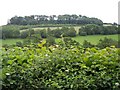
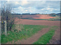
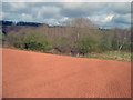
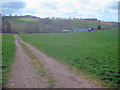
Nearby Images from Geograph Britain and Ireland:
©2006(licence)
©2009(licence)
©2009(licence)
©2009(licence)
©2009(licence)
The above images may not be of the site on this page, they are loaded from Geograph.
Please Submit an Image of this site or go out and take one for us!
Click here to see more info for this site
Nearby sites
Key: Red: member's photo, Blue: 3rd party photo, Yellow: other image, Green: no photo - please go there and take one, Grey: site destroyed
Download sites to:
KML (Google Earth)
GPX (GPS waypoints)
CSV (Garmin/Navman)
CSV (Excel)
To unlock full downloads you need to sign up as a Contributory Member. Otherwise downloads are limited to 50 sites.
Turn off the page maps and other distractions
Nearby sites listing. In the following links * = Image available
3.0km NW 307° Bach Camp* Hillfort (SO546602)
4.1km SW 223° Risbury Camp* Hillfort (SO542554)
4.4km WSW 239° Blackwardine Crossroads* Modern Stone Circle etc (SO5318656161)
6.0km NE 55° Garmsley Camp* Hillfort (SO620618)
8.2km SW 217° Dinmore Hill Hillfort (SO520519)
9.3km WSW 246° Ivington Camp* Hillfort (SO484547)
9.8km WNW 300° Luston Holy Well* Holy Well or Sacred Spring (SO4859563407)
10.3km NNE 13° St Mary's Church cross fragment* Ancient Cross (SO5944268368)
12.6km WNW 283° St Michael's Church (Kingsland)* Ancient Cross (SO4468461269)
12.7km SSW 207° St Ethelbert's Well (Marden)* Holy Well or Sacred Spring (SO512471)
12.8km SSW 200° Sutton Walls* Hillfort (SO525464)
13.1km ESE 121° Stanford Bishop Church Stone* Standing Stone (Menhir) (SO682515)
13.9km WSW 240° Bush Bank* Standing Stone (Menhir) (SO4496251449)
13.9km WNW 303° Bircher Common* Misc. Earthwork (SO454661)
14.9km SSW 195° The Wergin's Stone* Standing Stone (Menhir) (SO5297543981)
15.1km WNW 303° Croft Ambrey* Hillfort (SO444668)
15.5km N 350° Caynham Camp* Hillfort (SO545737)
15.8km N 6° St John the Baptist (Hope Bagot)* Holy Well or Sacred Spring (SO5885874092)
15.9km WNW 295° St John the Baptist and St Alkmund (Aymestrey)* Ancient Cross (SO4256065130)
16.0km NNW 330° Haye Park Wood Enclosure* Ancient Village or Settlement (SO49167229)
16.6km WNW 298° Pyon Wood* Hillfort (SO424664)
17.2km NNW 340° Ludlow Museum* Museum (SO512746)
17.4km E 89° The Berrow* Hillfort (SO744585)
17.4km NNW 342° St Julian's Well (Ludlow)* Holy Well or Sacred Spring (SO5184275060)
17.9km NNW 339° Boiling Well (Ludlow)* Holy Well or Sacred Spring (SO508752)
View more nearby sites and additional images


 We would like to know more about this location. Please feel free to add a brief description and any relevant information in your own language.
 Wir möchten mehr über diese Stätte erfahren. Bitte zögern Sie nicht, eine kurze Beschreibung und relevante Informationen in Deutsch hinzuzufügen.
 Nous aimerions en savoir encore un peu sur les lieux. S'il vous plaît n'hesitez pas à ajouter une courte description et tous les renseignements pertinents dans votre propre langue.
 Quisieramos informarnos un poco más de las lugares. No dude en añadir una breve descripción y otros datos relevantes en su propio idioma.