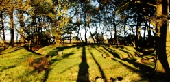
Featured: Current Archaeology Book of the Year 2019!

Current Archaeology Book of the Year 2019!

Random Image


Llangwnnadl

Megalithomania by John Michell, Only £4.99 + P&P

Megalithomania by John Michell, Only £4.99 + P&P

Who's Online

There are currently, 305 guests and 4 members online.

You are a guest. To join in, please register for free by clicking here

Sponsors

<< Our Photo Pages >> Bleasdale - Timber Circle in England in Lancashire

Submitted by Lewis_Sharp on Tuesday, 14 September 2004  Page Views: 25016

Neolithic and Bronze AgeSite Name: Bleasdale
Country: England County: Lancashire Type: Timber Circle
Nearest Town: Garstang / Preston  Nearest Village: Bleasdale
Map Ref: SD5771145994  Landranger Map Number: 102
Latitude: 53.908366N  Longitude: 2.645204W
Condition:
5Perfect
4Almost Perfect
3Reasonable but with some damage
2Ruined but still recognisable as an ancient site
1Pretty much destroyed, possibly visible as crop marks
0No data.
-1Completely destroyed
3 Ambience:
5Superb
4Good
3Ordinary
2Not Good
1Awful
0No data.
no data Access:
5Can be driven to, probably with disabled access
4Short walk on a footpath
3Requiring a bit more of a walk
2A long walk
1In the middle of nowhere, a nightmare to find
0No data.
3 Accuracy:
5co-ordinates taken by GPS or official recorded co-ordinates
4co-ordinates scaled from a detailed map
3co-ordinates scaled from a bad map
2co-ordinates of the nearest village
1co-ordinates of the nearest town
0no data
5

Internal Links:
External Links:

I have visited· I would like to visit

Modern-neolithic would like to visit

SumDoood visited on 5th May 2017 - their rating: Cond: 3 Amb: 4 Access: 3 It's better at dawn or dusk, of course. I don't think I've been anywhere else where the circle is offset within an ellipse. The overall position where the circle is cupped inside a combe with two mountains backing it up is impressive, though not particularly unusual, but the fact that the land occupied by the circle is slightly but significantly higher than the wider surroundings, yet receives the sunlight last, is quite exceptional. The circle is (exactly enough) equidistant to north and south from the headwaters of two rivers both known as the River Brock which combine at 53.895482, -2.662299. The views to the west are very wide, and long. Watching the sun coming down onto the treetops before slicing on down into the circle was such a thrill. I'd like to be there on one of those misty mornings when you can only just see the sun so as to try and record its alignment. I guess that at midsummer it might rise out of, or become completely visible in one particular notch on the ridge, "Nick's Chair", which is exactly due east of the circle.

FrothNinja visited - their rating: Access: 2

AngieLake have visited here

Average ratings for this site from all visit loggers: Access: 2.5
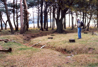
Bleasdale
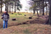
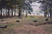
Bleasdale submitted by AngieLake : This is the (north?)western half of Bleasdale wooden circle. My brother is 6'1" tall, for comparison. This is a rare timber circle, where the posts have been replaced by concrete markers. (Vote or comment on this photo)
Timber Circle in Lancashire

Though there isnt much of the circle left, I seem to remmember it being mostly concrete marker posts, its set in a little piece of woodland at the foot of the mountains leading into the Trough of Bowland.
Its marked on the Ordnance Survey map Landranger 102 so you should have no trouble finding it. Cheers. Lewis.

This monument is scheduled as Historic England List ID 1011678, Bleasdale Circle enclosed Bronze Age urnfield. It is also recorded as Pastscape Monument No. 42758 which tells us this is an "Enclosed Bronze Age urnfield surviving as an earthwork. Excavation located a timber palisade with a causeway to a central mound containing three cremation vessels, surrounded by a post setting. The monument has been partly reconstructed".

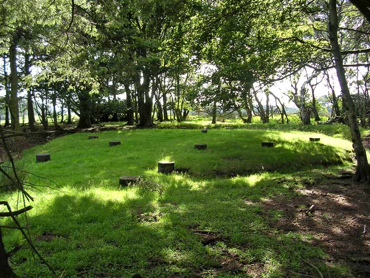
The Journal of Antiquities also includes an entry for Bleasdale Circle, Bleasdale, Lancashire, which tells us finding this site requires a good climb up onto the fells, where you will find " a circle of 11 concrete posts marking out where a circle of timber posts used to be and, which is also referred to as a ‘henge monument’, at the centre of which was a mound with a burial inside". The Journal also includes a photograph, a plan of the Bleasdale Circle and a list of reference sources for more information.
You may be viewing yesterday's version of this page. To see the most up to date information please register for a free account.
Bleasdale
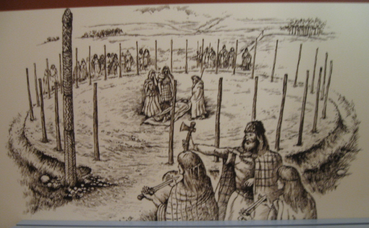
Bleasdale submitted by AngieLake : Artist's impression of Bleasdale wooden circle in its heyday. From a poster in Ribchester Museum, May 2012. (Vote or comment on this photo)

Bleasdale
Bleasdale submitted by LivingRocks : Bleasdale Circle from near the causeway entrance. http://www.magic.gov.uk/rsm/23749.pdf (Vote or comment on this photo)

Bleasdale
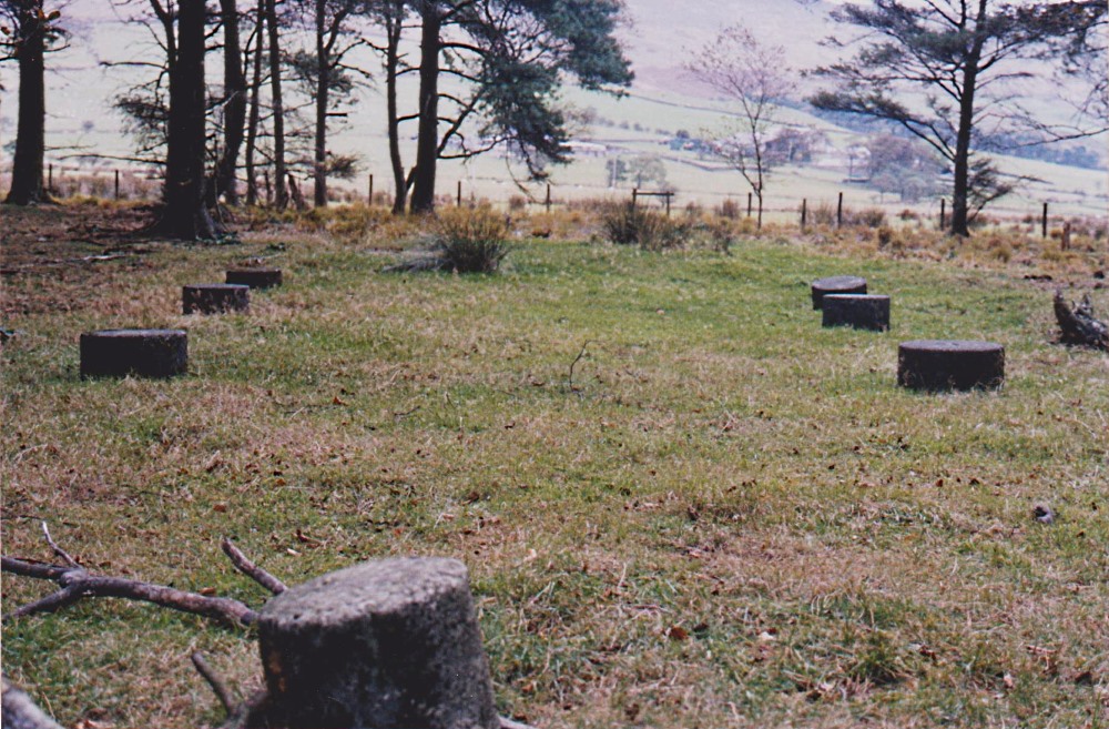
Bleasdale submitted by AngieLake : To replace original small photo. (Vote or comment on this photo)

Bleasdale
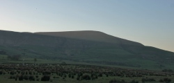
Bleasdale submitted by SumDoood : Taken from Oakenclough Road north of Beacon Fell, the arrow indicates the position of the circle on what can from here be seen to be the highest ground to the west of the west-facing semi-circle of much higher ground, *and* also between the valleys in front of, and behind the circle (in this view), both of which are formed by two identically named branches of the headwaters of the River Brock (and... (Vote or comment on this photo)

Bleasdale
Bleasdale submitted by SumDoood : As seen from the circle, the morning sun at Beltane cuts across Parlick from notch to notch. Coincidence? I remember walking through the large notch and thinking it was an unusual piece of geography and quite possibly not (entirely) natural. I haven't been to the left hand notches.

Bleasdale
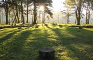
Bleasdale submitted by SumDoood : In the immediate foreground is the most westerly "post" and opposite is the apparent entrance marked by three "posts" either side. Taken at 06.38 on 05052017 (Beltane).

Bleasdale
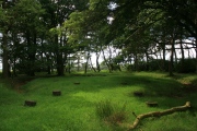
Bleasdale submitted by postman : Looking west-ish over the circle (1 comment)

Bleasdale
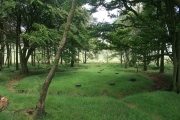
Bleasdale submitted by postman : Looking eastish over the circle

Bleasdale
Bleasdale submitted by LivingRocks : The outer ditch of Bleasdale Circle.

Bleasdale
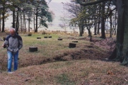
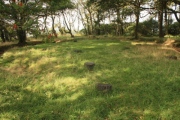
Bleasdale submitted by AngieLake : This is the (south?)east half of the Bleasdale Circle at the point of access from the footpath across the fields. My brother is 6'1" tall for comparison. The original timber posts of this rare circle are now marked by low concrete posts.

Bleasdale
Bleasdale submitted by AngieLake : This is a shot from the same visit that was not posted before.

Bleasdale
Bleasdale submitted by AngieLake : To replace original small photo.

Bleasdale
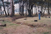
Bleasdale submitted by AngieLake : To replace small original one. My late brother Mike at Bleasdale. (1 comment)

Bleasdale
Bleasdale submitted by AngieLake : To replace original post. My late brother Mike at Bleasdale.

Bleasdale
Bleasdale submitted by SumDoood : 06.36 on Beltane 05052017.

Bleasdale
Bleasdale submitted by 6A44NNx : Two sketches of the Inner Oval and Outer Fence existing at the same time

Bleasdale
Bleasdale submitted by 6A44NNx : A New SITE PLAN of the Outer and Inner Ovals

Bleasdale
Bleasdale submitted by postman : Approaching the copse with the circle in it with Snape fell towering above.

Bleasdale
Bleasdale submitted by postman : Bits of stuff tied to trees ?

Bleasdale
Bleasdale submitted by Bladup : Bleasdale circle.

Bleasdale
Bleasdale submitted by Briton : View of Snape Fell from the Circle.

Bleasdale
Bleasdale submitted by Briton : An ethereal spot at the base of Bleasdale Fell. The main access roadway is "private" so one must park on the nearby minor road and walk. Pleasant enough and the views are astounding. Very tranquil site surrounded by trees. The posts are markers and the ditch can be easily seen.

Bleasdale
Bleasdale submitted by AngieLake : An information board on Bleasdale, seen recently in Ribchester Museum.

Bleasdale
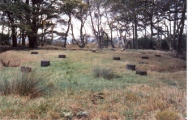
Bleasdale submitted by AngieLake : This view of the Bleasdale Circle shows the eastern causewayed entrance. The nearest marker posts are outside the ditch. The next two further in are aligned with the ditch, and the next to be seen are actually part of the circle. These concrete posts mark the positions of the original timber posts that were excavated, re-set, and decayed in the 1930s. The noticeboard explaining the circle is v...

These are just the first 25 photos of Bleasdale. If you log in with a free user account you will be able to see our entire collection.

Do not use the above information on other web sites or publications without permission of the contributor.
Click here to see more info for this site

Nearby sites

Click here to view sites on an interactive OS map

Key: Red: member's photo, Blue: 3rd party photo, Yellow: other image, Green: no photo - please go there and take one, Grey: site destroyed

Download sites to:
KML (Google Earth)
GPX (GPS waypoints)
CSV (Garmin/Navman)
CSV (Excel)

To unlock full downloads you need to sign up as a Contributory Member. Otherwise downloads are limited to 50 sites.


Turn off the page maps and other distractions

Nearby sites listing. In the following links * = Image available
 2.1km ESE 117° Parlick Pike Cairn* Cairn (SD59574502)
 7.3km WSW 241° Claughton Hlaew* Round Barrow(s) (SD51274247)
 7.4km SSW 203° St Anne's Well (Inglewhite)* Holy Well or Sacred Spring (SD547392)
 7.8km E 84° Fairy Holes* Cave or Rock Shelter (SD65534678)
 8.6km W 274° Roman Milestone (Garstang)* Marker Stone (SD4907146676)
 8.7km SE 129° Jeffrey Hill Cairn Circle* Cairn (SD644404)
 8.8km SE 129° Thornley Hall Fell Cairn* Round Barrow(s) (SD64524047)
 9.1km WSW 248° Catterall Cross* Ancient Cross (SD4920242700)
 9.5km SSE 148° The Written Stone* Sculptured Stone (SD6262237892)
 9.6km SSW 205° Barton Cross Ancient Cross (SD5350037332)
 10.0km WSW 251° Medieval Grave Covers (Churchtown)* Sculptured Stone (SD4818242808)
 10.8km ENE 69° The Knowlmere Cross* Ancient Cross (SD679498)
 12.0km ENE 74° The Foulscales Stone (Newton)* Early Christian Sculptured Stone (SD693492)
 12.2km ESE 116° Kemple End Cross* Ancient Cross (SD6864240438)
 12.5km S 189° Our Lady's Well, Fernyhalgh* Holy Well or Sacred Spring (SD55613362)
 12.6km SE 142° St Saviour's Churchyard (Stydd) Ancient Cross (SD6539435971)
 13.1km SSE 146° St Wilfrid's Church (Ribchester)* Ancient Cross (SD649350)
 13.9km ESE 112° Withgill Cross (Great Mitton) Ancient Cross (SD70604062)
 14.3km E 80° Walloper Well (Newton) Holy Well or Sacred Spring (SD7182348265)
 14.3km ENE 77° Easington Fell Ring (Newton) Ancient Village or Settlement (SD71674911)
 14.4km SSE 168° Marsden Well/Spring* Holy Well or Sacred Spring (SD607319)
 14.7km ENE 64° Slaidburn Angel Stone* Sculptured Stone (SD7103552188)
 14.7km ENE 65° Balaam's Grove burial mound Round Barrow(s) (SD7112652069)
 14.8km ENE 72° Skelshaw Ring (Easington) Ancient Village or Settlement (SD71915036)
 14.8km SE 124° Billington Round Barrow(s) (SD699375)
View more nearby sites and additional images

<< Carragh Bhan

Casteddu d'Araggiu >>

Please add your thoughts on this site

Explore Wales with the amazing Megalithic Portal smartphone app

Explore Wales with the amazing Megalithic Portal smartphone app

Sponsors

Auto-Translation (Google)

Translate from English into:

"Bleasdale" | Login/Create an Account | 6 News and Comments
  
Go back to top of page    Comments are owned by the poster. We aren't responsible for their content.
Re: Bleasdale by SumDoood on Tuesday, 28 August 2018
(User Info | Send a Message)
I visited in early March 2018 and found the circle almost completely filled with fallen trees blown down by high easterly winds known as the "Beast from the East".
[ Reply to This ]

Re: Bleasdale by Anne T on Saturday, 29 April 2017
(User Info | Send a Message)
The Northern Antiquarian (TNA) has a page on this site, giving directions, a brief archaeology & history of the area immediately surrounding this circle, a plan and photographs of the 1898 dig and the urns found at that time. Visit the TNA page for Bleasdale Circle, Lancaster, Lancashire.

Pastscape Monument No. 42758 also contains a lot of detail.
[ Reply to This ]

Re: Bleasdale by Anonymous on Tuesday, 14 July 2009
The site was actually discovered by Thomas Kelsall, my great grandfather. Not J.Kelsall. Seems to be a common mistake, the Lancashire County Council website made the same mistake also.
[ Reply to This ]
    Re: Bleasdale by Anonymous on Tuesday, 26 February 2013
    I am currently undergoing a project regarding the mystery of the bleasdale circle and would love to get in contact with you regarding your great grandfather, I understand that this is an incredibly late post but it would prove very beneficial to my research.

    You can contact me at: djbeckett1@uclan.ac.uk

    Thanks
    [ Reply to This ]

Re: Bleasdale by Anonymous on Sunday, 09 November 2008
hi my name is jesse bleasdale just looking on this site trying to find out a bit of back ground about my family tree
[ Reply to This ]

Re: Bleasdale by AngieLake on Tuesday, 14 September 2004
(User Info | Send a Message)
I visited this lovely small circle in the Trough of Bowland for the second time in October 2003. It appears to have once been surrounded by a large palisade (150ft - 46m - in diameter), and occupied an area near that circle's east side. The noticeboard gave much needed information. I videoed it, and will try to transcribe what Lancashire County Council said: (NB. - some of the comments in brackets - starting with a capital letter - are my own!) You may also be interested in the results of my dowsing of the circle's ceremonial/ritual route, and how it aligns with the landscape around the circle.

"The Bleasdale Circle consists of an outer circle or palisade and an inner burial monument. The outer circle was originally composed of a series of large oak posts with smaller posts set closely in between them and had an entrance to the south-south-west. Set inside this is a smaller inner monument (The circle as we see it today) consisting of a mound covering a central grave, surrounded by a flat-bottomed ditch 1.2m wide and 0.9m deep with an entrance to the east. There were eleven large oak posts set in a circle surrounding the grave and three additional smaller posts flanking each side of the causeway or entrance across the ditch. The smaller circle is offset within the larger so that the entrance is very close to the outer circle. When excavated the ditch was found to be floored with birch poles.

The site was discovered in 1898 by J. Kelsall and S. Jackson, and partly excavated by them during 1898-1900. In 1933-5 (When my brother was a baby!) re-excavation of the whole site was carried out under the direction of W.S. Varley. The first excavation revealed the grave, which measured 1.2m by 0.75m and 0.45m deep. This held two inverted cremation urns, about 20cm high, both containing charcoal and cremated bone. The larger urn also contained a small accessory vessel (these are sometimes called incense or pygmy cups, but their exact use is not clear). The cremation urns are of a type called 'collared' after their distinct shape and are typical burial vessels of the Bronze Age (c.2000BC - c.700BC).
A fragment of material, identified as linen by the British Museum, was also found but no other grave goods were discovered. Tools, weapons, ornaments and votive offerings have been discovered at other contemporary funerary sites in the county. The urns have been restored and can be seen in the Harris Museum & Art Gallery Preston.

The outer circle or palisade cannot be directly dated and it is by no means sure that it is contemporary with the inner monument. Indeed, as the outer circle would have blocked the entrance to the inner site it seems possible that it had decayed and disappeared before the inner monument was constructed. Whilst there are no direct parallels, the outer circle is reminiscent of a Neolithic (c.4000BC - c.2000BC) ritual monument. It is not unusual for such ritual sites to be used and re-used, for example construction at Stonehenge started in the Neolithic period and continued until the Iron Age (c.700BC - c.AD50).

What Can We See Now?
Following the first excavation the oak posts of the inner monument (The circle we see today) were lifted up so that they could be seen, and a 'protective' screen of trees and shrubbery was planted to protect the exposed site. Unfortunately the posts rotted and during the 1935 excavation they were replaced with the short concrete posts that still stand on the site. The ditch surrounding the mound was also re-excavated in 1935 and the spoil appears to have been dumped outside it to form a low bank that was not part of the original monument. The mound itself is also present, although it is only some 20cm high. The trees and shrubs on the site have also become a problem. Their growth has obscured the monument and their roots may be damaging any surviving buried remains, as well as hiding views to and from the site that may have been important to its siting and use."

Results of do

Read the rest of this post...
[ Reply to This ]

Your Name: Anonymous [ Register Now ]
Subject:


Add your comment or contribution to this page. Spam or offensive posts are deleted immediately, don't even bother

<<< What is five plus one as a number? (Please type the answer to this question in the little box on the left)
You can also embed videos and other things. For Youtube please copy and paste the 'embed code'.
For Google Street View please include Street View in the text.
Create a web link like this: <a href="https://www.megalithic.co.uk">This is a link</a>  

Allowed HTML is:
<p> <b> <i> <a> <img> <em> <br> <strong> <blockquote> <tt> <li> <ol> <ul> <object> <param> <embed> <iframe>

We would like to know more about this location. Please feel free to add a brief description and any relevant information in your own language.
Wir möchten mehr über diese Stätte erfahren. Bitte zögern Sie nicht, eine kurze Beschreibung und relevante Informationen in Deutsch hinzuzufügen.
Nous aimerions en savoir encore un peu sur les lieux. S'il vous plaît n'hesitez pas à ajouter une courte description et tous les renseignements pertinents dans votre propre langue.
Quisieramos informarnos un poco más de las lugares. No dude en añadir una breve descripción y otros datos relevantes en su propio idioma.