<< Our Photo Pages >> West Pitcorthie - Standing Stone (Menhir) in Scotland in Fife
Submitted by Nick on Sunday, 14 December 2003 Page Views: 8904
Neolithic and Bronze AgeSite Name: West PitcorthieCountry: Scotland County: Fife Type: Standing Stone (Menhir)
Nearest Town: Anstruther Wester Nearest Village: West Pitcorthie
Map Ref: NO572071 Landranger Map Number: 59
Latitude: 56.254470N Longitude: 2.692374W
Condition:
| 5 | Perfect |
| 4 | Almost Perfect |
| 3 | Reasonable but with some damage |
| 2 | Ruined but still recognisable as an ancient site |
| 1 | Pretty much destroyed, possibly visible as crop marks |
| 0 | No data. |
| -1 | Completely destroyed |
| 5 | Superb |
| 4 | Good |
| 3 | Ordinary |
| 2 | Not Good |
| 1 | Awful |
| 0 | No data. |
| 5 | Can be driven to, probably with disabled access |
| 4 | Short walk on a footpath |
| 3 | Requiring a bit more of a walk |
| 2 | A long walk |
| 1 | In the middle of nowhere, a nightmare to find |
| 0 | No data. |
| 5 | co-ordinates taken by GPS or official recorded co-ordinates |
| 4 | co-ordinates scaled from a detailed map |
| 3 | co-ordinates scaled from a bad map |
| 2 | co-ordinates of the nearest village |
| 1 | co-ordinates of the nearest town |
| 0 | no data |
Internal Links:
External Links:
")
Take the B9171 east from Spalefield towards Crail and you will see the the stone in a field just east of West Pitcorthie Farm. Parking at the farm I asked permission to cross the fields, as there were sheep and lambs in the first field. There was no problem about this, and I set off - much to the amusement of the sheep, who lined up to inspect their visitor... This 7 foot tall stone is of local red sandstone, and is set on a N-S axis. It has only a small area uncultivated round it, and there are a couple of fairly recent scrape marks on the western face. There are a couple of possible cup marks on the top, I'm not sure if these are just weathering or not.
You may be viewing yesterday's version of this page. To see the most up to date information please register for a free account.
")
Do not use the above information on other web sites or publications without permission of the contributor.
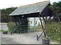
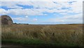
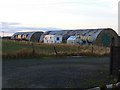
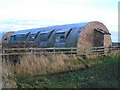
Nearby Images from Geograph Britain and Ireland:
©2006(licence)
©2013(licence)
©2009(licence)
©2009(licence)
©2021(licence)
The above images may not be of the site on this page, they are loaded from Geograph.
Please Submit an Image of this site or go out and take one for us!
Click here to see more info for this site
Nearby sites
Key: Red: member's photo, Blue: 3rd party photo, Yellow: other image, Green: no photo - please go there and take one, Grey: site destroyed
Download sites to:
KML (Google Earth)
GPX (GPS waypoints)
CSV (Garmin/Navman)
CSV (Excel)
To unlock full downloads you need to sign up as a Contributory Member. Otherwise downloads are limited to 50 sites.
Turn off the page maps and other distractions
Nearby sites listing. In the following links * = Image available
2.5km S 182° Skeith Stone* Class II Pictish Symbol Stone (NO571046)
3.0km ESE 115° Caiplie* Class I Pictish Symbol Stone (NO599058)
3.9km ENE 78° Sauchope* Class III Pictish Cross Slab (NO61040788)
4.3km ENE 79° Devil's Blue Stane* Standing Stone (Menhir) (NO614079)
4.5km E 81° Briery Well* Holy Well or Sacred Spring (NO617078)
4.9km NW 319° Druid's Well (Dunino)* Holy Well or Sacred Spring (NO540108)
5.0km NW 319° Dunino Den* Stone Row / Alignment (NO540109)
5.1km SSW 205° St Fillan's Well (Pittenweem)* Holy Well or Sacred Spring (NO550025)
5.7km NW 312° Dunino Stone Circle (NO530110)
6.5km NNW 342° Boarhills* Standing Stone (Menhir) (NO5525413356)
8.1km WSW 246° Easter Pitcorthie* Standing Stone (Menhir) (NO497039)
9.2km SW 227° Ardross souterrain* Souterrain (Fogou, Earth House) (NO5037500950)
11.1km NNW 328° Monk's Well, St Andrews* Holy Well or Sacred Spring (NO514166)
11.4km NW 321° St. Andrews Museum* Museum (NO5016)
11.7km NW 325° The Blue Stane (St Andrews)* Standing Stone (Menhir) (NO5055216707)
12.8km WNW 298° Drumcarrow Craig* Broch or Nuraghe (NO459132)
15.3km WSW 256° Largo Pictish Stone* Class II Pictish Symbol Stone (NO42340347)
16.3km W 270° Norrie's Law* Round Barrow(s) (NO409073)
17.2km WSW 255° Lundin Links* Stone Circle (NO40480272)
17.7km WNW 283° Spout Well* Holy Well or Sacred Spring (NO400114)
18.6km NW 321° Lady's Well (Leuchars) Holy Well or Sacred Spring (NO4557321645)
18.7km NW 320° St Bunyan's Well (Leuchars) Holy Well or Sacred Spring (NO4525221483)
19.8km WSW 259° Aithernie (Scoonie) Cairn (NO37690339)
20.1km WSW 257° Balgrummo* Standing Stone (Menhir) (NO375029)
21.9km S 184° St. Andrew's Well Holy Well or Sacred Spring (NT55438520)
View more nearby sites and additional images


 We would like to know more about this location. Please feel free to add a brief description and any relevant information in your own language.
 Wir möchten mehr über diese Stätte erfahren. Bitte zögern Sie nicht, eine kurze Beschreibung und relevante Informationen in Deutsch hinzuzufügen.
 Nous aimerions en savoir encore un peu sur les lieux. S'il vous plaît n'hesitez pas à ajouter une courte description et tous les renseignements pertinents dans votre propre langue.
 Quisieramos informarnos un poco más de las lugares. No dude en añadir una breve descripción y otros datos relevantes en su propio idioma.