<< Text Pages >> Eday Manse - Cairn in Scotland in Orkney
Submitted by AKFisher on Wednesday, 10 April 2024 Page Views: 25
Neolithic and Bronze AgeSite Name: Eday Manse Alternative Name: Eday Manse TombCountry: Scotland County: Orkney Type: Cairn
Map Ref: HY56023242
Latitude: 59.176208N Longitude: 2.771174W
Condition:
| 5 | Perfect |
| 4 | Almost Perfect |
| 3 | Reasonable but with some damage |
| 2 | Ruined but still recognisable as an ancient site |
| 1 | Pretty much destroyed, possibly visible as crop marks |
| 0 | No data. |
| -1 | Completely destroyed |
| 5 | Superb |
| 4 | Good |
| 3 | Ordinary |
| 2 | Not Good |
| 1 | Awful |
| 0 | No data. |
| 5 | Can be driven to, probably with disabled access |
| 4 | Short walk on a footpath |
| 3 | Requiring a bit more of a walk |
| 2 | A long walk |
| 1 | In the middle of nowhere, a nightmare to find |
| 0 | No data. |
| 5 | co-ordinates taken by GPS or official recorded co-ordinates |
| 4 | co-ordinates scaled from a detailed map |
| 3 | co-ordinates scaled from a bad map |
| 2 | co-ordinates of the nearest village |
| 1 | co-ordinates of the nearest town |
| 0 | no data |
Internal Links:
External Links:
Cairn in Orkney
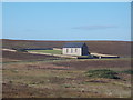
Approximately 50m above sea level observable on a hillside, the Eday Manse cairn consists of a remainder of a rectangular mound of large stones. What used to be a ‘Maeshowe-type’ chambered tomb, the site is in close proximity to the ruined remains of a United Presbyterian church. During the construction of the church in 1821 the tomb was demolished and leveled.
Links:
1. www.orkneystonetools.org.uk/themes/sites/funerary/eday-manse
2. archaeologyorkney.com/tombs-of-the-isles/eday/eday-manse/
You may be viewing yesterday's version of this page. To see the most up to date information please register for a free account.
Do not use the above information on other web sites or publications without permission of the contributor.
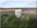
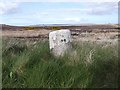
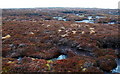
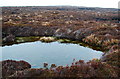
Nearby Images from Geograph Britain and Ireland:
©2020(licence)
©2019(licence)
©2009(licence)
©2009(licence)
©2015(licence)
The above images may not be of the site on this page, they are loaded from Geograph.
Please Submit an Image of this site or go out and take one for us!
Click here to see more info for this site
Nearby sites
Key: Red: member's photo, Blue: 3rd party photo, Yellow: other image, Green: no photo - please go there and take one, Grey: site destroyed
Download sites to:
KML (Google Earth)
GPX (GPS waypoints)
CSV (Garmin/Navman)
CSV (Excel)
To unlock full downloads you need to sign up as a Contributory Member. Otherwise downloads are limited to 50 sites.
Turn off the page maps and other distractions
Nearby sites listing. In the following links * = Image available
578m N 9° Sandyhill Smithy (Eday) Cairn (HY56123299)
1.0km N 0° Eday Church Chambered Cairn* Chambered Cairn (HY56043344)
2.8km N 7° Eday Heritage Centre* Museum (HY56403515)
3.0km NNE 13° Withebeir (Eday) Artificial Mound (HY5676135375)
3.2km S 177° Southside (Eday)* Standing Stone (Menhir) (HY56152922)
3.6km SSE 164° Green (Eday)* Ancient Village or Settlement (HY5697128987)
4.6km N 5° Mill Loch* Cairn (HY56513702)
4.8km N 4° Stone of Setter* Standing Stone (Menhir) (HY56453718)
5.1km N 4° Fold of Setter* Misc. Earthwork (HY56423750)
5.2km N 3° Braeside* Chambered Cairn (HY56333757)
5.3km N 2° Huntersquoy* Chambered Cairn (HY56263773)
5.5km ENE 57° Loth Road Bronze Age Structure Ancient Village or Settlement (HY6067635354)
5.7km N 359° Vinquoy* Chambered Cairn (HY56013809)
5.8km ENE 67° Hacksness (Sanday) Artificial Mound (HY61403464)
6.4km NNE 17° Calf of Eday Southeast Chambered Cairn (HY57923852)
6.4km N 2° Carrick House* Chambered Cairn (HY56363880)
6.4km NNE 16° Calf of Eday, North West Round Cairn (HY57883858)
6.4km NNW 329° Faray Chambered Cairn (HY52743797)
6.4km NNE 16° Calf of Eday (Long) Chambered Cairn (HY57863861)
6.9km E 100° Holm of Huip (Stronsay) Cairn (HY62823116)
7.0km N 354° Linkertaing* Chambered Cairn (HY55393937)
7.8km NE 50° Braehowar Broch or Nuraghe (HY620374)
9.5km SE 142° Lochend (Stronsay) Cairn (HY61762487)
9.7km WSW 241° Onziebist* Chambered Cairn (HY4741827807)
9.9km ESE 121° Oram's Fancy Cists* Cist (HY64502718)
View more nearby sites and additional images


 We would like to know more about this location. Please feel free to add a brief description and any relevant information in your own language.
 Wir möchten mehr über diese Stätte erfahren. Bitte zögern Sie nicht, eine kurze Beschreibung und relevante Informationen in Deutsch hinzuzufügen.
 Nous aimerions en savoir encore un peu sur les lieux. S'il vous plaît n'hesitez pas à ajouter une courte description et tous les renseignements pertinents dans votre propre langue.
 Quisieramos informarnos un poco más de las lugares. No dude en añadir una breve descripción y otros datos relevantes en su propio idioma.