

<< Our Photo Pages >> Eggardon earthwork - Henge in England in Dorset
Submitted by JimChampion on Friday, 29 December 2006 Page Views: 6477
Neolithic and Bronze AgeSite Name: Eggardon earthworkCountry: England County: Dorset Type: Henge
Nearest Town: Bridport Nearest Village: Powerstock
Map Ref: SY54689460
Latitude: 50.749222N Longitude: 2.643756W
Condition:
| 5 | Perfect |
| 4 | Almost Perfect |
| 3 | Reasonable but with some damage |
| 2 | Ruined but still recognisable as an ancient site |
| 1 | Pretty much destroyed, possibly visible as crop marks |
| 0 | No data. |
| -1 | Completely destroyed |
| 5 | Superb |
| 4 | Good |
| 3 | Ordinary |
| 2 | Not Good |
| 1 | Awful |
| 0 | No data. |
| 5 | Can be driven to, probably with disabled access |
| 4 | Short walk on a footpath |
| 3 | Requiring a bit more of a walk |
| 2 | A long walk |
| 1 | In the middle of nowhere, a nightmare to find |
| 0 | No data. |
| 5 | co-ordinates taken by GPS or official recorded co-ordinates |
| 4 | co-ordinates scaled from a detailed map |
| 3 | co-ordinates scaled from a bad map |
| 2 | co-ordinates of the nearest village |
| 1 | co-ordinates of the nearest town |
| 0 | no data |
Internal Links:
External Links:
")
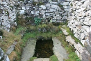
This circular earthwork lies about 300 metres to the east of Eggardon hillfort. Its outer bank is about 65 metres in diameter, and has an inner ditch. At the centre of the enclosed area is a small circular barrow mound, and there are possible entrances at the NNW and SSE. A small barrow overlies part of its bank and ditch on the southwest side. [source]
There are several other bowl barrows nearby.
Access The earthwork is immediately to the west of Barrowland Lane, between the crossroads with King's Lane and the junction with Shatombe Lane. If you walk directly from the Shatcombe Lane picnic area car park to the eastern entrance to Eggardon hillfort, the earthwork is to your left in the corner of the field.
You may be viewing yesterday's version of this page. To see the most up to date information please register for a free account.
")
")
")
")
")
")
")
")
")
")
")
")
Do not use the above information on other web sites or publications without permission of the contributor.
Click here to see more info for this site
Nearby sites
Key: Red: member's photo, Blue: 3rd party photo, Yellow: other image, Green: no photo - please go there and take one, Grey: site destroyed
Download sites to:
KML (Google Earth)
GPX (GPS waypoints)
CSV (Garmin/Navman)
CSV (Excel)
To unlock full downloads you need to sign up as a Contributory Member. Otherwise downloads are limited to 50 sites.
Turn off the page maps and other distractions
Nearby sites listing. In the following links * = Image available
571m WNW 282° Eggardon Hill* Hillfort (SY54129472)
1.2km SE 135° Two Gates (Dorset)* Burial Chamber or Dolmen (SY5548593770)
2.2km ESE 120° West Compton Bowl Barrow Round Barrow(s) (SY56619347)
2.9km ESE 112° West Compton Fort Hillfort (SY574935)
3.0km SSE 161° Litton Cheney* Timber Circle (SY5562591741)
3.1km SSW 212° Chilcombe Hill* Hillfort (SY530920)
3.5km SSW 212° Chilcombe Hill Barrows* Round Barrow(s) (SY528916)
3.6km NNE 23° Toller Porcorum* Standing Stones (SY561979)
4.0km SE 146° Martin's Down Round Barrows* Round Barrow(s) (SY569913)
4.0km SE 140° Kingston Russell Standing Stone* Standing Stone (Menhir) (SY57259149)
4.3km SE 144° Long Bredy Bank Barrow* Long Barrow (SY57179115)
4.3km SE 140° Long Bredy A Cursus* Cursus (SY57419124)
4.3km SE 140° Martin's Down Bell Barrows* Round Barrow(s) (SY57419124)
4.3km SE 143° Long Bredy Barrow Cemetery* Barrow Cemetery (SY5726491115)
4.5km SE 144° Long Bredy 2* Long Barrow (SY573909)
4.6km SE 135° Kingston Russell Stone 1 Standing Stone (Menhir) (SY579913)
4.7km SE 136° Long Bredy B Cursus Cursus (SY579912)
4.7km WSW 237° Shipton Hill* Hillfort (SY507921)
5.1km SE 133° Hangman's Rocks Stone Circle (SY58389109)
5.3km SE 141° Kingston Russell 1* Long Barrow (SY580905)
5.3km SE 141° Kingston Russell Stone 3* Standing Stone (Menhir) (SY580905)
5.3km SE 141° Kingston Russell 2* Long Barrow (SY580904)
5.7km SE 132° Poor Lot Barrows* Barrow Cemetery (SY589907)
6.0km SE 137° Pitcombe Down* Barrow Cemetery (SY587902)
6.1km N 9° Wraxall Cromlech Burial Chamber or Dolmen (ST557006)
View more nearby sites and additional images


 We would like to know more about this location. Please feel free to add a brief description and any relevant information in your own language.
 Wir möchten mehr über diese Stätte erfahren. Bitte zögern Sie nicht, eine kurze Beschreibung und relevante Informationen in Deutsch hinzuzufügen.
 Nous aimerions en savoir encore un peu sur les lieux. S'il vous plaît n'hesitez pas à ajouter une courte description et tous les renseignements pertinents dans votre propre langue.
 Quisieramos informarnos un poco más de las lugares. No dude en añadir una breve descripción y otros datos relevantes en su propio idioma.