<< Text Pages >> Battle Hill Dolmen - Cairn in Scotland in Aberdeenshire
Submitted by Anne T on Tuesday, 25 April 2017 Page Views: 1395
Neolithic and Bronze AgeSite Name: Battle Hill DolmenCountry: Scotland
NOTE: This site is 0.2 km away from the location you searched for.
County: Aberdeenshire Type: Cairn
Nearest Town: Huntly
Map Ref: NJ542401
Latitude: 57.448884N Longitude: 2.764786W
Condition:
| 5 | Perfect |
| 4 | Almost Perfect |
| 3 | Reasonable but with some damage |
| 2 | Ruined but still recognisable as an ancient site |
| 1 | Pretty much destroyed, possibly visible as crop marks |
| 0 | No data. |
| -1 | Completely destroyed |
| 5 | Superb |
| 4 | Good |
| 3 | Ordinary |
| 2 | Not Good |
| 1 | Awful |
| 0 | No data. |
| 5 | Can be driven to, probably with disabled access |
| 4 | Short walk on a footpath |
| 3 | Requiring a bit more of a walk |
| 2 | A long walk |
| 1 | In the middle of nowhere, a nightmare to find |
| 0 | No data. |
| 5 | co-ordinates taken by GPS or official recorded co-ordinates |
| 4 | co-ordinates scaled from a detailed map |
| 3 | co-ordinates scaled from a bad map |
| 2 | co-ordinates of the nearest village |
| 1 | co-ordinates of the nearest town |
| 0 | no data |
Internal Links:
External Links:
Cairn in Aberdeenshire
The Northern Antiquarian (TNA) page gives the location together with the archaeology and history and folklore of this now destroyed cairn, which was described in 1929 by Dr H O Forbes as a 'dolmen-like monument' and 'a ruined druid's altar'. See the TNA entry for Battle Hill Dolmen, Huntly, Aberdeenshire.
There is no entry on Canmore for this cairn, although it lies near to the site of a battle between the Clans Gordon and Cummin in the 14th century, at NJ 5417 3985.
Note: For more information, please see the comments below
You may be viewing yesterday's version of this page. To see the most up to date information please register for a free account.
Do not use the above information on other web sites or publications without permission of the contributor.
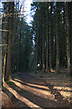
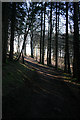
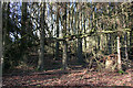
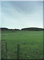
Nearby Images from Geograph Britain and Ireland:
©2015(licence)
©2015(licence)
©2015(licence)
©2007(licence)
©2021(licence)
The above images may not be of the site on this page, they are loaded from Geograph.
Please Submit an Image of this site or go out and take one for us!
Click here to see more info for this site
Nearby sites
Key: Red: member's photo, Blue: 3rd party photo, Yellow: other image, Green: no photo - please go there and take one, Grey: site destroyed
Download sites to:
KML (Google Earth)
GPX (GPS waypoints)
CSV (Garmin/Navman)
CSV (Excel)
To unlock full downloads you need to sign up as a Contributory Member. Otherwise downloads are limited to 50 sites.
Turn off the page maps and other distractions
Nearby sites listing. In the following links * = Image available
1.3km W 261° Stannin Steens O Strathbogie* Class I Pictish Symbol Stone (NJ529399)
1.3km W 261° Huntly Stone Circle (NJ529399)
3.3km E 88° Gerrieswells Long Barrow (NJ575402)
4.7km SSW 210° Hill Of Bucharn Stone Circle (NJ518360)
5.3km ESE 117° Stonyfield* Stone Circle (NJ589376)
5.6km NNW 348° Arnhill* Stone Circle (NJ531456)
6.2km W 267° Bowman Hillock* Stone Circle (NJ480398)
6.3km NE 43° Westertown* Stone Circle (NJ58594467)
6.7km N 357° Avochie* Rock Art (NJ5398046840)
7.0km N 1° Kimmonity Stone Circle (NJ54394707)
7.0km N 349° Tillytarmont 2* Class I Pictish Symbol Stone (NJ52974705)
7.4km ENE 67° Frendraught* Stone Circle (NJ6110442869)
7.9km WNW 290° Gingomyres Stone Circle (NJ46794294)
8.2km NE 45° Yonder Bognie* Stone Circle (NJ601458)
8.4km ENE 64° Raich Stone Circle* Stone Circle (NJ6187543655)
8.7km N 5° Rothiemay* Stone Circle (NJ55084872)
9.8km ENE 59° Conwath Stone (Inverkeithny) Standing Stone (Menhir) (NJ62654507)
9.8km S 185° Candy* Stone Circle (NJ533303)
10.1km S 180° Leith Hall* Class I Pictish Symbol Stone (NJ540300)
10.1km SSE 165° Wardhouse Ancient Village or Settlement (NJ567303)
10.1km S 181° Newbigging Leslie Class I Pictish Symbol Stone (NJ53992998)
10.2km ESE 109° Hillhead (Forgue) Stone Circle (NJ638367)
11.5km E 94° Logie Newton SW* Stone Circle (NJ65653915)
11.5km NNE 28° Marnoch Church* Stone Circle (NJ5970250206)
11.5km E 94° Logie Newton NE* Stone Circle (NJ657392)
View more nearby sites and additional images


 We would like to know more about this location. Please feel free to add a brief description and any relevant information in your own language.
 Wir möchten mehr über diese Stätte erfahren. Bitte zögern Sie nicht, eine kurze Beschreibung und relevante Informationen in Deutsch hinzuzufügen.
 Nous aimerions en savoir encore un peu sur les lieux. S'il vous plaît n'hesitez pas à ajouter une courte description et tous les renseignements pertinents dans votre propre langue.
 Quisieramos informarnos un poco más de las lugares. No dude en añadir una breve descripción y otros datos relevantes en su propio idioma.