<< Our Photo Pages >> Dunino Den - Stone Row / Alignment in Scotland in Fife
Submitted by hamish on Saturday, 11 June 2005 Page Views: 23645
Neolithic and Bronze AgeSite Name: Dunino Den Alternative Name: Balkethly, Balkaithley, Dunino's DenCountry: Scotland County: Fife Type: Stone Row / Alignment
Nearest Town: Kilrenny Nearest Village: Belaybridge
Map Ref: NO540109
Latitude: 56.288308N Longitude: 2.74468W
Condition:
| 5 | Perfect |
| 4 | Almost Perfect |
| 3 | Reasonable but with some damage |
| 2 | Ruined but still recognisable as an ancient site |
| 1 | Pretty much destroyed, possibly visible as crop marks |
| 0 | No data. |
| -1 | Completely destroyed |
| 5 | Superb |
| 4 | Good |
| 3 | Ordinary |
| 2 | Not Good |
| 1 | Awful |
| 0 | No data. |
| 5 | Can be driven to, probably with disabled access |
| 4 | Short walk on a footpath |
| 3 | Requiring a bit more of a walk |
| 2 | A long walk |
| 1 | In the middle of nowhere, a nightmare to find |
| 0 | No data. |
| 5 | co-ordinates taken by GPS or official recorded co-ordinates |
| 4 | co-ordinates scaled from a detailed map |
| 3 | co-ordinates scaled from a bad map |
| 2 | co-ordinates of the nearest village |
| 1 | co-ordinates of the nearest town |
| 0 | no data |
Internal Links:
External Links:
I have visited· I would like to visit
hamish has visited here
")
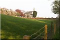
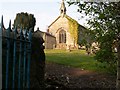
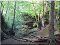
Dunino Den is regarded as a Sacred Site, there are a lot of ancient things to be found including a well and a circle. Another feature is a Church (Kirk) with an interesting Kirk Yard.
This Neolithic/Bronze Age stone circle is recorded as Canmore ID 34487 which says that a Druidical temple is said to have stood in this vicinity, and three stones close to the west wall of the minster's garden wall seem to have been part of a circle. They add: "The stone circle which formerly existed near the church at Dunino has now been entirely destroyed, but what are believed to be portions of some of the original stones are built into the dyke on the north side of the roadway at the south-west of the churchyard about 100 yards east of its junction with the main throughfare to St Andrews."
The Northern Antiquarian also features a page on this site - see their entry for Dunino, Fife which has a brief archaeology & history and local folklore, which says: "several of the stones within Dunino church have typical Masonic marks etched onto them and which, local folklore tells, identifies the standing stones that were once in the circle and which were then built into the church. Also in the churchyard is a small carved upright stone, which local people visit and leave offerings upon."
You may be viewing yesterday's version of this page. To see the most up to date information please register for a free account.
")
Do not use the above information on other web sites or publications without permission of the contributor.
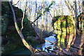
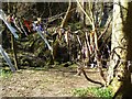
Nearby Images from Geograph Britain and Ireland:
©2006(licence)
©2006(licence)
©2018(licence)
©2009(licence)
©2015(licence)
The above images may not be of the site on this page, they are loaded from Geograph.
Please Submit an Image of this site or go out and take one for us!
Click here to see more info for this site
Nearby sites
Key: Red: member's photo, Blue: 3rd party photo, Yellow: other image, Green: no photo - please go there and take one, Grey: site destroyed
Download sites to:
KML (Google Earth)
GPX (GPS waypoints)
CSV (Garmin/Navman)
CSV (Excel)
To unlock full downloads you need to sign up as a Contributory Member. Otherwise downloads are limited to 50 sites.
Turn off the page maps and other distractions
Nearby sites listing. In the following links * = Image available
100m S 179° Druid's Well (Dunino)* Holy Well or Sacred Spring (NO540108)
1.0km W 275° Dunino Stone Circle (NO530110)
2.8km NNE 26° Boarhills* Standing Stone (Menhir) (NO5525413356)
5.0km SE 139° West Pitcorthie* Standing Stone (Menhir) (NO572071)
6.3km NNW 335° Monk's Well, St Andrews* Holy Well or Sacred Spring (NO514166)
6.5km NW 321° St. Andrews Museum* Museum (NO5016)
6.7km NNW 329° The Blue Stane (St Andrews)* Standing Stone (Menhir) (NO5055216707)
7.0km SSE 153° Skeith Stone* Class II Pictish Symbol Stone (NO571046)
7.6km ESE 113° Sauchope* Class III Pictish Cross Slab (NO61040788)
7.8km SE 130° Caiplie* Class I Pictish Symbol Stone (NO599058)
8.0km ESE 111° Devil's Blue Stane* Standing Stone (Menhir) (NO614079)
8.2km SSW 211° Easter Pitcorthie* Standing Stone (Menhir) (NO497039)
8.3km ESE 111° Briery Well* Holy Well or Sacred Spring (NO617078)
8.4km WNW 285° Drumcarrow Craig* Broch or Nuraghe (NO459132)
8.5km S 173° St Fillan's Well (Pittenweem)* Holy Well or Sacred Spring (NO550025)
10.6km SSW 199° Ardross souterrain* Souterrain (Fogou, Earth House) (NO5037500950)
13.5km WSW 254° Norrie's Law* Round Barrow(s) (NO409073)
13.6km NW 321° Lady's Well (Leuchars) Holy Well or Sacred Spring (NO4557321645)
13.7km NW 320° St Bunyan's Well (Leuchars) Holy Well or Sacred Spring (NO4525221483)
13.8km WSW 237° Largo Pictish Stone* Class II Pictish Symbol Stone (NO42340347)
14.0km W 271° Spout Well* Holy Well or Sacred Spring (NO400114)
15.8km WSW 238° Lundin Links* Stone Circle (NO40480272)
17.9km WSW 245° Aithernie (Scoonie) Cairn (NO37690339)
18.3km WSW 243° Balgrummo* Standing Stone (Menhir) (NO375029)
18.4km NW 309° Kilmany Cursus Cursus (NO39742263)
View more nearby sites and additional images


 We would like to know more about this location. Please feel free to add a brief description and any relevant information in your own language.
 Wir möchten mehr über diese Stätte erfahren. Bitte zögern Sie nicht, eine kurze Beschreibung und relevante Informationen in Deutsch hinzuzufügen.
 Nous aimerions en savoir encore un peu sur les lieux. S'il vous plaît n'hesitez pas à ajouter une courte description et tous les renseignements pertinents dans votre propre langue.
 Quisieramos informarnos un poco más de las lugares. No dude en añadir una breve descripción y otros datos relevantes en su propio idioma.