<< Text Pages >> Dinmore Hill - Hillfort in England in Herefordshire
Submitted by Andy B on Monday, 01 March 2010 Page Views: 16905
Iron Age and Later PrehistorySite Name: Dinmore Hill Alternative Name: Dinmore CampCountry: England County: Herefordshire Type: Hillfort
Nearest Village: Hope under Dinmore
Map Ref: SO520519
Latitude: 52.163271N Longitude: 2.703149W
Condition:
| 5 | Perfect |
| 4 | Almost Perfect |
| 3 | Reasonable but with some damage |
| 2 | Ruined but still recognisable as an ancient site |
| 1 | Pretty much destroyed, possibly visible as crop marks |
| 0 | No data. |
| -1 | Completely destroyed |
| 5 | Superb |
| 4 | Good |
| 3 | Ordinary |
| 2 | Not Good |
| 1 | Awful |
| 0 | No data. |
| 5 | Can be driven to, probably with disabled access |
| 4 | Short walk on a footpath |
| 3 | Requiring a bit more of a walk |
| 2 | A long walk |
| 1 | In the middle of nowhere, a nightmare to find |
| 0 | No data. |
| 5 | co-ordinates taken by GPS or official recorded co-ordinates |
| 4 | co-ordinates scaled from a detailed map |
| 3 | co-ordinates scaled from a bad map |
| 2 | co-ordinates of the nearest village |
| 1 | co-ordinates of the nearest town |
| 0 | no data |
Internal Links:
External Links:
Likely Hillfort in Herefordshire. In July of 2009 the Time Team investigated a possible Iron Age hillfort on Dinmore Hill north of Hereford. The mammoth operation involved not just the Time Team regulars, but also another seven HA archaeologists, ten HA coordinated volunteers, and around fifty Time Team support staff ranging from camera crews to caterers.
Despite some awful weather, the results were extremely interesting, and have potentially put a major and important new site on the Herefordshire prehistoric map.
Source: the Unnoficial Time Team page and Historic Environment Today.
However Time Team appear to be hiding their light under a bushel so here is a spoiler:
Public bridleway from A49 passes through this hillfort Single rampart and ditch survive in good condition across neck of hill N of the bridleway. South of this the line is continued as an eroded features followed by the parish boundary. Hillfort must have used the steep hillside as defence along most of its N & S and eastwards it must have extended as far as the house. Area enclosed about 9.6 hectares representing large hillfort from which the name of the hill (din mawr great fort or hill) is probably derived.
Source: Herefordshire SMR
You may be viewing yesterday's version of this page. To see the most up to date information please register for a free account.
Do not use the above information on other web sites or publications without permission of the contributor.
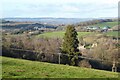
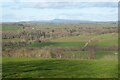
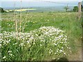
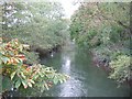
Nearby Images from Geograph Britain and Ireland:
©2022(licence)
©2022(licence)
©2007(licence)
©2010(licence)
©2012(licence)
The above images may not be of the site on this page, they are loaded from Geograph.
Please Submit an Image of this site or go out and take one for us!
Click here to see more info for this site
Nearby sites
Key: Red: member's photo, Blue: 3rd party photo, Yellow: other image, Green: no photo - please go there and take one, Grey: site destroyed
Download sites to:
KML (Google Earth)
GPX (GPS waypoints)
CSV (Garmin/Navman)
CSV (Excel)
To unlock full downloads you need to sign up as a Contributory Member. Otherwise downloads are limited to 50 sites.
Turn off the page maps and other distractions
Nearby sites listing. In the following links * = Image available
4.1km NNE 32° Risbury Camp* Hillfort (SO542554)
4.4km NNE 15° Blackwardine Crossroads* Modern Stone Circle etc (SO5318656161)
4.6km NW 307° Ivington Camp* Hillfort (SO484547)
4.9km S 189° St Ethelbert's Well (Marden)* Holy Well or Sacred Spring (SO512471)
5.5km S 174° Sutton Walls* Hillfort (SO525464)
7.0km W 266° Bush Bank* Standing Stone (Menhir) (SO4496251449)
8.0km S 172° The Wergin's Stone* Standing Stone (Menhir) (SO5297543981)
8.2km NE 37° Uphampton Camp Hillfort (SO57005838)
8.7km NNE 17° Bach Camp* Hillfort (SO546602)
10.1km SW 222° Credenhill Camp* Hillfort (SO451445)
11.6km SSW 213° Holy Well (Garway)* Holy Well or Sacred Spring (SO45554224)
11.9km NW 322° St Michael's Church (Kingsland)* Ancient Cross (SO4468461269)
12.0km NNW 343° Luston Holy Well* Holy Well or Sacred Spring (SO4859563407)
12.1km S 185° Hereford Museum and Art Gallery* Museum (SO5090039851)
12.2km S 185° The King's Ditch Natural Stone / Erratic / Other Natural Feature (SO50873974)
12.2km S 184° St Ethelbert's Well (Hereford)* Holy Well or Sacred Spring (SO5112239684)
13.1km SW 219° Holy Well (Swainshill)* Holy Well or Sacred Spring (SO43724177)
14.0km NE 45° Garmsley Camp* Hillfort (SO620618)
14.1km SE 143° St Edith's Well (Herefordshire)* Holy Well or Sacred Spring (SO604406)
14.2km SSW 207° Eaton Camp* Promontory Fort / Cliff Castle (SO454393)
14.6km SSE 152° Backbury* Hillfort (SO587389)
15.0km S 179° Rotherwas Ribbon* Ancient Trackway (SO52053690)
15.5km S 178° Dinedor Camp* Hillfort (SO524364)
15.6km NNW 335° Bircher Common* Misc. Earthwork (SO454661)
16.0km WNW 286° Tank Cottage Standing Stone (Menhir) (SO36615640)
View more nearby sites and additional images


 We would like to know more about this location. Please feel free to add a brief description and any relevant information in your own language.
 Wir möchten mehr über diese Stätte erfahren. Bitte zögern Sie nicht, eine kurze Beschreibung und relevante Informationen in Deutsch hinzuzufügen.
 Nous aimerions en savoir encore un peu sur les lieux. S'il vous plaît n'hesitez pas à ajouter une courte description et tous les renseignements pertinents dans votre propre langue.
 Quisieramos informarnos un poco más de las lugares. No dude en añadir una breve descripción y otros datos relevantes en su propio idioma.