<< Our Photo Pages >> Aberlemno - Standing Stones in Scotland in Angus
Submitted by cosmic on Saturday, 12 March 2022 Page Views: 29405
Neolithic and Bronze AgeSite Name: AberlemnoCountry: Scotland County: Angus Type: Standing Stones
Nearest Town: Montrose Nearest Village: Aberlemno
Map Ref: NO52245586 Landranger Map Number: 54
Latitude: 56.692015N Longitude: 2.781369W
Condition:
| 5 | Perfect |
| 4 | Almost Perfect |
| 3 | Reasonable but with some damage |
| 2 | Ruined but still recognisable as an ancient site |
| 1 | Pretty much destroyed, possibly visible as crop marks |
| 0 | No data. |
| -1 | Completely destroyed |
| 5 | Superb |
| 4 | Good |
| 3 | Ordinary |
| 2 | Not Good |
| 1 | Awful |
| 0 | No data. |
| 5 | Can be driven to, probably with disabled access |
| 4 | Short walk on a footpath |
| 3 | Requiring a bit more of a walk |
| 2 | A long walk |
| 1 | In the middle of nowhere, a nightmare to find |
| 0 | No data. |
| 5 | co-ordinates taken by GPS or official recorded co-ordinates |
| 4 | co-ordinates scaled from a detailed map |
| 3 | co-ordinates scaled from a bad map |
| 2 | co-ordinates of the nearest village |
| 1 | co-ordinates of the nearest town |
| 0 | no data |
Internal Links:
External Links:
I have visited· I would like to visit
X-Ice coin eirrac5 Lucianne would like to visit
aolson visited on 30th Jun 2024 - their rating: Cond: 4 Amb: 4 Access: 5 A highlight of our trip to Scotland. After seeing many Pictish stones in museums, it was great to see some in almost their natural setting.
LenGilbert visited on 10th Aug 2015 - their rating: Cond: 4 Amb: 5 Access: 5 At the car park across the street, you have easy access to the three stones. Mind the traffic as you cross and remember to continue to the kirk to see the stone there.
SandyG visited on 31st Aug 2013 - their rating: Cond: 4 Amb: 4 Access: 5
jeffrep visited on 13th May 2013 - their rating: Cond: 4 Amb: 5 Access: 5
megalithicmatt visited on 30th May 2005 - their rating: Cond: 4 Amb: 4 Access: 5 Picturesque setting despite being right by the road!
Andy B visited #4 in our rundown of favourite standing stones (and pairs) in Britain
DrewParsons h_fenton rldixon hamish AngieLake have visited here
Average ratings for this site from all visit loggers: Condition: 4 Ambience: 4.4 Access: 5

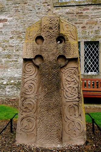
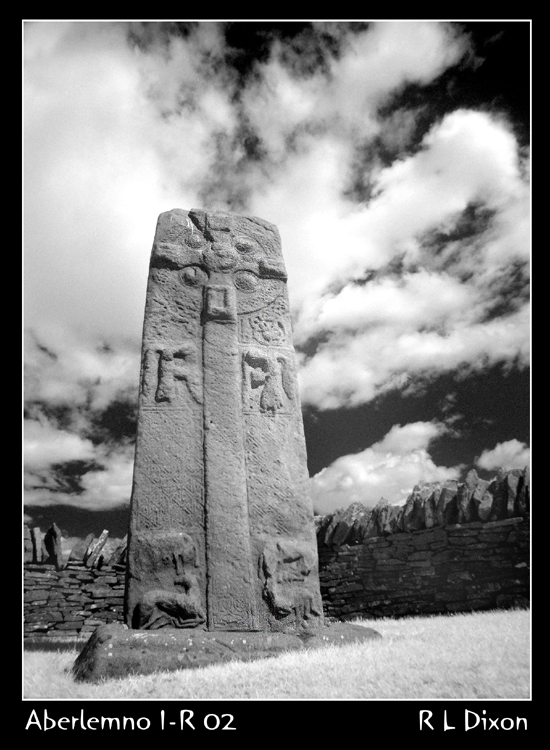
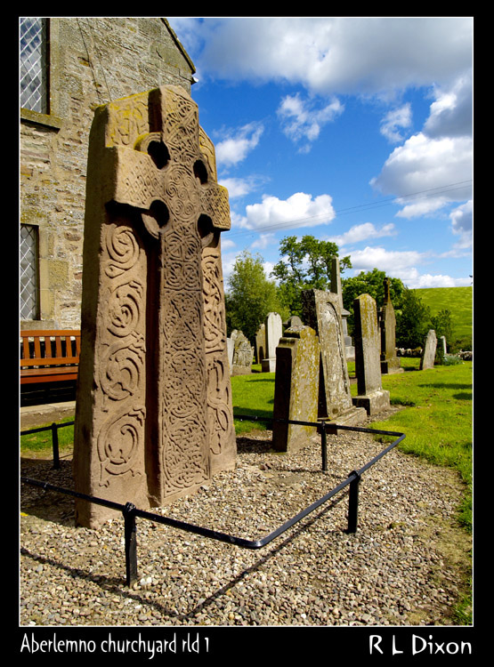
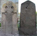
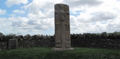
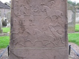
The one in the churchyard is a CII slade orientated North-South whlst the other three have their major sides facing East-West. From October to Easter they are all covered by wooden boxes to protect them from frost so save your visit untll the summer!
Additional Information supplied by Drew Parsons after a September 2012 visit: There is a car park opposite the three stones on the B9134. There is also a car park just past the church for the churchyard stone. The latter is located in the church grounds between the church and the road. The GPS / Ordnance Survey grid reference on this page is for the 3 stones on the B9134. That for the Churchyard Stone is NO 5223 5555 Another stone was found by a local farmer during ploughing and is now held at the McManus Galleries in Dundee ( see the Megalithic Portal page for McManus Galleries for a photo of that stone).
For more information see:
Canmore ID 34861; Canmore ID 34862; Canmore ID 34806; Canmore ID 34860, and Canmore ID 34863.
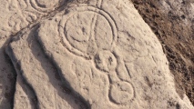
Two lovely new 3D models - one of this archetypal Pictish symbol stone, also one of Barlgarthno stone circle - try them out further down our page.
Note: Archaeologists rediscover a Pictish symbol stone close to the location of some of the most significant carved stones ever uncovered in Scotland. Photos, video and more on our page
You may be viewing yesterday's version of this page. To see the most up to date information please register for a free account.









These are just the first 25 photos of Aberlemno. If you log in with a free user account you will be able to see our entire collection.
Do not use the above information on other web sites or publications without permission of the contributor.
Click here to see more info for this site
Nearby sites
Key: Red: member's photo, Blue: 3rd party photo, Yellow: other image, Green: no photo - please go there and take one, Grey: site destroyed
Download sites to:
KML (Google Earth)
GPX (GPS waypoints)
CSV (Garmin/Navman)
CSV (Excel)
To unlock full downloads you need to sign up as a Contributory Member. Otherwise downloads are limited to 50 sites.
Turn off the page maps and other distractions
Nearby sites listing. In the following links * = Image available
1.7km W 260° Finavon* Vitrified Fort (NO506556)
2.1km S 179° Doo'cot Woods (Turin Hill) Rock Art (NO5224953716)
2.2km SW 230° Carsegownie Cairn* Cairn (NO50565449)
2.2km S 182° West Mains 1 & 2 (Turin Hill) Rock Art (NO52145369)
4.0km SSE 159° Westerton (Aberlemno)* Stone Circle (NO53645210)
4.6km SSW 201° Reswallie House rock art* Rock Art (NO50535154)
4.7km SW 222° Rob's Reed Stone Fort or Dun (NO49065243)
4.9km SW 231° Blackgate of Pitscandlie* Stone Circle (NO484528)
5.7km WSW 247° Baggerton Class I Pictish Symbol Stone (NO469537)
6.1km S 174° Girdle Stane of Dunnichen* Rock Art (NO5280849737)
6.2km E 80° St Murdoch's Well (Brechin) Holy Well or Sacred Spring (NO58405682)
6.3km S 185° Dunnichen* Class I Pictish Symbol Stone (NO516496)
6.4km WSW 250° Carse Gray* Stone Circle (NO462538)
6.4km NE 37° Killievair* Standing Stone (Menhir) (NO562609)
6.9km NE 53° Pictavia* Museum (NO578599)
7.0km NW 326° Ghaist Stone (Fern) Standing Stone (Menhir) (NO48326173)
7.2km ENE 63° St Ouret's Well (Brechin) Holy Well or Sacred Spring (NO58695904)
7.9km NE 53° Dubton Farm Iron Age settlement and Souterrain Souterrain (Fogou, Earth House) (NO58616062)
8.3km ENE 59° Aldbar* Class III Pictish Cross Slab (NO594601)
8.5km SSE 159° Dumbarrow Hill Stone Fort or Dun (NO55154791)
8.5km ENE 59° Brechin Cathedral* Sculptured Stone (NO596601)
8.5km SW 231° Meffan Institute* Museum (NO45525062)
8.6km N 7° Menmuir Pictish Cross Slab Class III Pictish Cross Slab (NO534644)
8.7km SE 132° Guthrie Cursus Cursus (NO587500)
9.0km N 358° Hill of Menmuir* Rock Art (NO52096489)
View more nearby sites and additional images


 We would like to know more about this location. Please feel free to add a brief description and any relevant information in your own language.
 Wir möchten mehr über diese Stätte erfahren. Bitte zögern Sie nicht, eine kurze Beschreibung und relevante Informationen in Deutsch hinzuzufügen.
 Nous aimerions en savoir encore un peu sur les lieux. S'il vous plaît n'hesitez pas à ajouter une courte description et tous les renseignements pertinents dans votre propre langue.
 Quisieramos informarnos un poco más de las lugares. No dude en añadir una breve descripción y otros datos relevantes en su propio idioma.