

<< Text Pages >> Clatt Hillhead - Stone Circle in Scotland in Aberdeenshire
Submitted by Anonymous on Monday, 15 July 2002 Page Views: 6926
Neolithic and Bronze AgeSite Name: Clatt HillheadCountry: Scotland County: Aberdeenshire Type: Stone Circle
Map Ref: NJ528265 Landranger Map Number: 37
Latitude: 57.326587N Longitude: 2.785493W
Condition:
| 5 | Perfect |
| 4 | Almost Perfect |
| 3 | Reasonable but with some damage |
| 2 | Ruined but still recognisable as an ancient site |
| 1 | Pretty much destroyed, possibly visible as crop marks |
| 0 | No data. |
| -1 | Completely destroyed |
| 5 | Superb |
| 4 | Good |
| 3 | Ordinary |
| 2 | Not Good |
| 1 | Awful |
| 0 | No data. |
| 5 | Can be driven to, probably with disabled access |
| 4 | Short walk on a footpath |
| 3 | Requiring a bit more of a walk |
| 2 | A long walk |
| 1 | In the middle of nowhere, a nightmare to find |
| 0 | No data. |
| 5 | co-ordinates taken by GPS or official recorded co-ordinates |
| 4 | co-ordinates scaled from a detailed map |
| 3 | co-ordinates scaled from a bad map |
| 2 | co-ordinates of the nearest village |
| 1 | co-ordinates of the nearest town |
| 0 | no data |
Be the first person to rate this site - see the 'Contribute!' box in the right hand menu.
Internal Links:
External Links:
Stone Circle in Aberdeenshire
Have you visited this site? Please contribute a description or any thoughts by adding a comment.
You may be viewing yesterday's version of this page. To see the most up to date information please register for a free account.
Do not use the above information on other web sites or publications without permission of the contributor.
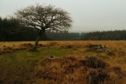
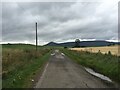
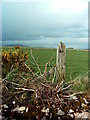
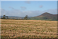
Nearby Images from Geograph Britain and Ireland:
©2023(licence)
©2007(licence)
©2015(licence)
©2015(licence)
©2009(licence)
The above images may not be of the site on this page, they are loaded from Geograph.
Please Submit an Image of this site or go out and take one for us!
Click here to see more info for this site
Nearby sites
Key: Red: member's photo, Blue: 3rd party photo, Yellow: other image, Green: no photo - please go there and take one, Grey: site destroyed
Download sites to:
KML (Google Earth)
GPX (GPS waypoints)
CSV (Garmin/Navman)
CSV (Excel)
To unlock full downloads you need to sign up as a Contributory Member. Otherwise downloads are limited to 50 sites.
Turn off the page maps and other distractions
Nearby sites listing. In the following links * = Image available
nankm 0° Hillhead of Clatt Multiple Stone Rows / Avenue (NJ528265)
509m N 11° Clatt Bankhead Stone Circle (NJ529270)
509m N 11° Bankhead of Clatt Multiple Stone Rows / Avenue (NJ529270)
1.2km ESE 114° Clatt 2* Class I Pictish Symbol Stone (NJ53892600)
1.9km WNW 288° Corrstone Wood* Stone Circle (NJ510271)
2.2km ENE 74° The Sunken Kirk, Seggieden Stone Circle (NJ54912708)
2.2km ESE 102° Tofthill, Clatt Stone Circle (NJ5526)
2.8km WNW 297° Mill o'Noth* Standing Stones (NJ5034727801)
2.8km W 271° Rhynie 6* Class I Pictish Symbol Stone (NJ49972659)
2.9km ENE 59° Ardlair (Circle)* Stone Circle (NJ55272794)
2.9km SE 146° Clatt 1* Class I Pictish Symbol Stone (NJ54422408)
3.0km ENE 63° Ardlair (Pictish Stone)* Class I Pictish Symbol Stone (NJ5547027840)
3.0km W 279° Rhynie 4* Class I Pictish Symbol Stone (NJ49822700)
3.0km W 267° Rhynie Man* Class I Pictish Symbol Stone (NJ49762636)
3.0km W 266° Craw Stane* Class I Pictish Symbol Stone (NJ4974926345)
3.1km WNW 282° Rhynie 2* Class I Pictish Symbol Stone (NJ49802715)
3.1km W 264° Rhynie 8* Class I Pictish Symbol Stone (NJ497262)
3.7km NNE 18° Newbigging Leslie Class I Pictish Symbol Stone (NJ53992998)
3.7km NNE 18° Leith Hall* Class I Pictish Symbol Stone (NJ540300)
3.8km N 7° Candy* Stone Circle (NJ533303)
4.4km W 275° Upper Ord* Stone Circle (NJ484269)
4.8km W 271° Wheedlemont* Stone Circle (NJ4797226606)
5.2km WNW 302° Tap o'Noth* Hillfort (NJ484293)
5.3km ESE 104° Johnston, The Ringing Stone* Standing Stone (Menhir) (NJ57902517)
5.4km NE 45° Wardhouse Ancient Village or Settlement (NJ567303)
View more nearby sites and additional images


 We would like to know more about this location. Please feel free to add a brief description and any relevant information in your own language.
 Wir möchten mehr über diese Stätte erfahren. Bitte zögern Sie nicht, eine kurze Beschreibung und relevante Informationen in Deutsch hinzuzufügen.
 Nous aimerions en savoir encore un peu sur les lieux. S'il vous plaît n'hesitez pas à ajouter une courte description et tous les renseignements pertinents dans votre propre langue.
 Quisieramos informarnos un poco más de las lugares. No dude en añadir una breve descripción y otros datos relevantes en su propio idioma.