


<< Text Pages >> Kidlaw Hillfort - Hillfort in Scotland in East Lothian
Submitted by Andy B on Monday, 23 June 2008 Page Views: 8209
Iron Age and Later PrehistorySite Name: Kidlaw HillfortCountry: Scotland
NOTE: This site is 5.0 km away from the location you searched for.
County: East Lothian Type: Hillfort
Nearest Town: Dalkeith Nearest Village: Gilchriston
Map Ref: NT512642
Latitude: 55.868488N Longitude: 2.781367W
Condition:
| 5 | Perfect |
| 4 | Almost Perfect |
| 3 | Reasonable but with some damage |
| 2 | Ruined but still recognisable as an ancient site |
| 1 | Pretty much destroyed, possibly visible as crop marks |
| 0 | No data. |
| -1 | Completely destroyed |
| 5 | Superb |
| 4 | Good |
| 3 | Ordinary |
| 2 | Not Good |
| 1 | Awful |
| 0 | No data. |
| 5 | Can be driven to, probably with disabled access |
| 4 | Short walk on a footpath |
| 3 | Requiring a bit more of a walk |
| 2 | A long walk |
| 1 | In the middle of nowhere, a nightmare to find |
| 0 | No data. |
| 5 | co-ordinates taken by GPS or official recorded co-ordinates |
| 4 | co-ordinates scaled from a detailed map |
| 3 | co-ordinates scaled from a bad map |
| 2 | co-ordinates of the nearest village |
| 1 | co-ordinates of the nearest town |
| 0 | no data |
Be the first person to rate this site - see the 'Contribute!' box in the right hand menu.
Internal Links:
External Links:
Hillfort in East Lothian. Hill fort with a single defensive bank.
You may be viewing yesterday's version of this page. To see the most up to date information please register for a free account.
Do not use the above information on other web sites or publications without permission of the contributor.
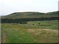
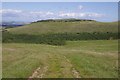
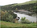
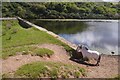
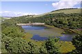
Nearby Images from Geograph Britain and Ireland:
©2006(licence)
©2018(licence)
©2009(licence)
©2018(licence)
©2018(licence)
The above images may not be of the site on this page, they are loaded from Geograph.
Please Submit an Image of this site or go out and take one for us!
Click here to see more info for this site
Nearby sites
Key: Red: member's photo, Blue: 3rd party photo, Yellow: other image, Green: no photo - please go there and take one, Grey: site destroyed
Download sites to:
KML (Google Earth)
GPX (GPS waypoints)
CSV (Garmin/Navman)
CSV (Excel)
To unlock full downloads you need to sign up as a Contributory Member. Otherwise downloads are limited to 50 sites.
Turn off the page maps and other distractions
Nearby sites listing. In the following links * = Image available
3.0km WSW 254° Leaston House (Humbie) Rock Art (NT483634)
6.2km S 176° Tollis Hill* Hillfort (NT51605804)
6.3km S 173° Tollishill* Standing Stone (Menhir) (NT51905797)
9.7km N 2° Custom Stone (Haddington) Marker Stone (NT51697388)
10.5km E 87° Mayshiel Stone Circle (NT617646)
10.6km E 84° Crow Stones (Cranshaws)* Stone Circle (NT61836519)
10.6km S 173° Addinston Hill fort* Hillfort (NT523536)
11.0km SSW 202° Kirktonhill Stone Circle (NT470540)
11.0km ENE 66° White Castle Fort* Hillfort (NT61356860)
11.1km ENE 74° Ragstone Rig (Cranshaws) Stone Row / Alignment (NT61956705)
11.4km E 83° Nine Stones Rig* Stone Circle (NT62546549)
11.4km E 84° Stone Standing Stone Standing Stone (Menhir) (NT62586518)
11.4km WSW 258° Crichton Souterrain* Souterrain (Fogou, Earth House) (NT40016191)
11.4km ENE 77° Tavers Cleugh* Cairn (NT62386671)
11.4km E 85° Kingside Hill Stone Circle (NT62636503)
11.5km NE 34° Standingstone (East Lothian)* Standing Stone (Menhir) (NT57737363)
11.8km E 87° Mayshiel Stone Circle* Stone Circle (NT62986465)
11.9km NNE 33° Loth Stone* Standing Stone (Menhir) (NT5782374146)
12.0km E 89° Penshiel Hill Stone Circle (NT632642)
12.1km N 2° Kaeheughs Hillfort (NT51837627)
12.2km ESE 115° Mutiny Stones* Cairn (NT62255902)
12.5km NNE 32° Traprain Law* Hillfort (NT5805674696)
12.7km NNE 33° Maiden Stone (East Lothian)* Standing Stone (Menhir) (NT5830774748)
12.7km SSE 158° Borrowston Rigg* Stone Circle (NT5576052315)
12.7km SSE 158° Borrowstone Rig* Stone Circle (NT55765231)
View more nearby sites and additional images


 We would like to know more about this location. Please feel free to add a brief description and any relevant information in your own language.
 Wir möchten mehr über diese Stätte erfahren. Bitte zögern Sie nicht, eine kurze Beschreibung und relevante Informationen in Deutsch hinzuzufügen.
 Nous aimerions en savoir encore un peu sur les lieux. S'il vous plaît n'hesitez pas à ajouter une courte description et tous les renseignements pertinents dans votre propre langue.
 Quisieramos informarnos un poco más de las lugares. No dude en añadir una breve descripción y otros datos relevantes en su propio idioma.