<< Text Pages >> Longhowe - Cairn in Scotland in Orkney
Submitted by Andy B on Tuesday, 14 August 2007 Page Views: 5100
Neolithic and Bronze AgeSite Name: Longhowe Alternative Name: Long HoweCountry: Scotland County: Orkney Type: Cairn
Map Ref: HY512061
Latitude: 58.939345N Longitude: 2.849632W
Condition:
| 5 | Perfect |
| 4 | Almost Perfect |
| 3 | Reasonable but with some damage |
| 2 | Ruined but still recognisable as an ancient site |
| 1 | Pretty much destroyed, possibly visible as crop marks |
| 0 | No data. |
| -1 | Completely destroyed |
| 5 | Superb |
| 4 | Good |
| 3 | Ordinary |
| 2 | Not Good |
| 1 | Awful |
| 0 | No data. |
| 5 | Can be driven to, probably with disabled access |
| 4 | Short walk on a footpath |
| 3 | Requiring a bit more of a walk |
| 2 | A long walk |
| 1 | In the middle of nowhere, a nightmare to find |
| 0 | No data. |
| 5 | co-ordinates taken by GPS or official recorded co-ordinates |
| 4 | co-ordinates scaled from a detailed map |
| 3 | co-ordinates scaled from a bad map |
| 2 | co-ordinates of the nearest village |
| 1 | co-ordinates of the nearest town |
| 0 | no data |
Be the first person to rate this site - see the 'Contribute!' box in the right hand menu.
Internal Links:
External Links:
A scattering of flints unearthed near Minehowe could mark the site of the earliest “settlement” found in Orkney to date. The flints were found during the excavation of the Bronze Age barrow on top of Longhowe – the raised strip of land between Minehowe and the circular feature known as Roundhowe, to the south-west.
Orkney Archaeological Trust project manager Nick Card explained: “Within the make-up of the barrow we found lots of bits of flint – in fact more flint from this one area than we got from the rest of the site. We originally thought these were Bronze Age but a couple were definitely diagnostic of the Mesolithic.”
More at Orkneyjar
You may be viewing yesterday's version of this page. To see the most up to date information please register for a free account.
Do not use the above information on other web sites or publications without permission of the contributor.
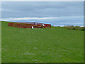
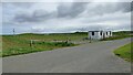
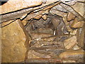
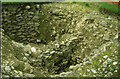
Nearby Images from Geograph Britain and Ireland:

©2006(licence)
©2009(licence)
©2021(licence)
©2011(licence)
©2005(licence)
The above images may not be of the site on this page, they are loaded from Geograph.
Please Submit an Image of this site or go out and take one for us!
Click here to see more info for this site
Nearby sites
Key: Red: member's photo, Blue: 3rd party photo, Yellow: other image, Green: no photo - please go there and take one, Grey: site destroyed
Download sites to:
KML (Google Earth)
GPX (GPS waypoints)
CSV (Garmin/Navman)
CSV (Excel)
To unlock full downloads you need to sign up as a Contributory Member. Otherwise downloads are limited to 50 sites.
Turn off the page maps and other distractions
Nearby sites listing. In the following links * = Image available
156m WSW 240° Mine Howe* Chambered Cairn (HY5106406023)
223m WNW 296° Stem Howe* Round Barrow(s) (HY510062)
315m WSW 251° Long Howe* Long Barrow (HY509060)
399m N 359° Hawell Burnt Mound* Round Barrow(s) (HY512065)
460m WSW 245° Round Howe* Broch or Nuraghe (HY50780591)
537m WSW 247° Burn of Langskaill* Ancient Village or Settlement (HY507059)
779m NE 39° Muckle Crofty* Stone Row / Alignment (HY517067)
804m E 96° Breck Farm* Standing Stones (HY520060)
805m NNW 330° Nearhouse* Ancient Village or Settlement (HY508068)
903m W 263° Brymer* Round Barrow(s) (HY503060)
1.4km NNE 29° Loch of Messigate* Standing Stones (HY519073)
1.9km N 2° Mill Sand* Standing Stones (HY513080)
2.2km WNW 290° Craw Howe* Cairn (HY491069)
2.4km N 357° Whitecleat* Holy Well or Sacred Spring (HY511085)
2.6km SE 141° Campston (Toab)* Broch or Nuraghe (HY528041)
2.9km N 3° The Howie of The Manse* Broch or Nuraghe (HY514090)
3.0km ESE 122° St. Peter's Bay Mound* Broch or Nuraghe (HY537045)
3.0km WNW 286° Staneloof* Cairn (HY48330698)
3.1km SE 128° St. Peter's Kirk* Ancient Village or Settlement (HY536042)
3.1km NNE 18° Grieves Cottage* Standing Stone (Menhir) (HY522090)
3.1km SE 127° Campston Cairn* Cairn (HY537042)
3.3km E 85° Hurnip's Point* Chambered Cairn (HY54480634)
3.3km NNE 17° Loch of Tankerness* Ancient Village or Settlement (HY522093)
3.5km W 274° Heathery Howes* Round Barrow(s) (HY477064)
3.5km SE 125° Comely* Cairn (HY54040403)
View more nearby sites and additional images


 We would like to know more about this location. Please feel free to add a brief description and any relevant information in your own language.
 Wir möchten mehr über diese Stätte erfahren. Bitte zögern Sie nicht, eine kurze Beschreibung und relevante Informationen in Deutsch hinzuzufügen.
 Nous aimerions en savoir encore un peu sur les lieux. S'il vous plaît n'hesitez pas à ajouter une courte description et tous les renseignements pertinents dans votre propre langue.
 Quisieramos informarnos un poco más de las lugares. No dude en añadir una breve descripción y otros datos relevantes en su propio idioma.