


<< Our Photo Pages >> Carsegownie Cairn - Cairn in Scotland in Angus
Submitted by DrewParsons on Monday, 29 October 2012 Page Views: 3738
Neolithic and Bronze AgeSite Name: Carsegownie Cairn Alternative Name: NO55SW 2; Canmore ID 34911Country: Scotland County: Angus Type: Cairn
Nearest Town: Forfar Nearest Village: Aberlemno
Map Ref: NO50565449
Latitude: 56.679534N Longitude: 2.808531W
Condition:
| 5 | Perfect |
| 4 | Almost Perfect |
| 3 | Reasonable but with some damage |
| 2 | Ruined but still recognisable as an ancient site |
| 1 | Pretty much destroyed, possibly visible as crop marks |
| 0 | No data. |
| -1 | Completely destroyed |
| 5 | Superb |
| 4 | Good |
| 3 | Ordinary |
| 2 | Not Good |
| 1 | Awful |
| 0 | No data. |
| 5 | Can be driven to, probably with disabled access |
| 4 | Short walk on a footpath |
| 3 | Requiring a bit more of a walk |
| 2 | A long walk |
| 1 | In the middle of nowhere, a nightmare to find |
| 0 | No data. |
| 5 | co-ordinates taken by GPS or official recorded co-ordinates |
| 4 | co-ordinates scaled from a detailed map |
| 3 | co-ordinates scaled from a bad map |
| 2 | co-ordinates of the nearest village |
| 1 | co-ordinates of the nearest town |
| 0 | no data |
Internal Links:
External Links:
I have visited· I would like to visit
aolson visited on 30th Jul 2023 - their rating: Cond: 4 Amb: 3 Access: 4 Not much to see. Fortunately we were there on a quiet morning, but I imagine parking without disrupting traffic could be a challenge on a busy day
DrewParsons have visited here
")
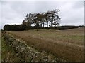
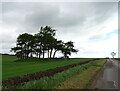
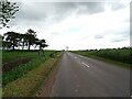
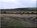
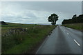
Carsegownie Cairn is located 50 metres north of the B9134 approximately two kilometres west of Aberlemno. It is shown on the Ordnance Survey map as a cairn just east of the farm lane leading to Carsegownie Farm. It comprises a small mound approximately 1 metre high and 30 metres in diameter with a number of stones around its perimeter. When excavated some time before 1842 a stone urn containing black ashes was found together with two stone dishes with handles. No other finds were made. The Canmore reference is: http://canmore.rcahms.gov.uk/en/site/34911/details/carsegownie/
You may be viewing yesterday's version of this page. To see the most up to date information please register for a free account.
")
")
")
Do not use the above information on other web sites or publications without permission of the contributor.
Nearby Images from Geograph Britain and Ireland:
©2016(licence)
©2021(licence)
©2021(licence)
©2016(licence)
©2020(licence)
The above images may not be of the site on this page, they are loaded from Geograph.
Please Submit an Image of this site or go out and take one for us!
Click here to see more info for this site
Nearby sites
Key: Red: member's photo, Blue: 3rd party photo, Yellow: other image, Green: no photo - please go there and take one, Grey: site destroyed
Download sites to:
KML (Google Earth)
GPX (GPS waypoints)
CSV (Garmin/Navman)
CSV (Excel)
To unlock full downloads you need to sign up as a Contributory Member. Otherwise downloads are limited to 50 sites.
Turn off the page maps and other distractions
Nearby sites listing. In the following links * = Image available
1.1km N 1° Finavon* Vitrified Fort (NO506556)
1.8km ESE 116° West Mains 1 & 2 (Turin Hill) Rock Art (NO52145369)
1.9km ESE 114° Doo'cot Woods (Turin Hill) Rock Art (NO5224953716)
2.2km NE 50° Aberlemno* Standing Stones (NO52245586)
2.5km SW 215° Rob's Reed Stone Fort or Dun (NO49065243)
2.7km SW 231° Blackgate of Pitscandlie* Stone Circle (NO484528)
2.9km S 180° Reswallie House rock art* Rock Art (NO50535154)
3.7km WSW 257° Baggerton Class I Pictish Symbol Stone (NO469537)
3.9km SE 127° Westerton (Aberlemno)* Stone Circle (NO53645210)
4.4km W 260° Carse Gray* Stone Circle (NO462538)
5.0km SSE 167° Dunnichen* Class I Pictish Symbol Stone (NO516496)
5.3km SSE 154° Girdle Stane of Dunnichen* Rock Art (NO5280849737)
6.3km SW 232° Meffan Institute* Museum (NO45525062)
7.6km NNW 342° Ghaist Stone (Fern) Standing Stone (Menhir) (NO48326173)
8.0km SE 144° Dumbarrow Hill Stone Fort or Dun (NO55154791)
8.2km ENE 73° St Murdoch's Well (Brechin) Holy Well or Sacred Spring (NO58405682)
8.5km NE 41° Killievair* Standing Stone (Menhir) (NO562609)
8.8km NW 310° Easter Memus Standing Stone (Menhir) (NO439603)
9.0km NE 52° Pictavia* Museum (NO578599)
9.2km WSW 255° Balinshoe Standing Stone (Menhir) (NO41645219)
9.3km ESE 118° Guthrie Cursus Cursus (NO587500)
9.3km ENE 60° St Ouret's Well (Brechin) Holy Well or Sacred Spring (NO58695904)
9.8km ESE 117° Guthrie Cursus Cursus (NO592499)
10.1km NE 52° Dubton Farm Iron Age settlement and Souterrain Souterrain (Fogou, Earth House) (NO58616062)
10.3km NNE 15° Menmuir Pictish Cross Slab Class III Pictish Cross Slab (NO534644)
View more nearby sites and additional images


 We would like to know more about this location. Please feel free to add a brief description and any relevant information in your own language.
 Wir möchten mehr über diese Stätte erfahren. Bitte zögern Sie nicht, eine kurze Beschreibung und relevante Informationen in Deutsch hinzuzufügen.
 Nous aimerions en savoir encore un peu sur les lieux. S'il vous plaît n'hesitez pas à ajouter une courte description et tous les renseignements pertinents dans votre propre langue.
 Quisieramos informarnos un poco más de las lugares. No dude en añadir una breve descripción y otros datos relevantes en su propio idioma.