


<< Our Photo Pages >> Sizergh Fell Round Cairn 2 - Round Cairn in England in Cumbria
Submitted by MonumentMan on Monday, 06 January 2020 Page Views: 638
Neolithic and Bronze AgeSite Name: Sizergh Fell Round Cairn 2 Alternative Name: Sizergh Fell Tumulus 2Country: England
NOTE: This site is 0.2 km away from the location you searched for.
County: Cumbria Type: Round Cairn
Nearest Town: Kendal Nearest Village: Levens
Map Ref: SD4952486868
Latitude: 54.274953N Longitude: 2.776646W
Condition:
| 5 | Perfect |
| 4 | Almost Perfect |
| 3 | Reasonable but with some damage |
| 2 | Ruined but still recognisable as an ancient site |
| 1 | Pretty much destroyed, possibly visible as crop marks |
| 0 | No data. |
| -1 | Completely destroyed |
| 5 | Superb |
| 4 | Good |
| 3 | Ordinary |
| 2 | Not Good |
| 1 | Awful |
| 0 | No data. |
| 5 | Can be driven to, probably with disabled access |
| 4 | Short walk on a footpath |
| 3 | Requiring a bit more of a walk |
| 2 | A long walk |
| 1 | In the middle of nowhere, a nightmare to find |
| 0 | No data. |
| 5 | co-ordinates taken by GPS or official recorded co-ordinates |
| 4 | co-ordinates scaled from a detailed map |
| 3 | co-ordinates scaled from a bad map |
| 2 | co-ordinates of the nearest village |
| 1 | co-ordinates of the nearest town |
| 0 | no data |
Internal Links:
External Links:
")
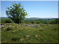
Site of a probable early Bronze Age Round cairn situated on Sizergh Fell to the south east of a large natural limestone knoll. Crouched inhumations of 4 adults and a child were found when the cairn was excavated in 1903 and later in 2002/5.
Cairn 2 occupies a prominent position on a limestone escarpment overlooking the River Kent valley to the south. It consists of an turfed over mound composed of limestone rubble measuring 16mx13m in plan and 0.5-1m high, with a discernible outer bank. The centre is a rubble hollow due to previous excavations.
The cairn is the largest and most visible of two cairns aligned on a due east-west bearing (see Sizergh Fell Cairn 1) and are demarcated by a Marker stone of Shap Blue Granite to the west of Cairn 1 (see Marker stone).
Cairn 2 is documented on Pastscape
You may be viewing yesterday's version of this page. To see the most up to date information please register for a free account.
")
Do not use the above information on other web sites or publications without permission of the contributor.
Nearby Images from Geograph Britain and Ireland:
©2011(licence)
©2011(licence)
©2015(licence)
©2020(licence)
©2006(licence)
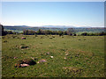
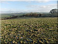
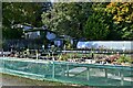
The above images may not be of the site on this page, they are loaded from Geograph.
Please Submit an Image of this site or go out and take one for us!
Click here to see more info for this site
Nearby sites
Key: Red: member's photo, Blue: 3rd party photo, Yellow: other image, Green: no photo - please go there and take one, Grey: site destroyed
Download sites to:
KML (Google Earth)
GPX (GPS waypoints)
CSV (Garmin/Navman)
CSV (Excel)
To unlock full downloads you need to sign up as a Contributory Member. Otherwise downloads are limited to 50 sites.
Turn off the page maps and other distractions
Nearby sites listing. In the following links * = Image available
9m SSW 206° Sizergh Settlement* Ancient Village or Settlement (SD49528686)
137m W 277° Sizergh Fell Round Cairn 1* Round Cairn (SD4938886886)
325m W 275° Sizergh Fell Stone Circle* Stone Circle (SD492869)
1.3km ESE 121° Leven's Park ringcairn* Ring Cairn (SD506862)
1.4km SE 132° Levens Park ring cairn 2* Ring Cairn (SD5053385945)
3.4km S 178° St Mary's Well (Heversham)* Holy Well or Sacred Spring (SD4958383452)
3.5km S 181° Heversham Ancient Wall Misc. Earthwork (SD494834)
3.5km S 178° St Peter's Church (Heversham)* Ancient Cross (SD4960083390)
4.0km ENE 62° Helm Hill* Hillfort (SD531887)
5.4km NNE 20° Anchorite Well (Kendal)* Holy Well or Sacred Spring (SD5140691932)
5.7km NNE 22° The Kendal Cross* Ancient Cross (SD5168692141)
6.2km S 188° Haverbrack Fell Misc. Earthwork (SD486807)
6.7km NNE 20° Kendal Museum* Museum (SD519931)
6.8km S 180° Bela Stone Row* Stone Row / Alignment (SD495801)
6.8km SSW 192° Haverbrack Cairn Cairn (SD480802)
6.9km S 190° The Dog Hole Cave or Rock Shelter (SD482801)
6.9km S 191° Dog Hole possible dolmen/propped stone* Natural Stone / Erratic / Other Natural Feature (SD481801)
7.7km S 177° The Rent Stone* Natural Stone / Erratic / Other Natural Feature (SD498792)
7.9km S 185° The Fairy Steps* Natural Stone / Erratic / Other Natural Feature (SD488790)
8.2km SE 145° Holme Park Fell 1* Rock Outcrop (SD5419280141)
8.4km SE 144° Holme Park Fell 2* Rock Outcrop (SD5439879957)
8.8km SSW 194° Hazelslack Stone* Standing Stone (Menhir) (SD473783)
10.0km S 189° Haweswater Stones* Misc. Earthwork (SD478770)
10.1km S 189° Haweswater Cairns and Propped Stone Cairn (SD479769)
10.1km SSW 208° Grubbins Wood Stone Natural Stone / Erratic / Other Natural Feature (SD446780)
View more nearby sites and additional images


 We would like to know more about this location. Please feel free to add a brief description and any relevant information in your own language.
 Wir möchten mehr über diese Stätte erfahren. Bitte zögern Sie nicht, eine kurze Beschreibung und relevante Informationen in Deutsch hinzuzufügen.
 Nous aimerions en savoir encore un peu sur les lieux. S'il vous plaît n'hesitez pas à ajouter une courte description et tous les renseignements pertinents dans votre propre langue.
 Quisieramos informarnos un poco más de las lugares. No dude en añadir una breve descripción y otros datos relevantes en su propio idioma.