<< Our Photo Pages >> Levens Park ring cairn 2 - Ring Cairn in England in Cumbria
Submitted by SumDoood on Friday, 16 June 2017 Page Views: 2516
Neolithic and Bronze AgeSite Name: Levens Park ring cairn 2Country: England
NOTE: This site is 1.67 km away from the location you searched for.
County: Cumbria Type: Ring Cairn
Nearest Town: Milnthorpe Nearest Village: Levens
Map Ref: SD5053385945
Latitude: 54.266758N Longitude: 2.761W
Condition:
| 5 | Perfect |
| 4 | Almost Perfect |
| 3 | Reasonable but with some damage |
| 2 | Ruined but still recognisable as an ancient site |
| 1 | Pretty much destroyed, possibly visible as crop marks |
| 0 | No data. |
| -1 | Completely destroyed |
| 5 | Superb |
| 4 | Good |
| 3 | Ordinary |
| 2 | Not Good |
| 1 | Awful |
| 0 | No data. |
| 5 | Can be driven to, probably with disabled access |
| 4 | Short walk on a footpath |
| 3 | Requiring a bit more of a walk |
| 2 | A long walk |
| 1 | In the middle of nowhere, a nightmare to find |
| 0 | No data. |
| 5 | co-ordinates taken by GPS or official recorded co-ordinates |
| 4 | co-ordinates scaled from a detailed map |
| 3 | co-ordinates scaled from a bad map |
| 2 | co-ordinates of the nearest village |
| 1 | co-ordinates of the nearest town |
| 0 | no data |
Internal Links:
External Links:
I have visited· I would like to visit
rvbaker2003 visited on 30th Dec 2024 - their rating: Cond: 2 Amb: 4 Access: 4
")
Historic England, Pastscape no. 1575246. Take a look there for dimensions, alignment, opinions, etc.
I was delighted to find this one. I'll even say "discover" perhaps, because I hadn't expected it, but a touch of optimism, intuition, and probability was all it took! (The probability I based on the proximity of the other well known cairn, and the surroundings, including the settlement and cairns at Sizergh (surprisingly only 1365m away), to the south the hillfort at Warton Crag, occasionally visible from the park the fort to the north at Castlesteads on The Helm, and other prehistoric locations in between.
Pastscape refers to this cairn as "An incomplete sub-circular earthwork, possibly a Bronze Age ring cairn". It feels real enough to me, and I noticed indications of recent activity by, I assumed, metal detectorists.
(After a visit to the better known cairn), stroll a little less than 300m south along the broad footpath from the small car park at 54.269092, -2.759151 and expect to see this cairn as a low mound on your left. Signposts ask you to stay on the path, but it was clear to me that short diversions are tolerated. If you do wander into the long grass in the park, I recommend you go in single file, and out and back by the same route.
A circular walking route can be completed mostly in the parkland on either side of the river, but it does include a short-ish dull section on tarmac. I advise against trying any shortcuts here.
Separate photo to follow shortly... Please include it with this text ^.
You may be viewing yesterday's version of this page. To see the most up to date information please register for a free account.
")
")
Do not use the above information on other web sites or publications without permission of the contributor.
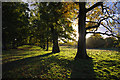
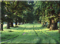
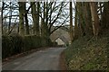
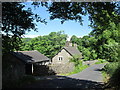
Nearby Images from Geograph Britain and Ireland:
©2013(licence)
©2008(licence)
©2024(licence)
©2013(licence)
©2010(licence)
The above images may not be of the site on this page, they are loaded from Geograph.
Please Submit an Image of this site or go out and take one for us!
Click here to see more info for this site
Nearby sites
Key: Red: member's photo, Blue: 3rd party photo, Yellow: other image, Green: no photo - please go there and take one, Grey: site destroyed
Download sites to:
KML (Google Earth)
GPX (GPS waypoints)
CSV (Garmin/Navman)
CSV (Excel)
To unlock full downloads you need to sign up as a Contributory Member. Otherwise downloads are limited to 50 sites.
Turn off the page maps and other distractions
Nearby sites listing. In the following links * = Image available
263m NNE 14° Leven's Park ringcairn* Ring Cairn (SD506862)
1.4km NW 312° Sizergh Settlement* Ancient Village or Settlement (SD49528686)
1.4km NW 312° Sizergh Fell Round Cairn 2* Round Cairn (SD4952486868)
1.5km NW 309° Sizergh Fell Round Cairn 1* Round Cairn (SD4938886886)
1.6km NW 305° Sizergh Fell Stone Circle* Stone Circle (SD492869)
2.7km SSW 200° St Mary's Well (Heversham)* Holy Well or Sacred Spring (SD4958383452)
2.7km SSW 199° St Peter's Church (Heversham)* Ancient Cross (SD4960083390)
2.8km SSW 203° Heversham Ancient Wall Misc. Earthwork (SD494834)
3.8km NE 42° Helm Hill* Hillfort (SD531887)
5.6km SSW 200° Haverbrack Fell Misc. Earthwork (SD486807)
5.9km S 189° Bela Stone Row* Stone Row / Alignment (SD495801)
6.0km N 8° Anchorite Well (Kendal)* Holy Well or Sacred Spring (SD5140691932)
6.3km SSW 203° Haverbrack Cairn Cairn (SD480802)
6.3km SSW 201° The Dog Hole Cave or Rock Shelter (SD482801)
6.3km N 10° The Kendal Cross* Ancient Cross (SD5168692141)
6.3km SSW 202° Dog Hole possible dolmen/propped stone* Natural Stone / Erratic / Other Natural Feature (SD481801)
6.8km S 186° The Rent Stone* Natural Stone / Erratic / Other Natural Feature (SD498792)
6.9km SSE 147° Holme Park Fell 1* Rock Outcrop (SD5419280141)
7.1km SSE 147° Holme Park Fell 2* Rock Outcrop (SD5439879957)
7.2km SSW 193° The Fairy Steps* Natural Stone / Erratic / Other Natural Feature (SD488790)
7.3km N 10° Kendal Museum* Museum (SD519931)
8.3km SSW 202° Hazelslack Stone* Standing Stone (Menhir) (SD473783)
9.3km SSW 196° Haweswater Stones* Misc. Earthwork (SD478770)
9.4km SSE 164° St James's Church (Burton-in-Kendal) Ancient Cross (SD5305076921)
9.4km SSW 196° Haweswater Cairns and Propped Stone Cairn (SD479769)
View more nearby sites and additional images


 We would like to know more about this location. Please feel free to add a brief description and any relevant information in your own language.
 Wir möchten mehr über diese Stätte erfahren. Bitte zögern Sie nicht, eine kurze Beschreibung und relevante Informationen in Deutsch hinzuzufügen.
 Nous aimerions en savoir encore un peu sur les lieux. S'il vous plaît n'hesitez pas à ajouter une courte description et tous les renseignements pertinents dans votre propre langue.
 Quisieramos informarnos un poco más de las lugares. No dude en añadir una breve descripción y otros datos relevantes en su propio idioma.