<< Text Pages >> St Weonard's Burial Mound - Artificial Mound in England in Herefordshire
Submitted by Sunny100 on Sunday, 21 November 2010 Page Views: 6459
Multi-periodSite Name: St Weonard''s Burial Mound Alternative Name: St Weonard's TumpCountry: England
NOTE: This site is 2.4 km away from the location you searched for.
County: Herefordshire Type: Artificial Mound
Nearest Town: Ross on Wye Nearest Village: St Weonards
Map Ref: SO495242
Latitude: 51.914028N Longitude: 2.735594W
Condition:
| 5 | Perfect |
| 4 | Almost Perfect |
| 3 | Reasonable but with some damage |
| 2 | Ruined but still recognisable as an ancient site |
| 1 | Pretty much destroyed, possibly visible as crop marks |
| 0 | No data. |
| -1 | Completely destroyed |
| 5 | Superb |
| 4 | Good |
| 3 | Ordinary |
| 2 | Not Good |
| 1 | Awful |
| 0 | No data. |
| 5 | Can be driven to, probably with disabled access |
| 4 | Short walk on a footpath |
| 3 | Requiring a bit more of a walk |
| 2 | A long walk |
| 1 | In the middle of nowhere, a nightmare to find |
| 0 | No data. |
| 5 | co-ordinates taken by GPS or official recorded co-ordinates |
| 4 | co-ordinates scaled from a detailed map |
| 3 | co-ordinates scaled from a bad map |
| 2 | co-ordinates of the nearest village |
| 1 | co-ordinates of the nearest town |
| 0 | no data |
Internal Links:
External Links:
I have visited· I would like to visit
Sunny100 visited on 21st Nov 2010 - their rating: Cond: 2 Amb: 3 Access: 5 The mound in the centre of the village is easy to find. It can't really be missed. Quite large compared to other nearby mounds. It is covered with trees and some lumps and bumps on the top.
Burial mound or tumulus close to the church of St Weonard near Ross on Wye. The large tree covered mound is located on the opposite side of the road from the church. Prehistoric in origin, it was occupied in the Dark Ages and again in Medieval times. Legend says the Celtic saint Weonard is buried in the mound.
The mound or "tump" in the centre of the village dates back to the Bronze Age, but according to the Legend, in the 6th century CE it was the burial place of St Weonard (Wannarth). He was a local woodcutter turned hermit who was a follower of St Dubricius, legendary archbishop of Caerleon who crowned King Arthur there in c518. A stained-glass window in the north aisle of the church depicts St Weonard, with a long beard, holding a bible in one hand and a woodcutter's axe in the other, and the words 'Wenardus Heremita'.
Local myth and legend claims that St Weonard was buried in the mound in a golden coffin. However when the site was excavated in 1855 no gold coffin was found, although some burnt bone fragments were discovered. There is a belief, locally, that pixies live inside the mound. And in the past morris dancing took place around the tump.
There is now hardly any trace of a motte and bailey castle that was built on top of the mound sometime between the 11th-13th century.
You may be viewing yesterday's version of this page. To see the most up to date information please register for a free account.
")
")
Do not use the above information on other web sites or publications without permission of the contributor.
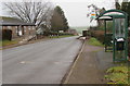
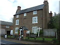
Nearby Images from Geograph Britain and Ireland:
©2015(licence)
©2023(licence)
©2013(licence)
©2013(licence)
©2019(licence)
The above images may not be of the site on this page, they are loaded from Geograph.
Please Submit an Image of this site or go out and take one for us!
Click here to see more info for this site
Nearby sites
Key: Red: member's photo, Blue: 3rd party photo, Yellow: other image, Green: no photo - please go there and take one, Grey: site destroyed
Download sites to:
KML (Google Earth)
GPX (GPS waypoints)
CSV (Garmin/Navman)
CSV (Excel)
To unlock full downloads you need to sign up as a Contributory Member. Otherwise downloads are limited to 50 sites.
Turn off the page maps and other distractions
Nearby sites listing. In the following links * = Image available
4.7km SE 130° St Deinst (Llangarron)* Early Christian Sculptured Stone (SO531211)
5.3km W 277° Garway Hill Long Barrow (SO44232492)
5.3km SW 221° St Ffraed's Well* Holy Well or Sacred Spring (SO45972023)
5.9km SW 215° Llangattock Barrow Round Barrow(s) (SO461194)
6.2km S 175° Welsh Newton Cross* Ancient Cross (SO4998118011)
6.9km ENE 69° Picts Cross Stone (Sellack) Standing Stone (Menhir) (SO560266)
7.4km NNE 12° Higgin's Well* Holy Well or Sacred Spring (SO51163141)
8.0km NW 321° Kilpeck church* Early Christian Sculptured Stone (SO44513051)
8.9km SE 132° The Queen Stone* Standing Stone (Menhir) (SO561182)
8.9km N 5° Aconbury Hill* Hillfort (SO504331)
9.0km W 270° Grosmont Churchyard Cross* Ancient Cross (SO40462432)
9.3km SSE 151° Little Doward Barrows Round Barrow(s) (SO539160)
9.3km SSE 151° King Arthur's Hall Cave Cave or Rock Shelter (SO53901600)
9.3km N 10° St Ann's Well (Aconbury)* Holy Well or Sacred Spring (SO51173338)
9.3km SSE 151° Little Doward* Hillfort (SO5416)
9.9km SE 138° Huntsham Hill Rockshelters Cave or Rock Shelter (SO561168)
10.0km SSE 149° King Arthur's Cave* Cave or Rock Shelter (SO54561559)
10.0km SSE 149° King Arthur's North* Cave or Rock Shelter (SO54601559)
10.2km SSE 153° Far Hearkening Rock* Natural Stone / Erratic / Other Natural Feature (SO5410515107)
10.2km SSE 150° Cavall's Cave Cave or Rock Shelter (SO546153)
10.3km SSE 150° Madawg Rockshelter Cave or Rock Shelter (SO54651526)
10.5km SE 141° Symonds Yat East Rockshelter Cave or Rock Shelter (SO56001600)
10.6km SE 144° Symonds Yat West Cave or Rock Shelter (SO55701555)
10.8km SE 145° Merlin's Cave (Herefordshire) Cave or Rock Shelter (SO556153)
10.8km E 100° Chase Wood Camp* Promontory Fort / Cliff Castle (SO602223)
View more nearby sites and additional images


 We would like to know more about this location. Please feel free to add a brief description and any relevant information in your own language.
 Wir möchten mehr über diese Stätte erfahren. Bitte zögern Sie nicht, eine kurze Beschreibung und relevante Informationen in Deutsch hinzuzufügen.
 Nous aimerions en savoir encore un peu sur les lieux. S'il vous plaît n'hesitez pas à ajouter une courte description et tous les renseignements pertinents dans votre propre langue.
 Quisieramos informarnos un poco más de las lugares. No dude en añadir una breve descripción y otros datos relevantes en su propio idioma.