<< Our Photo Pages >> Baillies White Cairn - Cairn in Scotland in Angus
Submitted by markj99 on Thursday, 26 March 2020 Page Views: 719
Neolithic and Bronze AgeSite Name: Baillies White Cairn Alternative Name: Tarfside White CairnCountry: Scotland
NOTE: This site is 3.3 km away from the location you searched for.
County: Angus Type: Cairn
Nearest Town: Ballater Nearest Village: Tarfside
Map Ref: NO48248273
Latitude: 56.932948N Longitude: 2.852129W
Condition:
| 5 | Perfect |
| 4 | Almost Perfect |
| 3 | Reasonable but with some damage |
| 2 | Ruined but still recognisable as an ancient site |
| 1 | Pretty much destroyed, possibly visible as crop marks |
| 0 | No data. |
| -1 | Completely destroyed |
| 5 | Superb |
| 4 | Good |
| 3 | Ordinary |
| 2 | Not Good |
| 1 | Awful |
| 0 | No data. |
| 5 | Can be driven to, probably with disabled access |
| 4 | Short walk on a footpath |
| 3 | Requiring a bit more of a walk |
| 2 | A long walk |
| 1 | In the middle of nowhere, a nightmare to find |
| 0 | No data. |
| 5 | co-ordinates taken by GPS or official recorded co-ordinates |
| 4 | co-ordinates scaled from a detailed map |
| 3 | co-ordinates scaled from a bad map |
| 2 | co-ordinates of the nearest village |
| 1 | co-ordinates of the nearest town |
| 0 | no data |
Internal Links:
External Links:
")
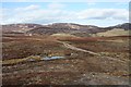
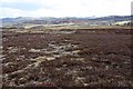
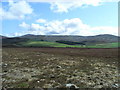
Baillies White Cairn is a ruined cairn situated 2.5 miles N of Tarfside, a hamlet in Angus. It was largely covered in heather on my visit so I will quote Canmore ID 33939 which states that it "measures 10.0m in diameter and 0.5m maximum height. A few large boulders are spread around the perimeter of the cairn forming a retaining kerb."
It is not spectacular but it is recognisable as an ancient site, partially hidden in heather.
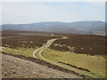
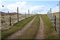
Parking is available in Tarfside, then walk on the road NW for 0.5 miles avoiding a L turn to Blackness. Bear R onto a private farm road for Burnfoot/Baillies. This dirt track leads past Burnfoot and through Baillies farm. A further 0.5 miles N takes you to a ford. The cairn is on the L, 50 yards beyond the ford, nestled in heather.
The total walking distance is around 5 miles and wellies may be needed to cross the ford.
You may be viewing yesterday's version of this page. To see the most up to date information please register for a free account.
")
")
Do not use the above information on other web sites or publications without permission of the contributor.
Nearby Images from Geograph Britain and Ireland:
©2013(licence)
©2013(licence)
©2019(licence)
©2013(licence)
©2009(licence)
The above images may not be of the site on this page, they are loaded from Geograph.
Please Submit an Image of this site or go out and take one for us!
Click here to see more info for this site
Nearby sites
Key: Red: member's photo, Blue: 3rd party photo, Yellow: other image, Green: no photo - please go there and take one, Grey: site destroyed
Download sites to:
KML (Google Earth)
GPX (GPS waypoints)
CSV (Garmin/Navman)
CSV (Excel)
To unlock full downloads you need to sign up as a Contributory Member. Otherwise downloads are limited to 50 sites.
Turn off the page maps and other distractions
Nearby sites listing. In the following links * = Image available
6.3km W 271° Queen's Well* Holy Well or Sacred Spring (NO419829)
9.0km NNE 30° Ballochan Hut Circles Ancient Village or Settlement (NO528905)
9.4km ESE 119° Colmeallie* Stone Circle (NO565781)
14.6km SSE 156° Newbigging Ring Cairn (NO541693)
14.6km E 85° Glen Dye Fogou* Souterrain (Fogou, Earth House) (NO629837)
15.0km SE 135° Dalbog Stone Circle (NO587719)
15.4km NE 44° Finzean House* Chambered Cairn (NO591937)
15.9km N 0° Ferrar Ancient Village or Settlement (NO485986)
15.9km NE 44° Dardannus Stone* Standing Stone (Menhir) (NO595940)
15.9km NE 41° Berrysloch* Standing Stone (Menhir) (NO588947)
16.0km NNE 18° Waterside Hut Circles Ancient Village or Settlement (NO533979)
16.1km NE 45° Corsedardar* Standing Stone (Menhir) (NO59709405)
16.3km NNE 26° Birse* Class I Pictish Symbol Stone (NO555973)
16.5km NNW 346° Kinord earth house* Souterrain (Fogou, Earth House) (NO444988)
16.8km E 96° Cairn o'Mount* Cairn (NO64938068)
16.8km NNE 14° Image Wood* Stone Circle (NO524990)
17.2km NNW 328° Braehead Farm* Souterrain (Fogou, Earth House) (NO393974)
17.2km NNW 346° Loch Kinord Crannog* Crannog (NO443995)
17.3km N 354° Knockenzie Ancient Village or Settlement (NJ465000)
17.4km NNW 327° Tullich* Class I Pictish Symbol Stone (NO390975)
17.4km NW 313° Scurriestone* Standing Stone (Menhir) (NO357949)
17.4km SSE 155° Brown Caterthun* Stone Fort or Dun (NO5555366871)
17.4km ESE 119° Fountain Hillock Round Barrow(s) (NO634740)
17.5km NNE 15° Lady Well (Aboyne)* Holy Well or Sacred Spring (NO531996)
17.5km NNW 345° Loch Kinord Cross Slab* Class III Pictish Cross Slab (NO44009978)
View more nearby sites and additional images


 We would like to know more about this location. Please feel free to add a brief description and any relevant information in your own language.
 Wir möchten mehr über diese Stätte erfahren. Bitte zögern Sie nicht, eine kurze Beschreibung und relevante Informationen in Deutsch hinzuzufügen.
 Nous aimerions en savoir encore un peu sur les lieux. S'il vous plaît n'hesitez pas à ajouter une courte description et tous les renseignements pertinents dans votre propre langue.
 Quisieramos informarnos un poco más de las lugares. No dude en añadir una breve descripción y otros datos relevantes en su propio idioma.