<< Text Pages >> Totty Pot - Cave or Rock Shelter in England in Somerset
Submitted by Andy B on Tuesday, 08 October 2013 Page Views: 6579
Natural PlacesSite Name: Totty PotCountry: England County: Somerset Type: Cave or Rock Shelter
Nearest Village: Cheddar
Map Ref: ST48255358
Latitude: 51.279000N Longitude: 2.743324W
Condition:
| 5 | Perfect |
| 4 | Almost Perfect |
| 3 | Reasonable but with some damage |
| 2 | Ruined but still recognisable as an ancient site |
| 1 | Pretty much destroyed, possibly visible as crop marks |
| 0 | No data. |
| -1 | Completely destroyed |
| 5 | Superb |
| 4 | Good |
| 3 | Ordinary |
| 2 | Not Good |
| 1 | Awful |
| 0 | No data. |
| 5 | Can be driven to, probably with disabled access |
| 4 | Short walk on a footpath |
| 3 | Requiring a bit more of a walk |
| 2 | A long walk |
| 1 | In the middle of nowhere, a nightmare to find |
| 0 | No data. |
| 5 | co-ordinates taken by GPS or official recorded co-ordinates |
| 4 | co-ordinates scaled from a detailed map |
| 3 | co-ordinates scaled from a bad map |
| 2 | co-ordinates of the nearest village |
| 1 | co-ordinates of the nearest town |
| 0 | no data |
Internal Links:
External Links:
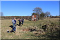
Cave in Somerset. Totty Pot is located some 5 km east of Cheddar, on the plateau that forms the top of the Mendip Hills, at approx. 245m OD. It was found by Christopher Hawkes during a family outing in 1960, and excavated by Hawkes, geologist Willie Stanton and the Wessex Cave Club between 1960 and 1965.
The present entrance is via a narrow, vertical shaft approximately 0.75 m wide and 4 m deep, leading to a short tunnel giving access into several small chambers, which open up to approximately two metres at the highest end. The approximate length of the cave is 10m. Although having the surface appearance of a swallet, Totty Pot is probably a relict section of an ancient stream cave whose entrance was formed by breaching of the cave roof through sub-aerial lowering of the plateau surface. The current vertical entrance was dug out in the 1960s and is probably not that used in antiquity, when the cave was most likely accessed via a relatively wide and low entrance on the south side of the depression.
Initial excavations at the site were primarily intended to explore its caving potential, and the recovery of archaeological material was unexpected, though it soon became apparent that bone material in particular was present, including both faunal and human remains. Work proceeded more carefully after this, as shown by the recovery of a small flint assemblage of 20 worked pieces, including seven convex backed blades, three rod and seven scalene microliths, and two microburins.
A small surviving human bone assemblage was identified as being from six individuals. The results confirmed the presence of one previously identified Mesolithic individual (7445-7080 cal BC), but unexpectedly placed the other five individuals spanning the Middle to Late Neolithic, from ca. 3500 to ca. 2600 cal BC.
Read more in the paper here:
Schulting, R.J., Gardiner, P., Hawkes, C., and Murray, E. 2010. A Mesolithic and Neolithic human bone assemblage from Totty Pot, Mendips, Somerset. Proceedings of the University of Bristol Spelaeological Society 25: 75-95.
You may be viewing yesterday's version of this page. To see the most up to date information please register for a free account.
Do not use the above information on other web sites or publications without permission of the contributor.
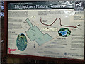
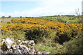
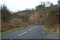
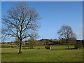
Nearby Images from Geograph Britain and Ireland:
©2015(licence)
©2015(licence)
©2005(licence)
©2009(licence)
©2015(licence)
The above images may not be of the site on this page, they are loaded from Geograph.
Please Submit an Image of this site or go out and take one for us!
Click here to see more info for this site
Nearby sites
Key: Red: member's photo, Blue: 3rd party photo, Yellow: other image, Green: no photo - please go there and take one, Grey: site destroyed
Download sites to:
KML (Google Earth)
GPX (GPS waypoints)
CSV (Garmin/Navman)
CSV (Excel)
To unlock full downloads you need to sign up as a Contributory Member. Otherwise downloads are limited to 50 sites.
Turn off the page maps and other distractions
Nearby sites listing. In the following links * = Image available
1.5km WNW 282° Soldier's Hole Cave or Rock Shelter (ST468539)
1.5km S 185° Batcombe Hollow north stone* Standing Stone (Menhir) (ST4810452088)
1.6km WNW 282° Goughs Cave (Cheddar)* Cave or Rock Shelter (ST46715392)
1.6km WNW 288° Sun Hole* Cave or Rock Shelter (ST467541)
1.6km WNW 282° Cheddar Museum of Prehistory* Museum (ST46655393)
1.8km SSW 193° Batcombe Hollow south standing stone* Standing Stone (Menhir) (ST4782451823)
1.9km N 4° Longwood Tumulus* Round Barrow(s) (ST4841955518)
2.0km W 276° Flint Jack's Cave Cave or Rock Shelter (ST463538)
2.3km N 4° Gorsey Bigbury Henge* Henge (ST48435584)
2.6km SSE 158° Westbury Camp* Hillfort (ST49205112)
2.9km ESE 112° Cheddar Head Stone Circle (ST509525)
3.0km NE 45° Charterhouse settlement* Misc. Earthwork (ST504557)
3.0km NNW 335° Tynings Farm Barrow Group* Barrow Cemetery (ST47005635)
3.3km SE 125° Bristol Plain Farm Barrow Cemetery* Barrow Cemetery (ST5097951665)
3.3km NE 49° Nordrach Tumulus* Round Barrow(s) (ST5078755765)
3.4km NNE 28° Charterhouse Earthwork* Misc. Earthwork (ST49885651)
3.6km NNW 344° Black Down barrows (Mendip)* Barrow Cemetery (ST473571)
3.7km N 3° Beacon Batch* Barrow Cemetery (ST48465726)
3.8km ESE 120° Townsend Farm Barrow Cemetery* Barrow Cemetery (ST5152851658)
4.1km SE 130° Priddy long barrow* Long Barrow (ST5141550915)
4.1km SE 141° Westbury-Sub-Mendip Cave or Rock Shelter (ST50855036)
4.3km NW 323° Cuck Hill Barrow Round Barrow(s) (ST4567057030)
4.3km ENE 66° Whites Town Farm Tumulus* Round Barrow(s) (ST5223355265)
4.5km ENE 78° Wright's Piece barrows (S)* Barrow Cemetery (ST527545)
4.9km ESE 116° Priddy Church Barrows* Barrow Cemetery (ST526514)
View more nearby sites and additional images


 We would like to know more about this location. Please feel free to add a brief description and any relevant information in your own language.
 Wir möchten mehr über diese Stätte erfahren. Bitte zögern Sie nicht, eine kurze Beschreibung und relevante Informationen in Deutsch hinzuzufügen.
 Nous aimerions en savoir encore un peu sur les lieux. S'il vous plaît n'hesitez pas à ajouter une courte description et tous les renseignements pertinents dans votre propre langue.
 Quisieramos informarnos un poco más de las lugares. No dude en añadir una breve descripción y otros datos relevantes en su propio idioma.