


<< Our Photo Pages >> Drumcarrow Craig - Broch or Nuraghe in Scotland in Fife
Submitted by vicky on Monday, 24 March 2003 Page Views: 12518
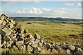
Iron Age and Later PrehistorySite Name: Drumcarrow CraigCountry: Scotland County: Fife Type: Broch or Nuraghe
Map Ref: NO459132 Landranger Map Number: 59
Latitude: 56.308113N Longitude: 2.875985W
Condition:
| 5 | Perfect |
| 4 | Almost Perfect |
| 3 | Reasonable but with some damage |
| 2 | Ruined but still recognisable as an ancient site |
| 1 | Pretty much destroyed, possibly visible as crop marks |
| 0 | No data. |
| -1 | Completely destroyed |
| 5 | Superb |
| 4 | Good |
| 3 | Ordinary |
| 2 | Not Good |
| 1 | Awful |
| 0 | No data. |
| 5 | Can be driven to, probably with disabled access |
| 4 | Short walk on a footpath |
| 3 | Requiring a bit more of a walk |
| 2 | A long walk |
| 1 | In the middle of nowhere, a nightmare to find |
| 0 | No data. |
| 5 | co-ordinates taken by GPS or official recorded co-ordinates |
| 4 | co-ordinates scaled from a detailed map |
| 3 | co-ordinates scaled from a bad map |
| 2 | co-ordinates of the nearest village |
| 1 | co-ordinates of the nearest town |
| 0 | no data |
Be the first person to rate this site - see the 'Contribute!' box in the right hand menu.
Internal Links:
External Links:
")
Have you visited this site? Please add a comment below.
You may be viewing yesterday's version of this page. To see the most up to date information please register for a free account.
Do not use the above information on other web sites or publications without permission of the contributor.
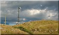
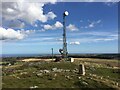
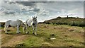
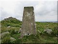
Nearby Images from Geograph Britain and Ireland:
©2007(licence)
©2021(licence)
©2019(licence)
©2016(licence)
©2007(licence)
The above images may not be of the site on this page, they are loaded from Geograph.
Please Submit an Image of this site or go out and take one for us!
Click here to see more info for this site
Nearby sites
Key: Red: member's photo, Blue: 3rd party photo, Yellow: other image, Green: no photo - please go there and take one, Grey: site destroyed
Download sites to:
KML (Google Earth)
GPX (GPS waypoints)
CSV (Garmin/Navman)
CSV (Excel)
To unlock full downloads you need to sign up as a Contributory Member. Otherwise downloads are limited to 50 sites.
Turn off the page maps and other distractions
Nearby sites listing. In the following links * = Image available
5.0km NE 55° St. Andrews Museum* Museum (NO5016)
5.8km NE 52° The Blue Stane (St Andrews)* Standing Stone (Menhir) (NO5055216707)
6.2km WSW 252° Spout Well* Holy Well or Sacred Spring (NO400114)
6.5km ENE 57° Monk's Well, St Andrews* Holy Well or Sacred Spring (NO514166)
7.4km ESE 107° Dunino Stone Circle (NO530110)
7.7km SW 219° Norrie's Law* Round Barrow(s) (NO409073)
8.3km N 355° St Bunyan's Well (Leuchars) Holy Well or Sacred Spring (NO4525221483)
8.4km ESE 105° Dunino Den* Stone Row / Alignment (NO540109)
8.4km ESE 106° Druid's Well (Dunino)* Holy Well or Sacred Spring (NO540108)
8.4km N 357° Lady's Well (Leuchars) Holy Well or Sacred Spring (NO4557321645)
9.3km E 88° Boarhills* Standing Stone (Menhir) (NO5525413356)
10.0km SSE 157° Easter Pitcorthie* Standing Stone (Menhir) (NO497039)
10.3km SSW 199° Largo Pictish Stone* Class II Pictish Symbol Stone (NO42340347)
10.8km NW 312° Lochmaloney Farmm (Kilmany) Rock Art (NO37902049)
11.2km NW 326° Kilmany Cursus Cursus (NO39742263)
11.4km W 260° Walton Symbol Stone Class I Pictish Symbol Stone (NO34651135)
11.8km SSW 207° Lundin Links* Stone Circle (NO40480272)
12.8km SW 219° Aithernie (Scoonie) Cairn (NO37690339)
12.8km ESE 118° West Pitcorthie* Standing Stone (Menhir) (NO572071)
13.0km SSE 159° Ardross souterrain* Souterrain (Fogou, Earth House) (NO5037500950)
13.3km SW 218° Balgrummo* Standing Stone (Menhir) (NO375029)
14.0km SE 139° St Fillan's Well (Pittenweem)* Holy Well or Sacred Spring (NO550025)
14.1km SE 127° Skeith Stone* Class II Pictish Symbol Stone (NO571046)
15.3km NW 318° Monk's Well (Balmerino)* Holy Well or Sacred Spring (NO358247)
15.8km ESE 117° Caiplie* Class I Pictish Symbol Stone (NO599058)
View more nearby sites and additional images


 We would like to know more about this location. Please feel free to add a brief description and any relevant information in your own language.
 Wir möchten mehr über diese Stätte erfahren. Bitte zögern Sie nicht, eine kurze Beschreibung und relevante Informationen in Deutsch hinzuzufügen.
 Nous aimerions en savoir encore un peu sur les lieux. S'il vous plaît n'hesitez pas à ajouter une courte description et tous les renseignements pertinents dans votre propre langue.
 Quisieramos informarnos un poco más de las lugares. No dude en añadir una breve descripción y otros datos relevantes en su propio idioma.