<< Our Photo Pages >> Eaton Camp - Promontory Fort / Cliff Castle in England in Herefordshire
Submitted by elensentier on Saturday, 06 August 2011 Page Views: 10652
Iron Age and Later PrehistorySite Name: Eaton CampCountry: England County: Herefordshire Type: Promontory Fort / Cliff Castle
Nearest Village: Ruckhall
Map Ref: SO454393
Latitude: 52.049387N Longitude: 2.797604W
Condition:
| 5 | Perfect |
| 4 | Almost Perfect |
| 3 | Reasonable but with some damage |
| 2 | Ruined but still recognisable as an ancient site |
| 1 | Pretty much destroyed, possibly visible as crop marks |
| 0 | No data. |
| -1 | Completely destroyed |
| 5 | Superb |
| 4 | Good |
| 3 | Ordinary |
| 2 | Not Good |
| 1 | Awful |
| 0 | No data. |
| 5 | Can be driven to, probably with disabled access |
| 4 | Short walk on a footpath |
| 3 | Requiring a bit more of a walk |
| 2 | A long walk |
| 1 | In the middle of nowhere, a nightmare to find |
| 0 | No data. |
| 5 | co-ordinates taken by GPS or official recorded co-ordinates |
| 4 | co-ordinates scaled from a detailed map |
| 3 | co-ordinates scaled from a bad map |
| 2 | co-ordinates of the nearest village |
| 1 | co-ordinates of the nearest town |
| 0 | no data |
Internal Links:
External Links:
I have visited· I would like to visit
SumDoood would like to visit
")
The inner bank is up to 5.0m high and turns at the south end to complete the defences. Several modern breaks occur along the bank and the entrance, though no longer apparent was probably at the NW corner.
Source PastScape.
Note: Report from the Eaton Camp Guided Walk, and geophysics carried out in March finds possible roundhouses which are due to be dug in October
You may be viewing yesterday's version of this page. To see the most up to date information please register for a free account.
")
")
")
")
Do not use the above information on other web sites or publications without permission of the contributor.
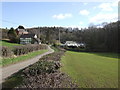
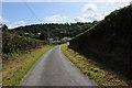
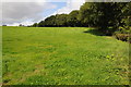
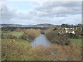
Nearby Images from Geograph Britain and Ireland:

©2019(licence)
©2007(licence)
©2012(licence)
©2012(licence)
©2007(licence)
The above images may not be of the site on this page, they are loaded from Geograph.
Please Submit an Image of this site or go out and take one for us!
Click here to see more info for this site
Nearby sites
Key: Red: member's photo, Blue: 3rd party photo, Yellow: other image, Green: no photo - please go there and take one, Grey: site destroyed
Download sites to:
KML (Google Earth)
GPX (GPS waypoints)
CSV (Garmin/Navman)
CSV (Excel)
To unlock full downloads you need to sign up as a Contributory Member. Otherwise downloads are limited to 50 sites.
Turn off the page maps and other distractions
Nearby sites listing. In the following links * = Image available
2.9km N 2° Holy Well (Garway)* Holy Well or Sacred Spring (SO45554224)
3.0km NW 325° Holy Well (Swainshill)* Holy Well or Sacred Spring (SO43724177)
5.2km N 356° Credenhill Camp* Hillfort (SO451445)
5.5km E 85° The King's Ditch Natural Stone / Erratic / Other Natural Feature (SO50873974)
5.5km E 84° Hereford Museum and Art Gallery* Museum (SO5090039851)
5.7km E 86° St Ethelbert's Well (Hereford)* Holy Well or Sacred Spring (SO5112239684)
7.1km ESE 109° Rotherwas Ribbon* Ancient Trackway (SO52053690)
7.2km WSW 248° Timberline Camp Hillfort (SO387367)
7.6km ESE 112° Dinedor Camp* Hillfort (SO524364)
7.9km ESE 122° Holy Well (Dinedor)* Holy Well or Sacred Spring (SO52013501)
8.0km SE 141° Aconbury Hill* Hillfort (SO504331)
8.3km SE 135° St Ann's Well (Aconbury)* Holy Well or Sacred Spring (SO51173338)
8.3km SW 228° Dunseal* Round Barrow(s) (SO391338)
8.4km WNW 283° Holy Well (Blakemere)* Holy Well or Sacred Spring (SO37254128)
8.8km S 185° Kilpeck church* Early Christian Sculptured Stone (SO44513051)
8.9km ENE 58° The Wergin's Stone* Standing Stone (Menhir) (SO5297543981)
9.3km W 280° Blakemere Church Stone* Marker Stone (SO362411)
9.5km W 259° Poston Camp Hillfort (SO3598937647)
9.7km NE 36° St Ethelbert's Well (Marden)* Holy Well or Sacred Spring (SO512471)
9.8km SE 143° Higgin's Well* Holy Well or Sacred Spring (SO51163141)
10.0km NE 44° Sutton Walls* Hillfort (SO525464)
10.1km W 267° Peterchurch St Peter's Well* Holy Well or Sacred Spring (SO35333880)
10.2km SW 220° Minns Close Tump Wood* Causewayed Enclosure (SO38693162)
12.2km N 357° Bush Bank* Standing Stone (Menhir) (SO4496251449)
12.4km W 280° Great Llanavon Farm* Long Barrow (SO3322441689)
View more nearby sites and additional images


 We would like to know more about this location. Please feel free to add a brief description and any relevant information in your own language.
 Wir möchten mehr über diese Stätte erfahren. Bitte zögern Sie nicht, eine kurze Beschreibung und relevante Informationen in Deutsch hinzuzufügen.
 Nous aimerions en savoir encore un peu sur les lieux. S'il vous plaît n'hesitez pas à ajouter une courte description et tous les renseignements pertinents dans votre propre langue.
 Quisieramos informarnos un poco más de las lugares. No dude en añadir una breve descripción y otros datos relevantes en su propio idioma.