<< Our Photo Pages >> Barrow at Rowberrow - Round Barrow(s) in England in Somerset
Submitted by andrewp on Wednesday, 16 February 2011 Page Views: 5780
Neolithic and Bronze AgeSite Name: Barrow at RowberrowCountry: England County: Somerset Type: Round Barrow(s)
Nearest Town: Shipham Nearest Village: Rowberrow
Map Ref: ST44925834
Latitude: 51.321484N Longitude: 2.791798W
Condition:
| 5 | Perfect |
| 4 | Almost Perfect |
| 3 | Reasonable but with some damage |
| 2 | Ruined but still recognisable as an ancient site |
| 1 | Pretty much destroyed, possibly visible as crop marks |
| 0 | No data. |
| -1 | Completely destroyed |
| 5 | Superb |
| 4 | Good |
| 3 | Ordinary |
| 2 | Not Good |
| 1 | Awful |
| 0 | No data. |
| 5 | Can be driven to, probably with disabled access |
| 4 | Short walk on a footpath |
| 3 | Requiring a bit more of a walk |
| 2 | A long walk |
| 1 | In the middle of nowhere, a nightmare to find |
| 0 | No data. |
| 5 | co-ordinates taken by GPS or official recorded co-ordinates |
| 4 | co-ordinates scaled from a detailed map |
| 3 | co-ordinates scaled from a bad map |
| 2 | co-ordinates of the nearest village |
| 1 | co-ordinates of the nearest town |
| 0 | no data |
Internal Links:
External Links:
")
Large, "excavated" in 1813. Looks out from the edge of Mendips at Rowberrow/Shipham towards Weston Super Mare. The picture is taken from another angle.
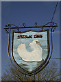
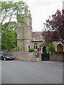
Note: Barrow is on private land but can be seen from the Swan pub car park or Philfare Lane (where the picture was taken from).
Taken while geophysics being done in the area on a wet and cold February morning.
Further details in Somerset Historic Environment Record (No. 10763).
Also in Tratman Barrow Catalogue (no. 185) and Grinsell (listed as Shipham 2).
You may be viewing yesterday's version of this page. To see the most up to date information please register for a free account.
Do not use the above information on other web sites or publications without permission of the contributor.
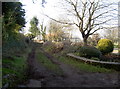
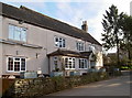
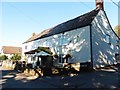
Nearby Images from Geograph Britain and Ireland:
©2017(licence)
©2017(licence)
©2017(licence)
©2018(licence)
©2005(licence)
The above images may not be of the site on this page, they are loaded from Geograph.
Please Submit an Image of this site or go out and take one for us!
Click here to see more info for this site
Nearby sites
Key: Red: member's photo, Blue: 3rd party photo, Yellow: other image, Green: no photo - please go there and take one, Grey: site destroyed
Download sites to:
KML (Google Earth)
GPX (GPS waypoints)
CSV (Garmin/Navman)
CSV (Excel)
To unlock full downloads you need to sign up as a Contributory Member. Otherwise downloads are limited to 50 sites.
Turn off the page maps and other distractions
Nearby sites listing. In the following links * = Image available
566m N 7° Dolebury Camp* Hillfort (ST450589)
1.5km SSE 150° Cuck Hill Barrow Round Barrow(s) (ST4567057030)
1.6km W 274° The Wimblestone* Standing Stone (Menhir) (ST43355848)
2.7km ESE 117° Black Down barrows (Mendip)* Barrow Cemetery (ST473571)
2.7km E 82° Aveline's Hole* Cave or Rock Shelter (ST47615867)
2.9km SE 133° Tynings Farm Barrow Group* Barrow Cemetery (ST47005635)
2.9km E 81° Burrington Camp* Hillfort (ST47825878)
3.7km ESE 106° Beacon Batch* Barrow Cemetery (ST48465726)
4.1km W 279° Banwell Camp Hillfort (ST409590)
4.1km SSW 204° Axbridge Church Wells* Holy Well or Sacred Spring (ST432546)
4.3km SE 125° Gorsey Bigbury Henge* Henge (ST48435584)
4.5km SE 128° Longwood Tumulus* Round Barrow(s) (ST4841955518)
4.6km SSE 157° Sun Hole* Cave or Rock Shelter (ST467541)
4.7km SSE 158° Cheddar Museum of Prehistory* Museum (ST46655393)
4.7km SSE 163° Flint Jack's Cave Cave or Rock Shelter (ST463538)
4.8km SSE 157° Goughs Cave (Cheddar)* Cave or Rock Shelter (ST46715392)
4.8km SSE 156° Soldier's Hole Cave or Rock Shelter (ST468539)
4.9km WSW 239° Wavering Down cairn* Round Cairn (ST40705590)
5.1km W 277° Butstone (Banwell) Marker Stone (ST398590)
5.2km WNW 299° Banwell Moor Stone 2 Marker Stone (ST40406086)
5.3km ESE 110° Charterhouse Earthwork* Misc. Earthwork (ST49885651)
5.3km SW 228° Compton Bishop* Standing Stones (ST409548)
5.6km NNW 346° Congresbury Church Cross* Ancient Cross (ST4359863744)
5.6km NNW 347° Congresbury Village Cross* Ancient Cross (ST4373263818)
5.8km SE 144° Totty Pot Cave or Rock Shelter (ST48255358)
View more nearby sites and additional images


 We would like to know more about this location. Please feel free to add a brief description and any relevant information in your own language.
 Wir möchten mehr über diese Stätte erfahren. Bitte zögern Sie nicht, eine kurze Beschreibung und relevante Informationen in Deutsch hinzuzufügen.
 Nous aimerions en savoir encore un peu sur les lieux. S'il vous plaît n'hesitez pas à ajouter une courte description et tous les renseignements pertinents dans votre propre langue.
 Quisieramos informarnos un poco más de las lugares. No dude en añadir una breve descripción y otros datos relevantes en su propio idioma.