<< Text Pages >> Garway Hill - Long Barrow in England in Herefordshire
Submitted by SolarMegalith on Saturday, 05 February 2011 Page Views: 6199
Neolithic and Bronze AgeSite Name: Garway HillCountry: England County: Herefordshire Type: Long Barrow
Nearest Town: Monmouth
Map Ref: SO44232492
Latitude: 51.919996N Longitude: 2.81232W
Condition:
| 5 | Perfect |
| 4 | Almost Perfect |
| 3 | Reasonable but with some damage |
| 2 | Ruined but still recognisable as an ancient site |
| 1 | Pretty much destroyed, possibly visible as crop marks |
| 0 | No data. |
| -1 | Completely destroyed |
| 5 | Superb |
| 4 | Good |
| 3 | Ordinary |
| 2 | Not Good |
| 1 | Awful |
| 0 | No data. |
| 5 | Can be driven to, probably with disabled access |
| 4 | Short walk on a footpath |
| 3 | Requiring a bit more of a walk |
| 2 | A long walk |
| 1 | In the middle of nowhere, a nightmare to find |
| 0 | No data. |
| 5 | co-ordinates taken by GPS or official recorded co-ordinates |
| 4 | co-ordinates scaled from a detailed map |
| 3 | co-ordinates scaled from a bad map |
| 2 | co-ordinates of the nearest village |
| 1 | co-ordinates of the nearest town |
| 0 | no data |
Internal Links:
External Links:
Long Barrow in Herefordshire
The earthwork which might be a trace of a long barrow or an enclosure.
You may be viewing yesterday's version of this page. To see the most up to date information please register for a free account.
Do not use the above information on other web sites or publications without permission of the contributor.
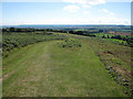
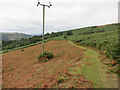
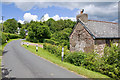
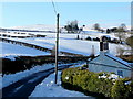
Nearby Images from Geograph Britain and Ireland:
©2009(licence)
©2014(licence)
©2014(licence)
©2010(licence)
©2010(licence)
The above images may not be of the site on this page, they are loaded from Geograph.
Please Submit an Image of this site or go out and take one for us!
Click here to see more info for this site
Nearby sites
Key: Red: member's photo, Blue: 3rd party photo, Yellow: other image, Green: no photo - please go there and take one, Grey: site destroyed
Download sites to:
KML (Google Earth)
GPX (GPS waypoints)
CSV (Garmin/Navman)
CSV (Excel)
To unlock full downloads you need to sign up as a Contributory Member. Otherwise downloads are limited to 50 sites.
Turn off the page maps and other distractions
Nearby sites listing. In the following links * = Image available
3.8km W 260° Grosmont Churchyard Cross* Ancient Cross (SO40462432)
5.0km SSE 159° St Ffraed's Well* Holy Well or Sacred Spring (SO45972023)
5.3km E 97° St Weonard's Burial Mound Artificial Mound (SO495242)
5.6km N 2° Kilpeck church* Early Christian Sculptured Stone (SO44513051)
5.8km SSE 161° Llangattock Barrow Round Barrow(s) (SO461194)
6.6km SW 233° Grosmont Fawr Hillfort (SO389210)
8.7km NW 320° Minns Close Tump Wood* Causewayed Enclosure (SO38693162)
9.0km SE 140° Welsh Newton Cross* Ancient Cross (SO4998118011)
9.5km NE 46° Higgin's Well* Holy Well or Sacred Spring (SO51163141)
9.6km ESE 113° St Deinst (Llangarron)* Early Christian Sculptured Stone (SO531211)
10.2km NE 36° Aconbury Hill* Hillfort (SO504331)
10.2km NNW 329° Dunseal* Round Barrow(s) (SO391338)
10.8km SSW 203° Churchyard Cross, Llantilio Crossenny* Ancient Cross (SO3985514986)
10.9km SW 223° Llanvetherine Holy Well* Holy Well or Sacred Spring (SO36671704)
10.9km NE 39° St Ann's Well (Aconbury)* Holy Well or Sacred Spring (SO51173338)
11.0km SW 225° St Gwytherine's Grave Stone* Early Christian Sculptured Stone (SO364172)
11.8km WNW 281° St. Clodock's Well* Holy Well or Sacred Spring (SO32692738)
11.8km WNW 282° Clodock Inscribed Stone* Carving (SO32642751)
11.9km E 81° Picts Cross Stone (Sellack) Standing Stone (Menhir) (SO560266)
12.2km W 260° Pen-Twyn Hillfort (SO321230)
12.7km NE 37° Holy Well (Dinedor)* Holy Well or Sacred Spring (SO52013501)
12.9km WSW 239° Ysgyryd Fawr* Hillfort (SO331183)
13.0km NNW 334° Timberline Camp Hillfort (SO387367)
13.0km SSE 155° Rockfield Road site* Ancient Village or Settlement (SO4963513072)
13.1km SE 132° Little Doward Barrows Round Barrow(s) (SO539160)
View more nearby sites and additional images


 We would like to know more about this location. Please feel free to add a brief description and any relevant information in your own language.
 Wir möchten mehr über diese Stätte erfahren. Bitte zögern Sie nicht, eine kurze Beschreibung und relevante Informationen in Deutsch hinzuzufügen.
 Nous aimerions en savoir encore un peu sur les lieux. S'il vous plaît n'hesitez pas à ajouter une courte description et tous les renseignements pertinents dans votre propre langue.
 Quisieramos informarnos un poco más de las lugares. No dude en añadir una breve descripción y otros datos relevantes en su propio idioma.